www.tinaja.com/hang01.shtml             12/30/18
   Don Lancaster's Guru's Lair.    Don Lancaster classics USB  
  
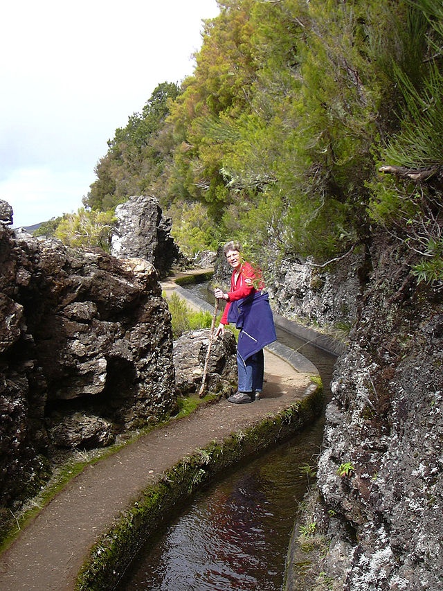
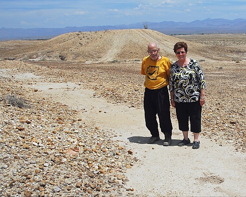
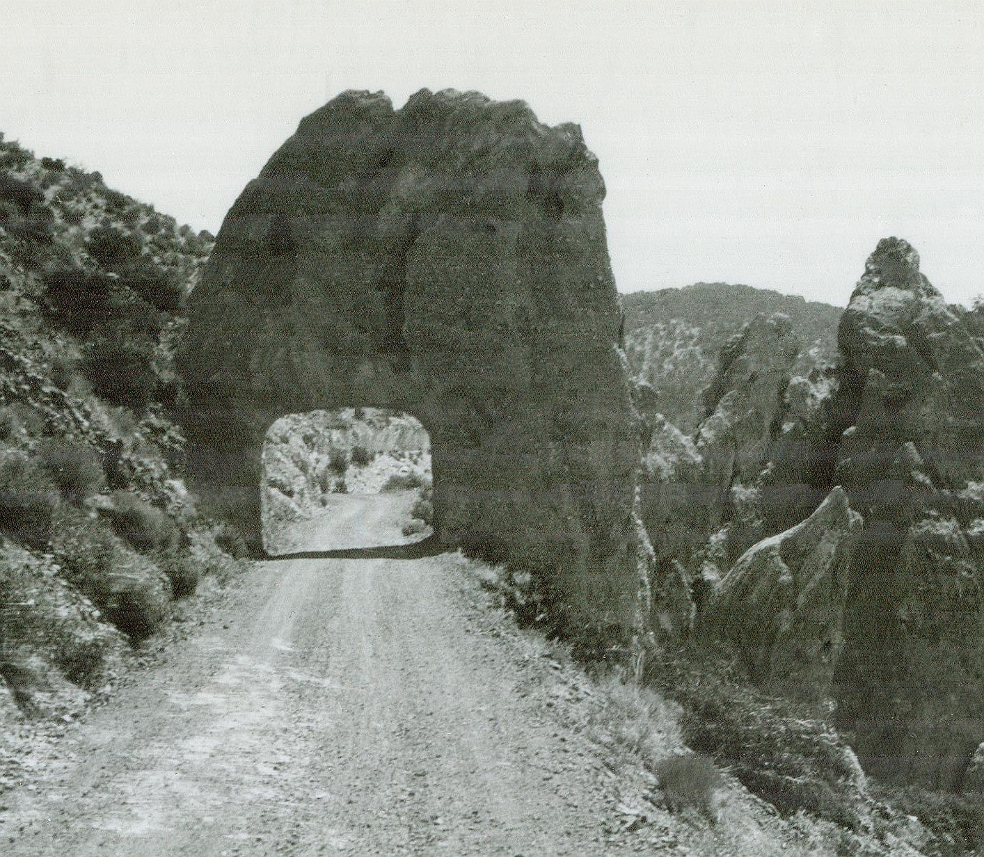
 Jim Neely & Don Lancaster:
Prehistoric Bajada
"Hanging" Canals
 
   365 Gila Valley Dayhikes.   The worst of Marcia Swampfelder  
Click here for the latest updates!
Some recent Safford AZ area discoveries have now located
many dozens of Mt. Graham mountain stream fed prehistoric
CE 1350 "hanging" canals that represent utterly mind boggling
world class stone age engineering.
An apparently unique hallmark of the entire complex system is
that the canals are often literally "hung" on the extremely
difficult terrain of steep mesa edges.
In a clear attempt to make
their routings and carefully controlled slopes fully independent
of local typography!
Ownership is primarily Bureau of Land Management, AZ State
Lands
, Coronado National Forest, and some private inholdings.
A few canals are severely endangered, but the vast majority
simply remain woefully unappreciated.
 

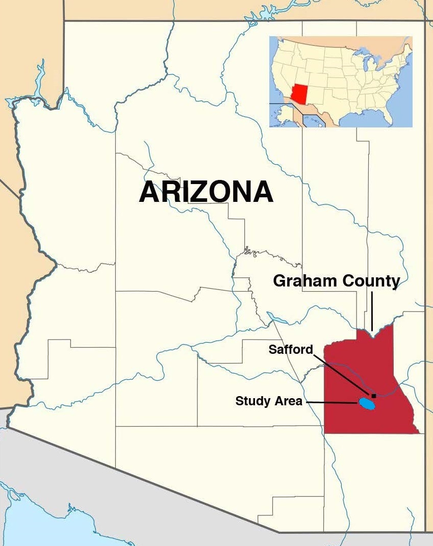
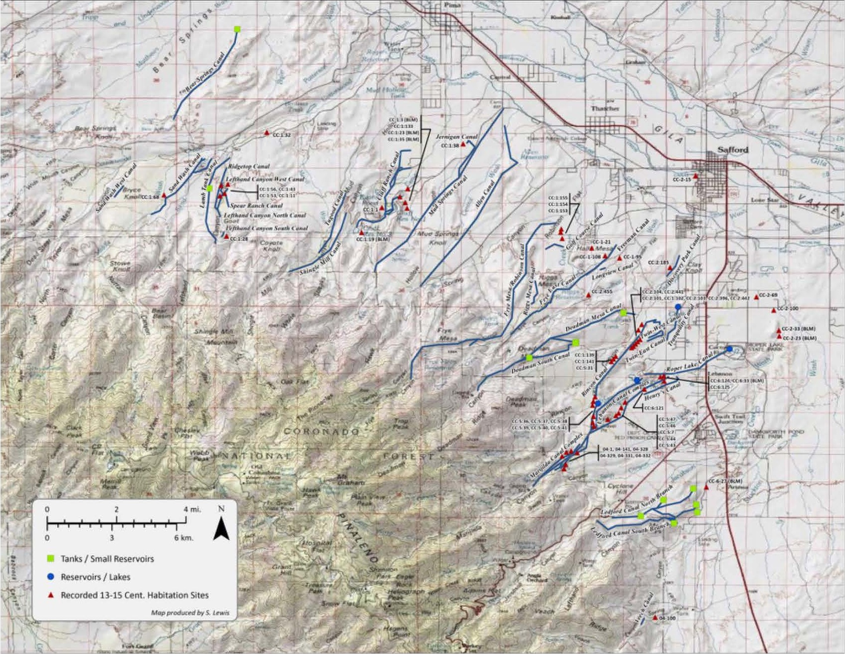
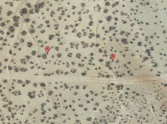
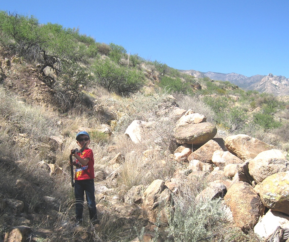
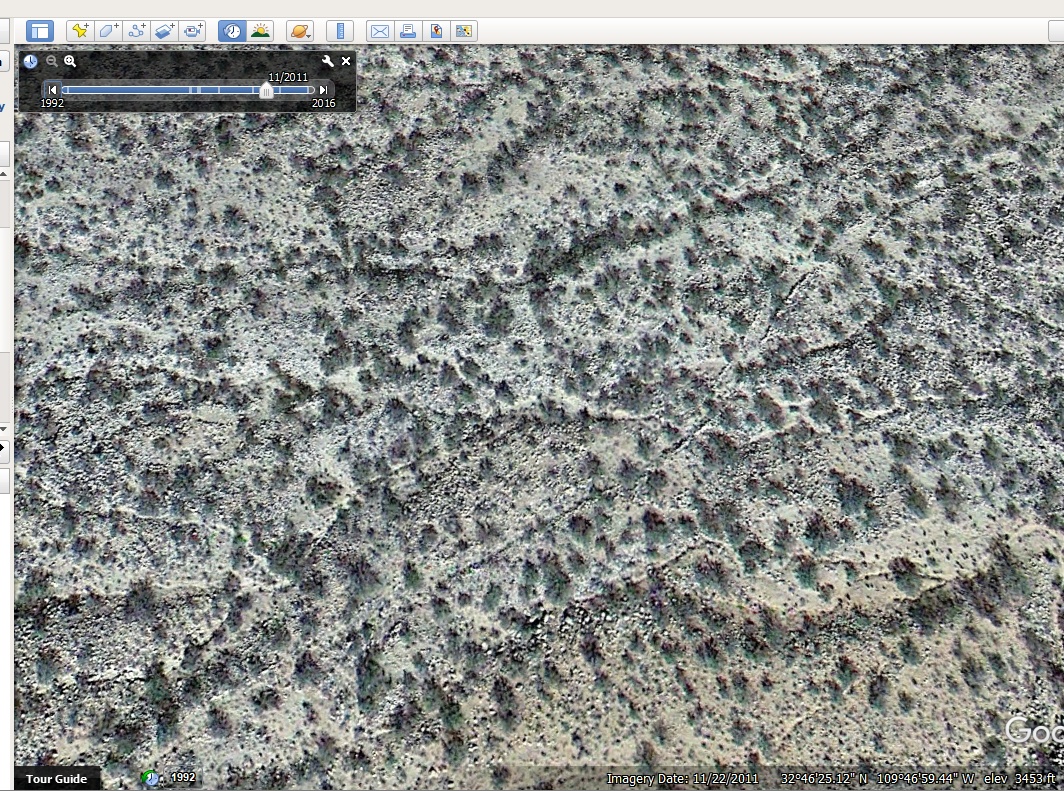
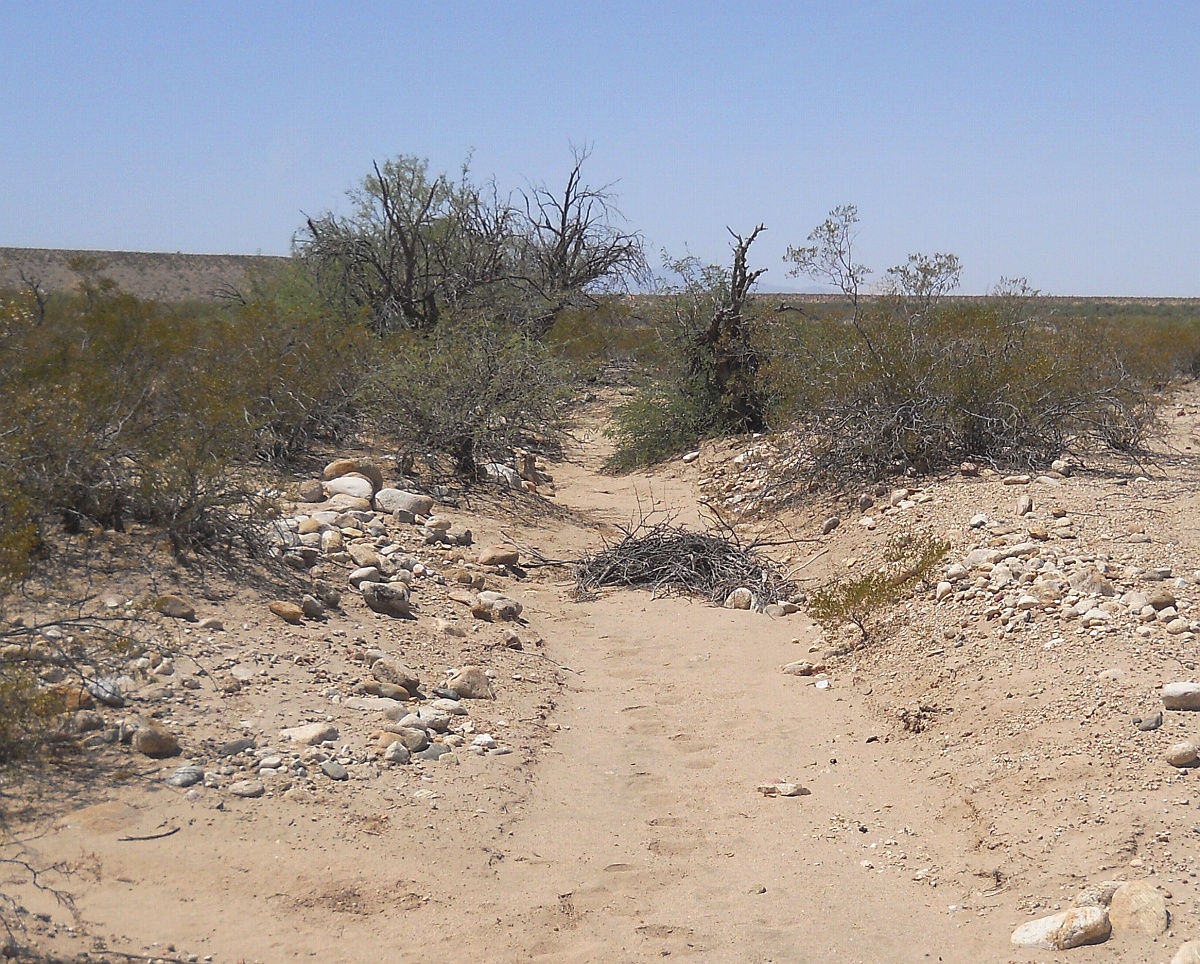
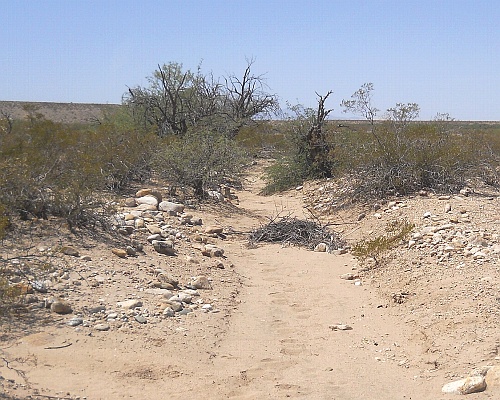
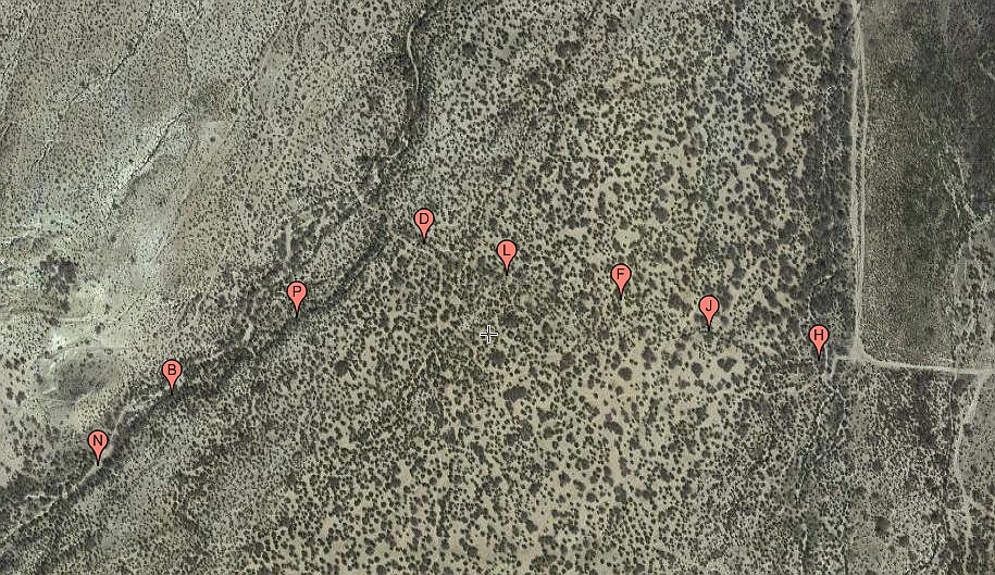
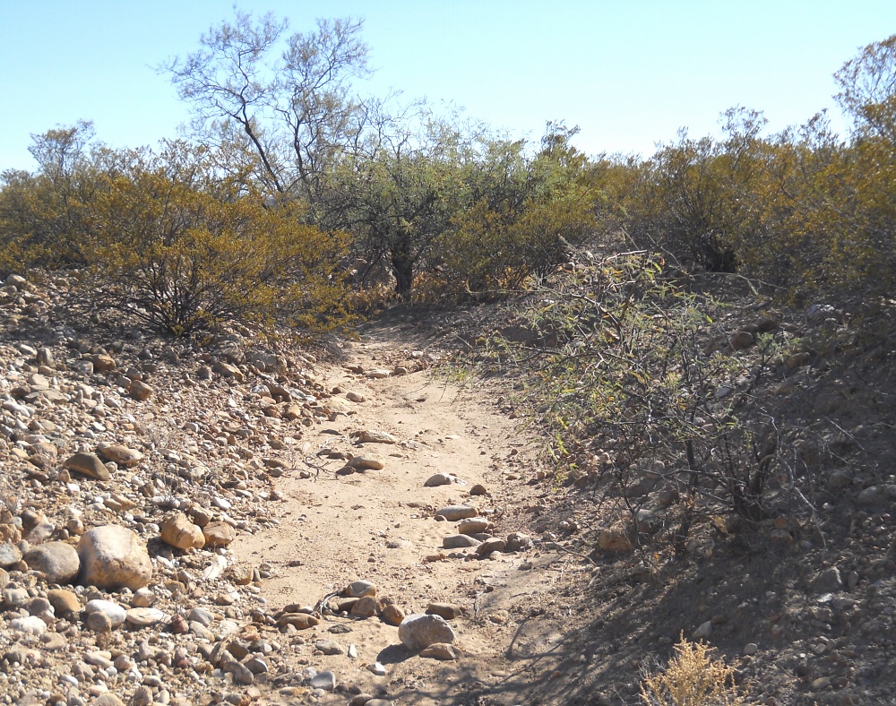
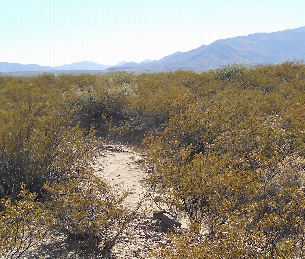
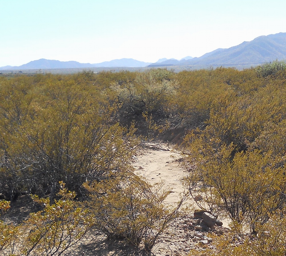
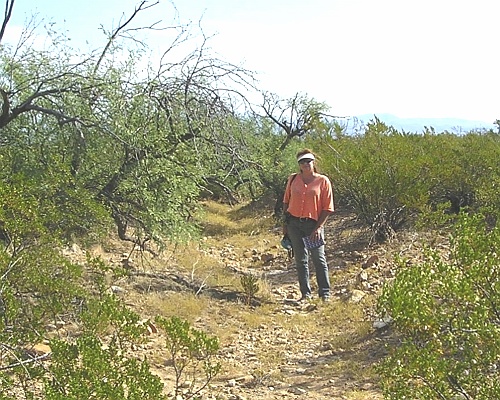
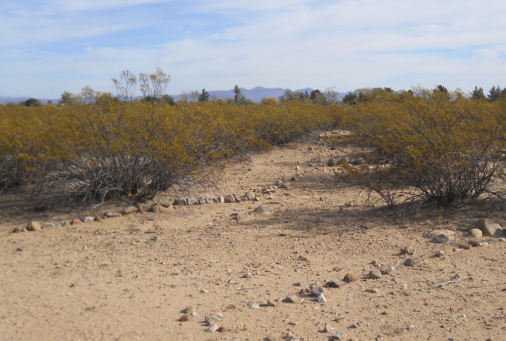
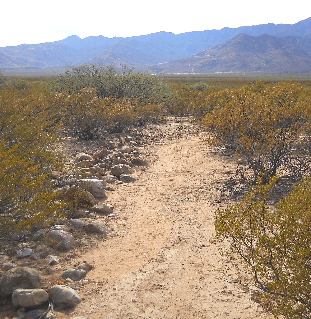
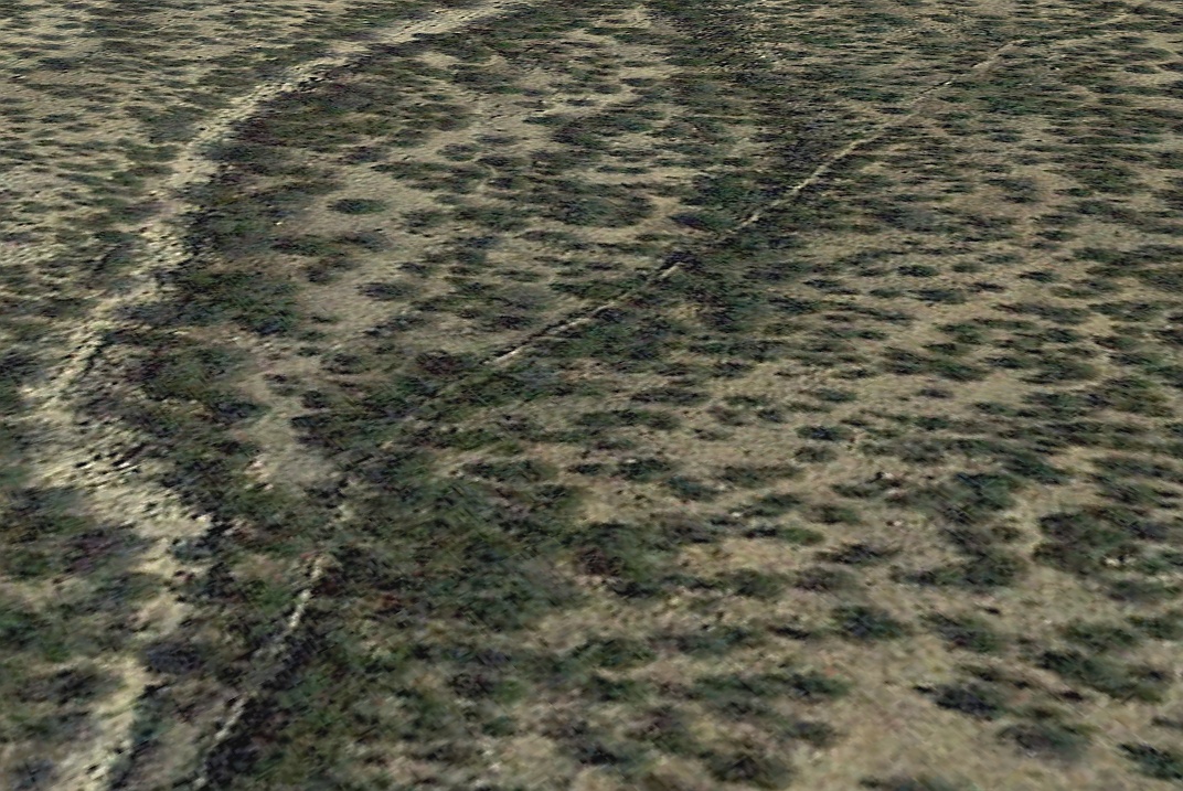
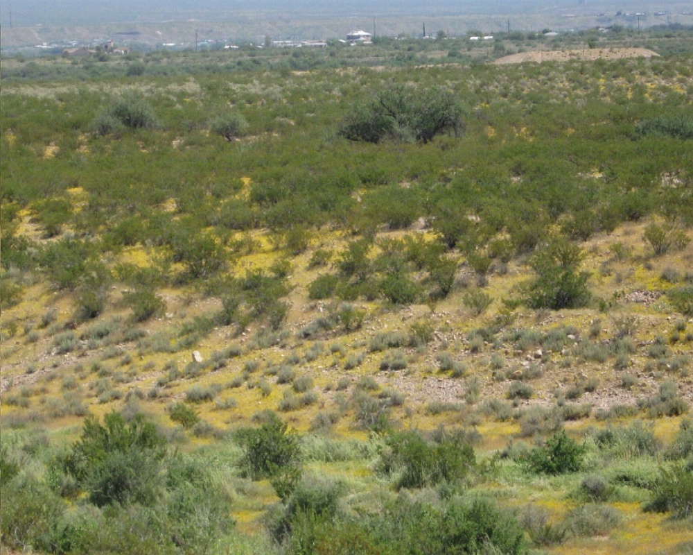
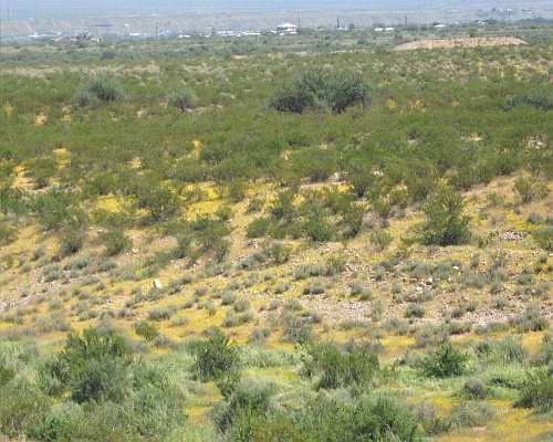
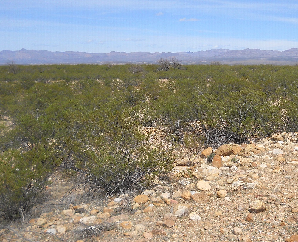
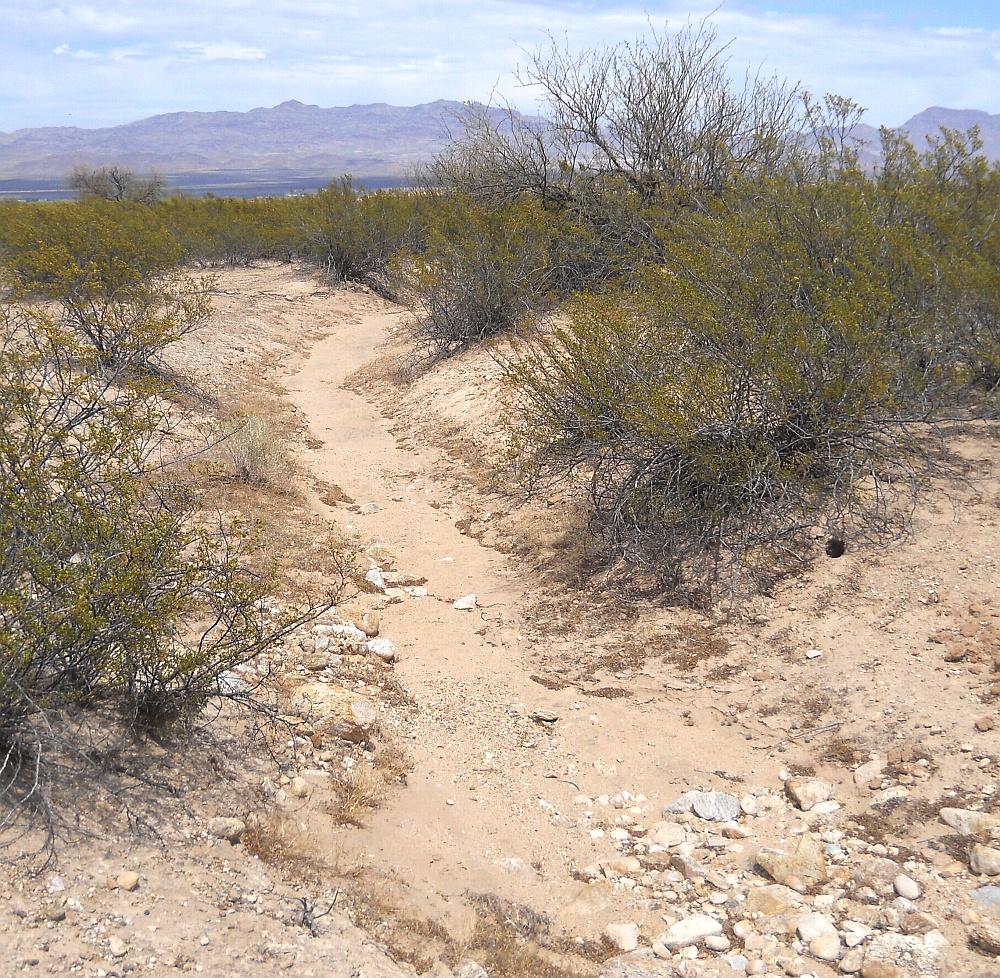
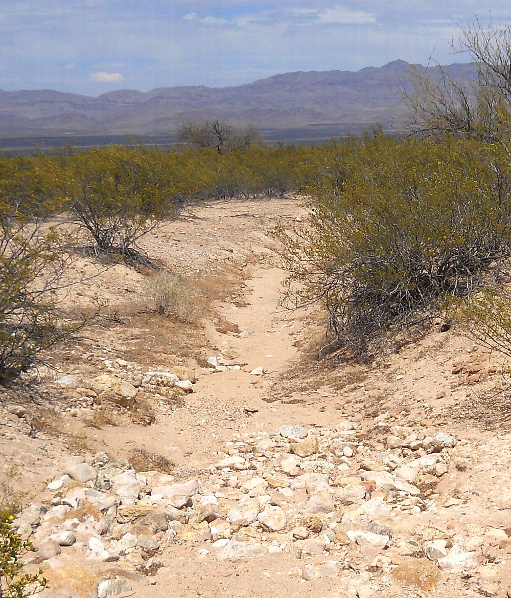
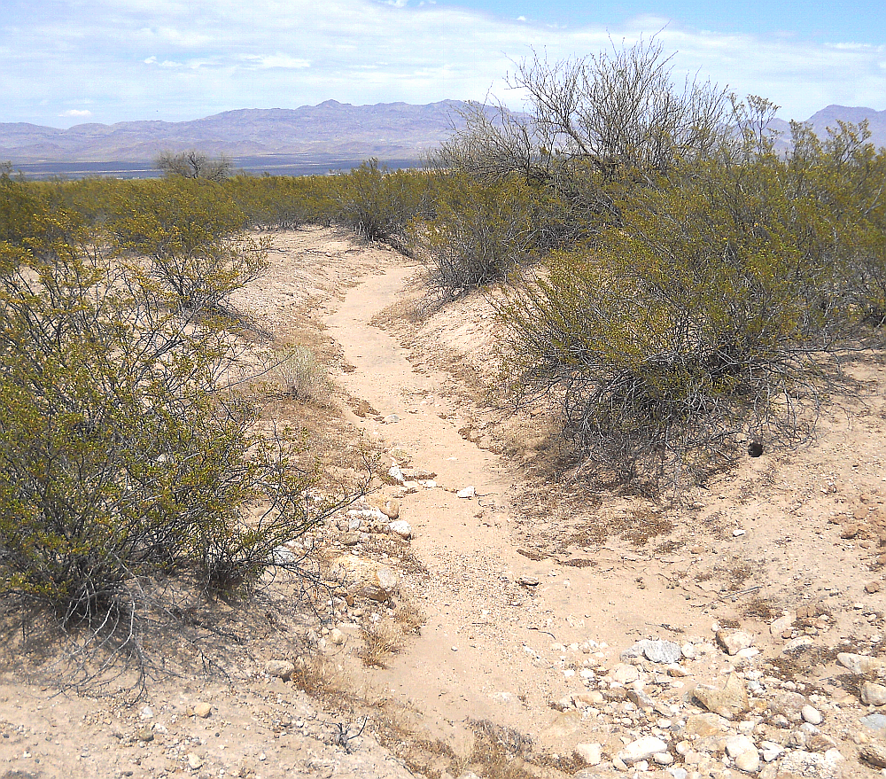
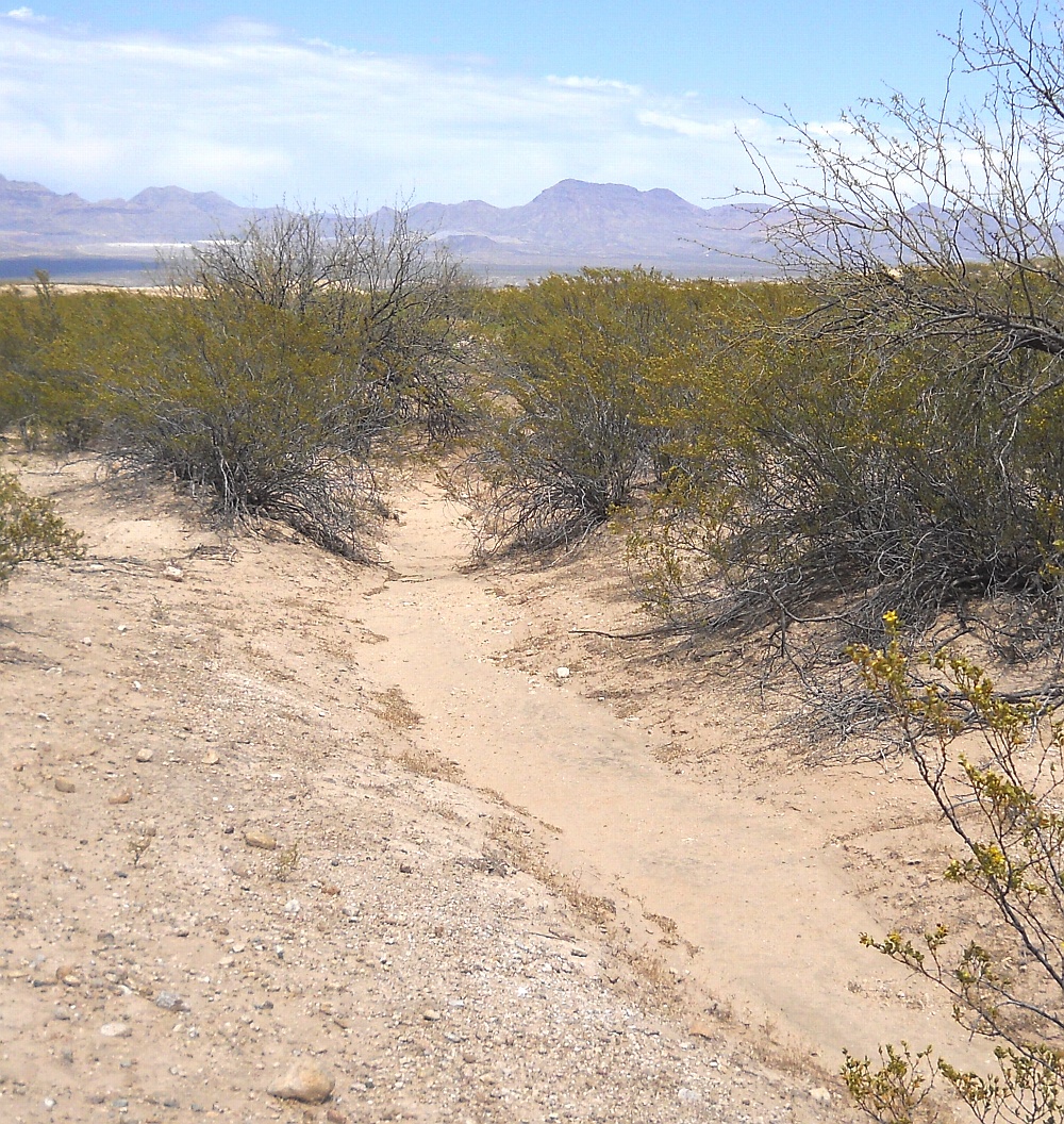
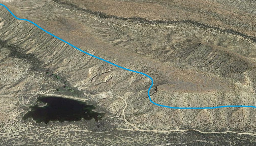
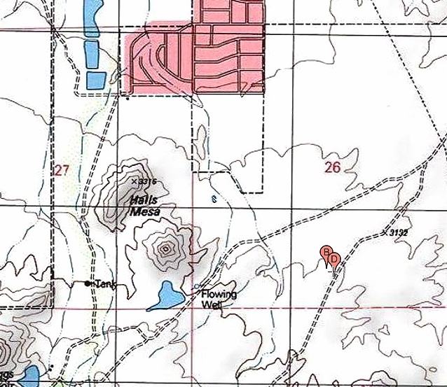
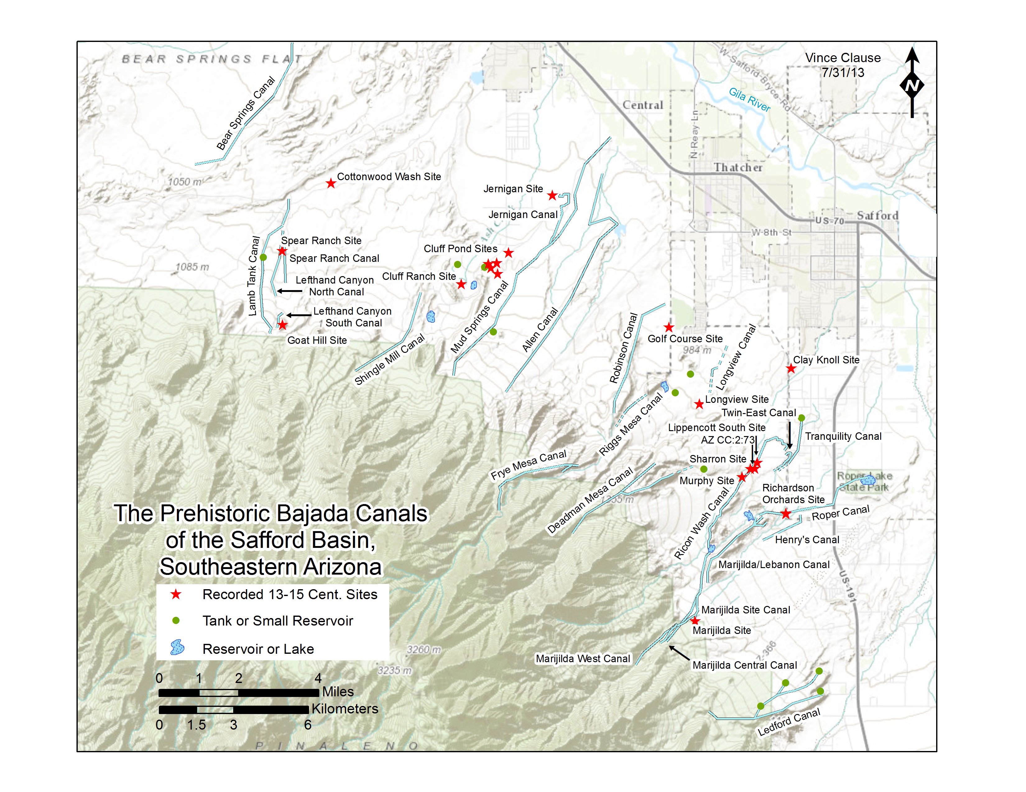
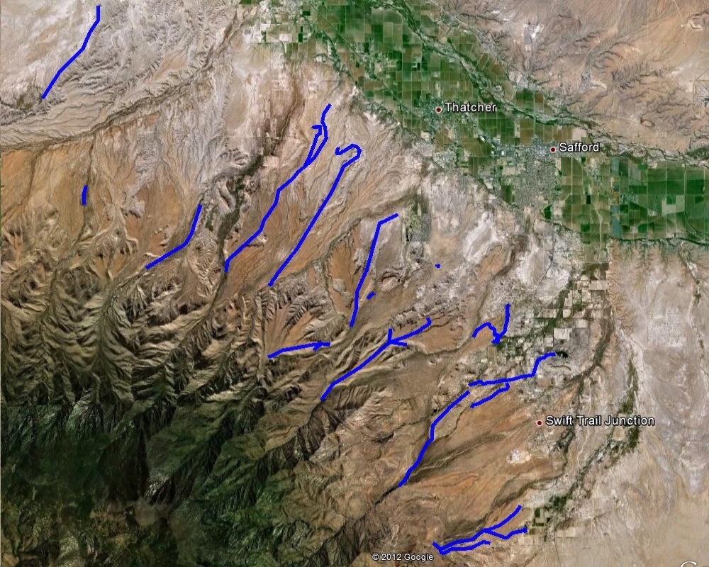
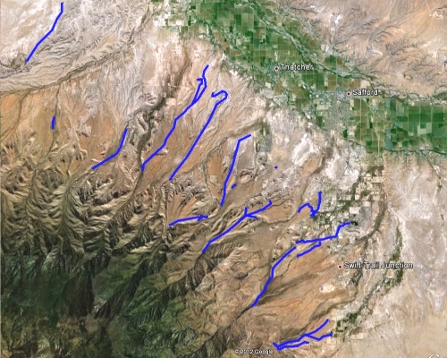
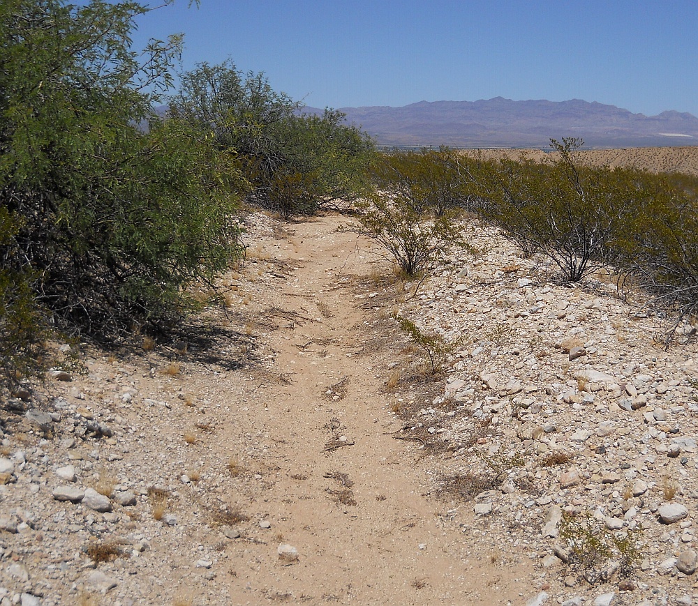
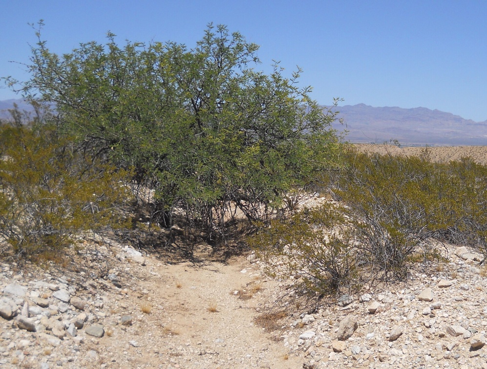
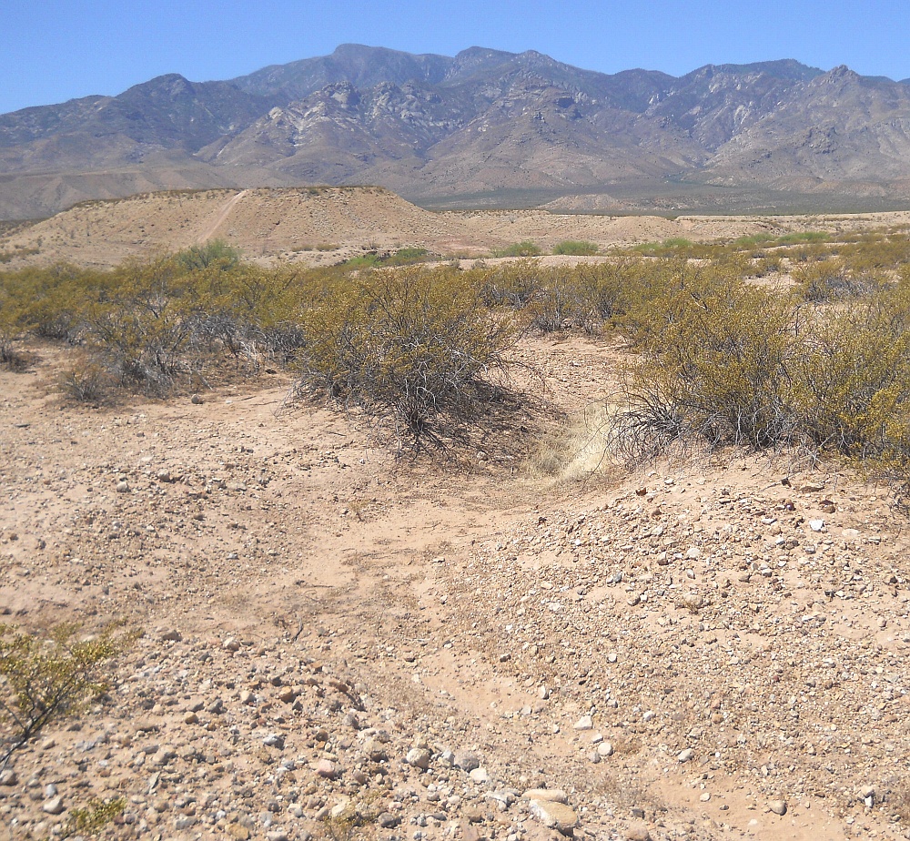
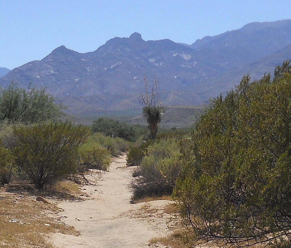
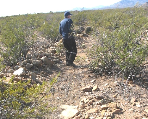
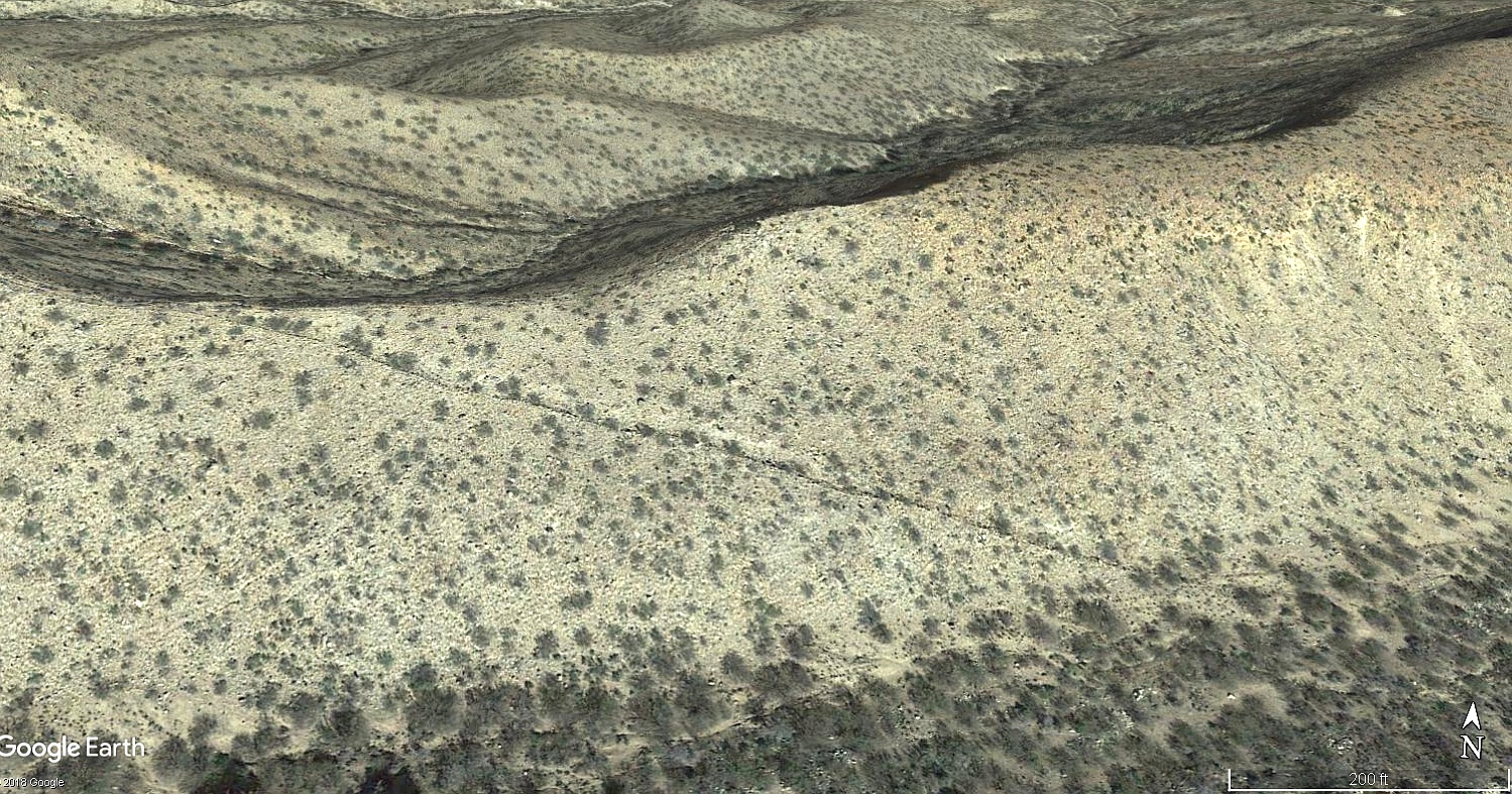
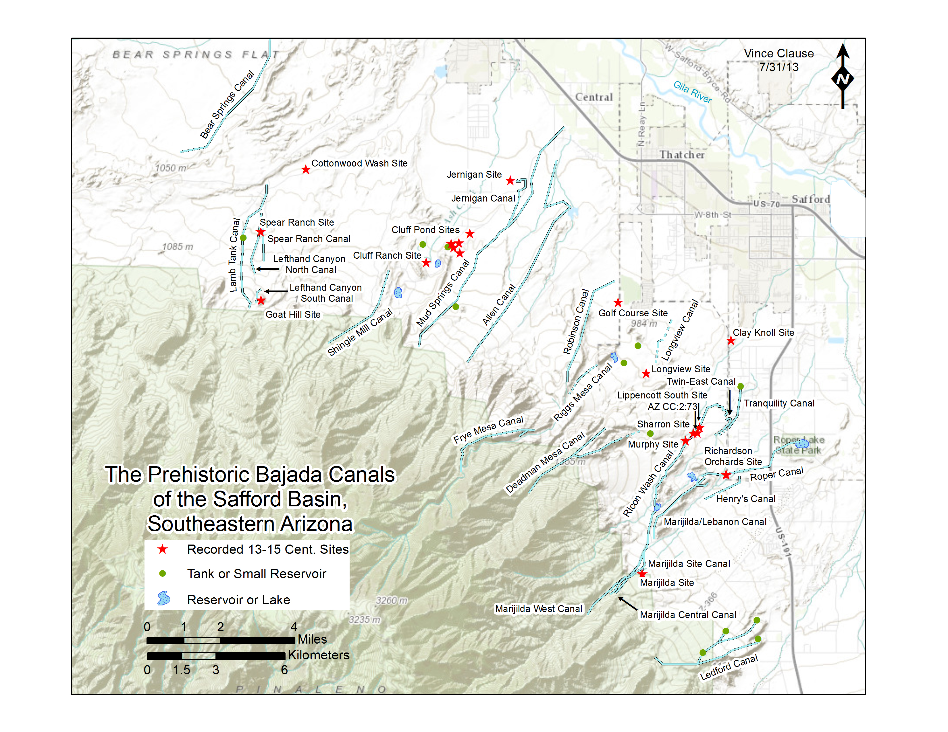
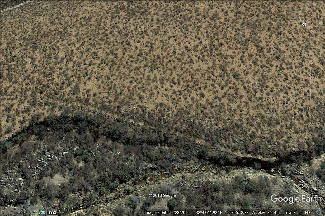
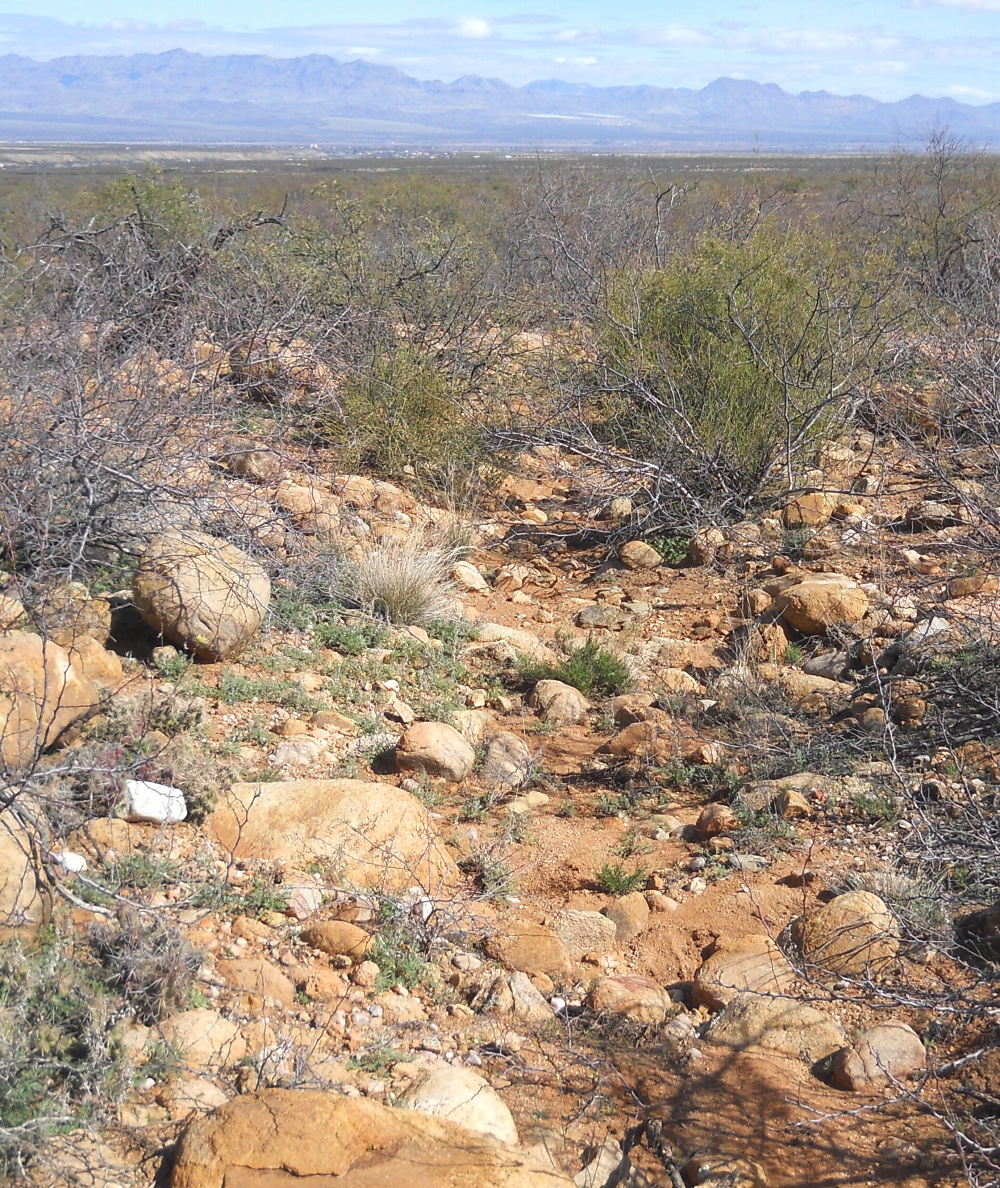
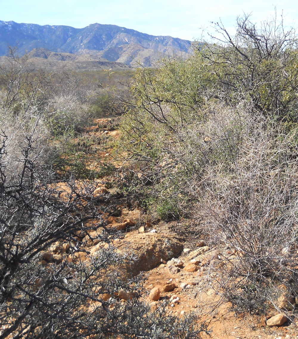
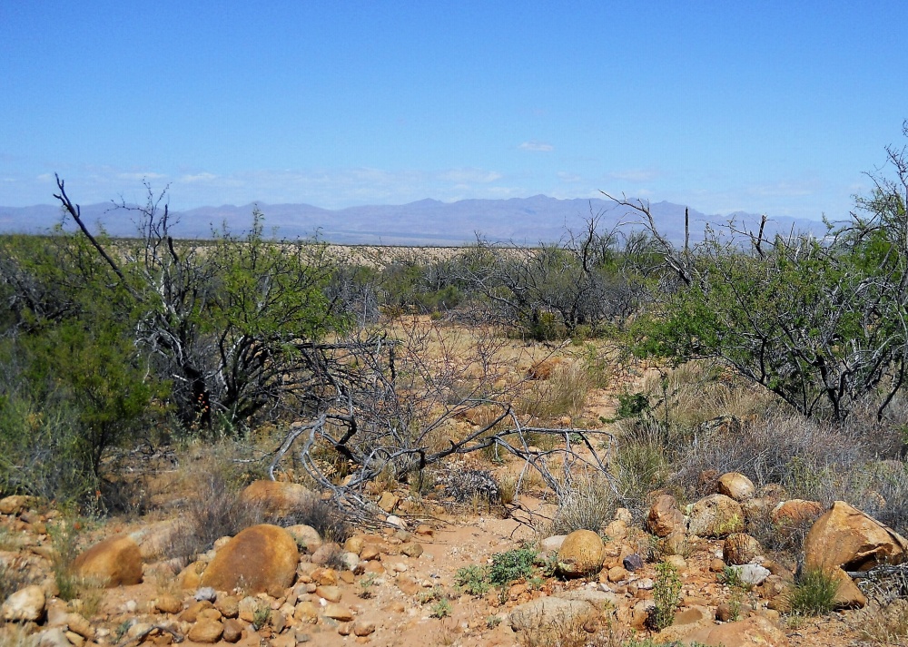
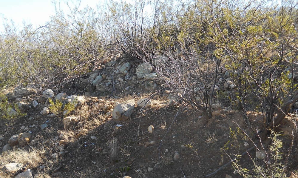
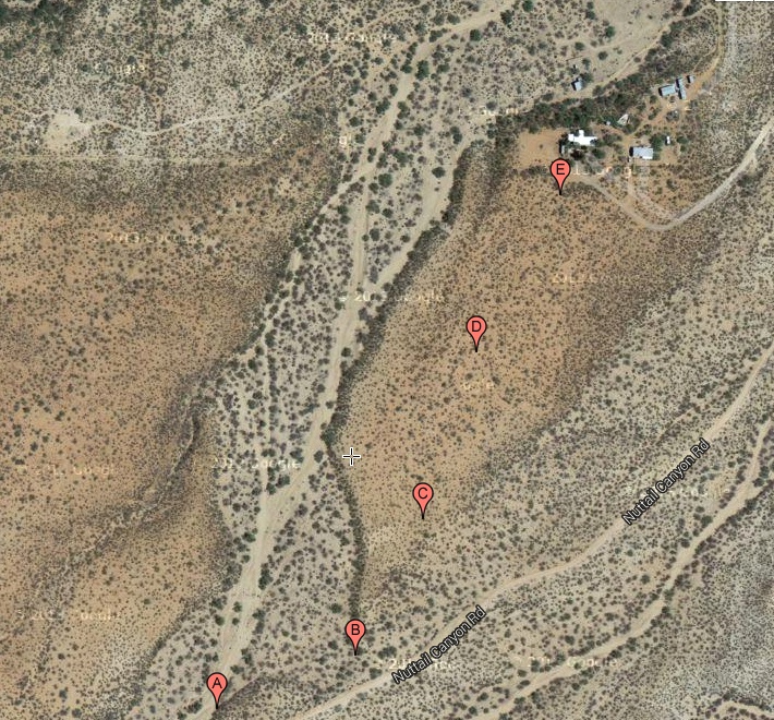
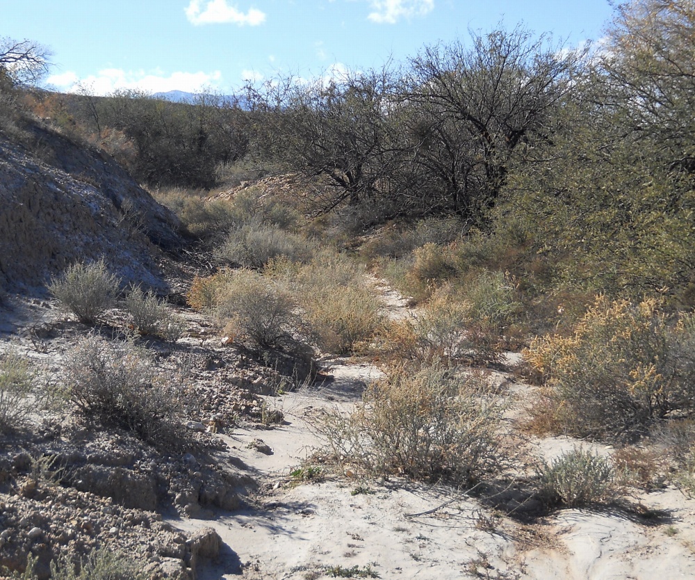
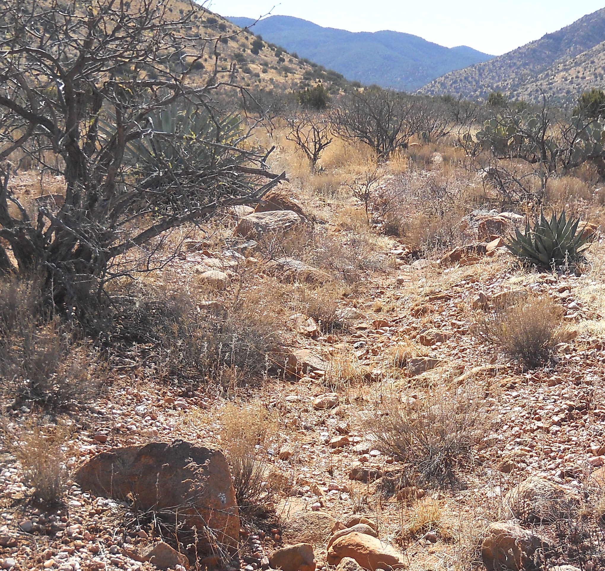
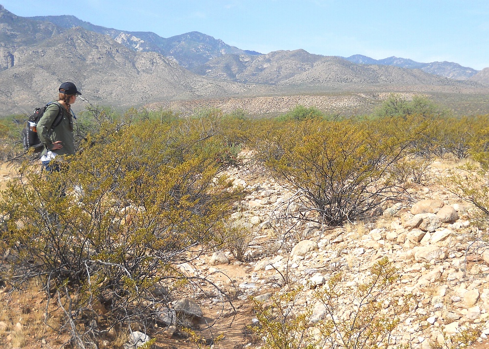
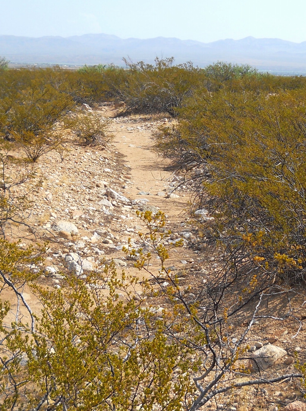
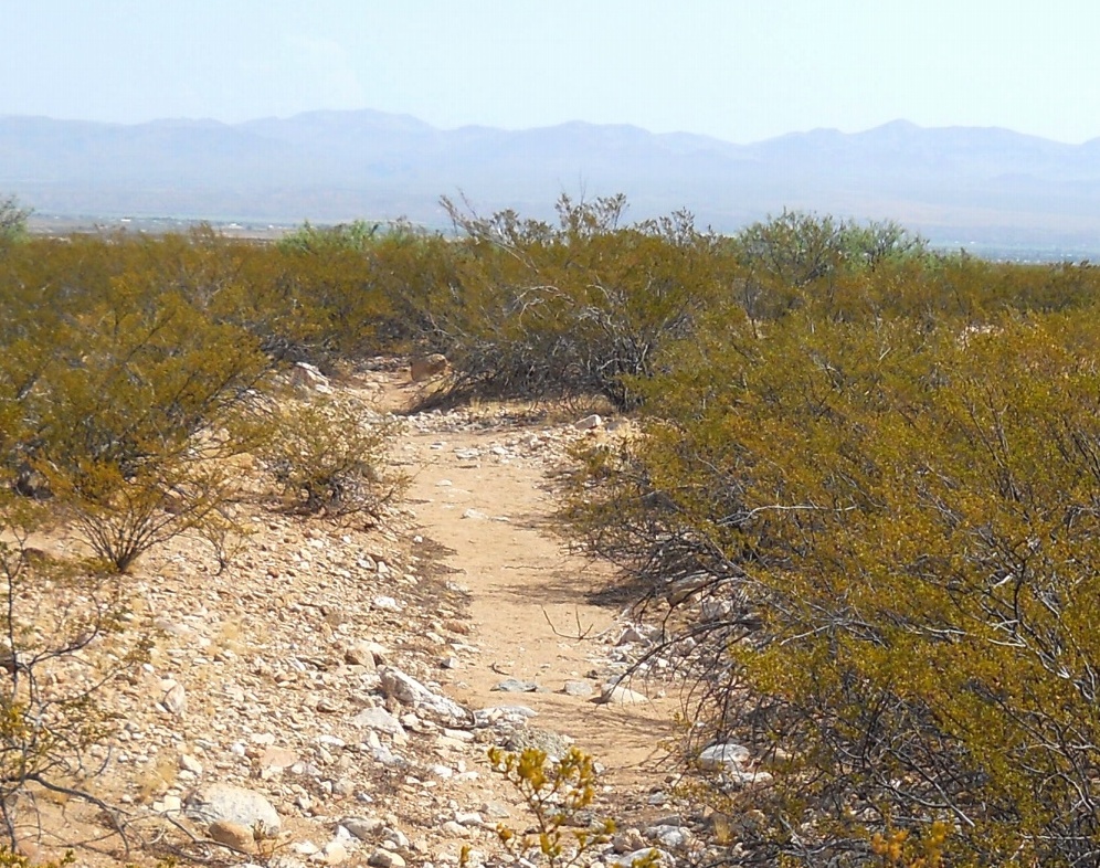
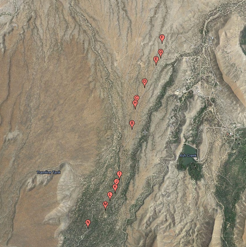
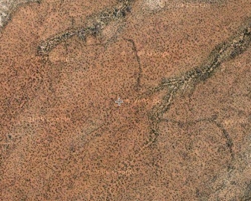
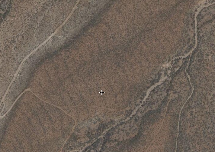
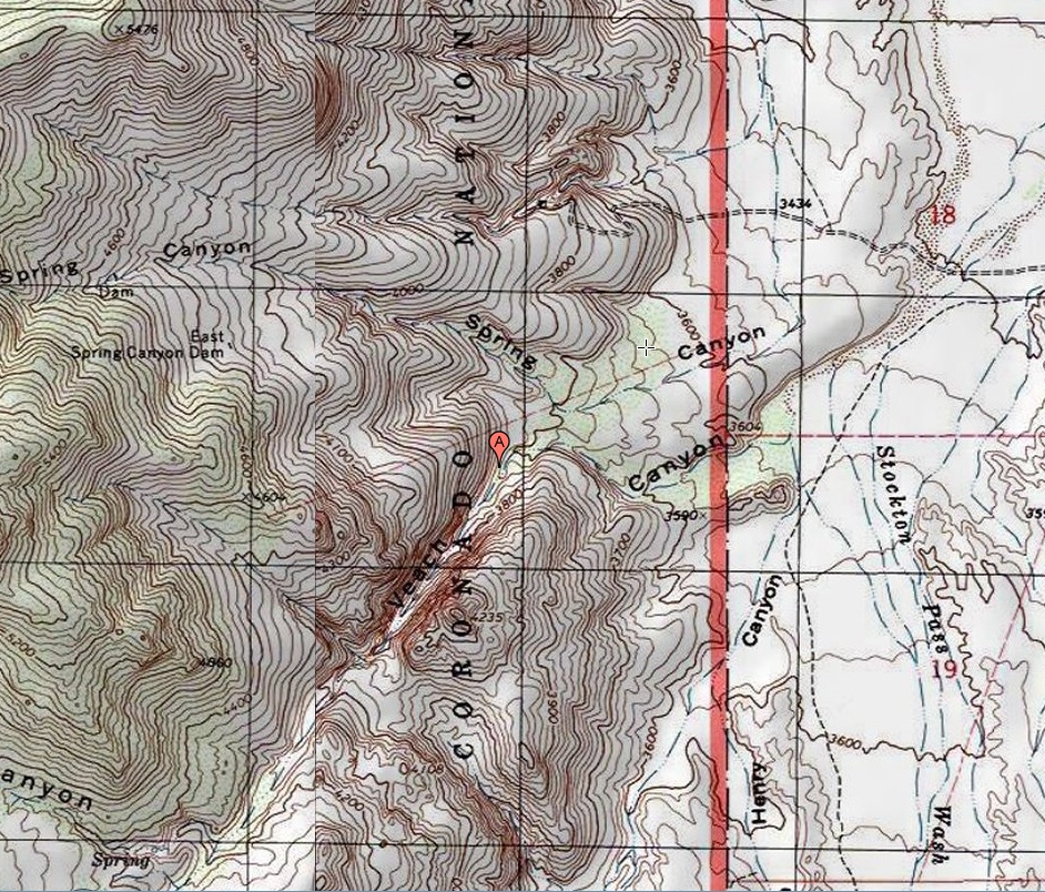
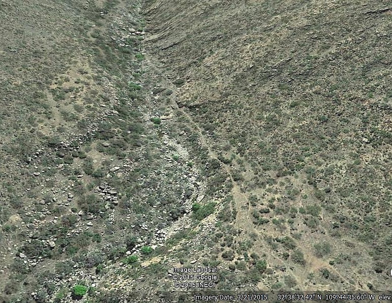
Nearly 100 canal study areas have already gotten identified,
with a projected total length likely well in excess of 150 miles
or 250 kilometers.

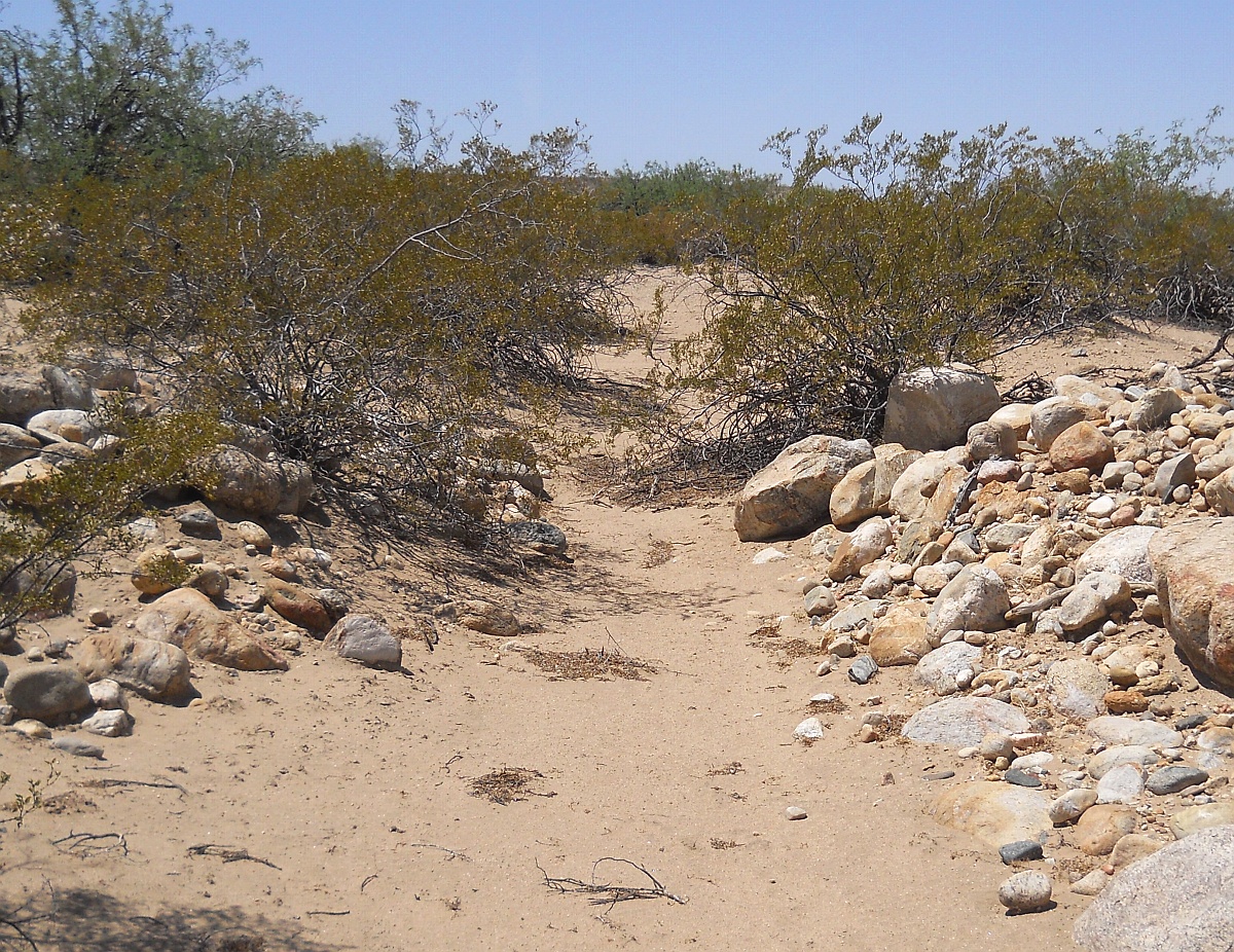
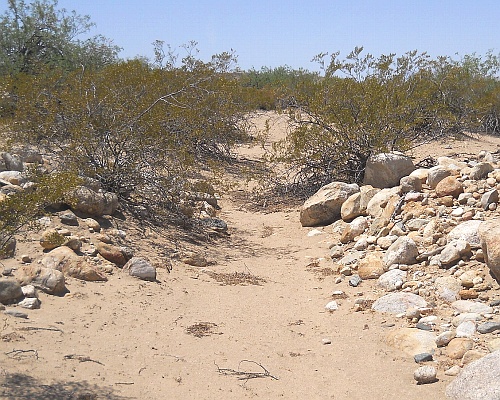
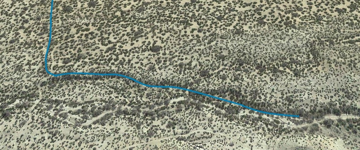
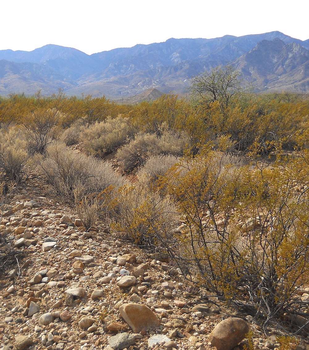
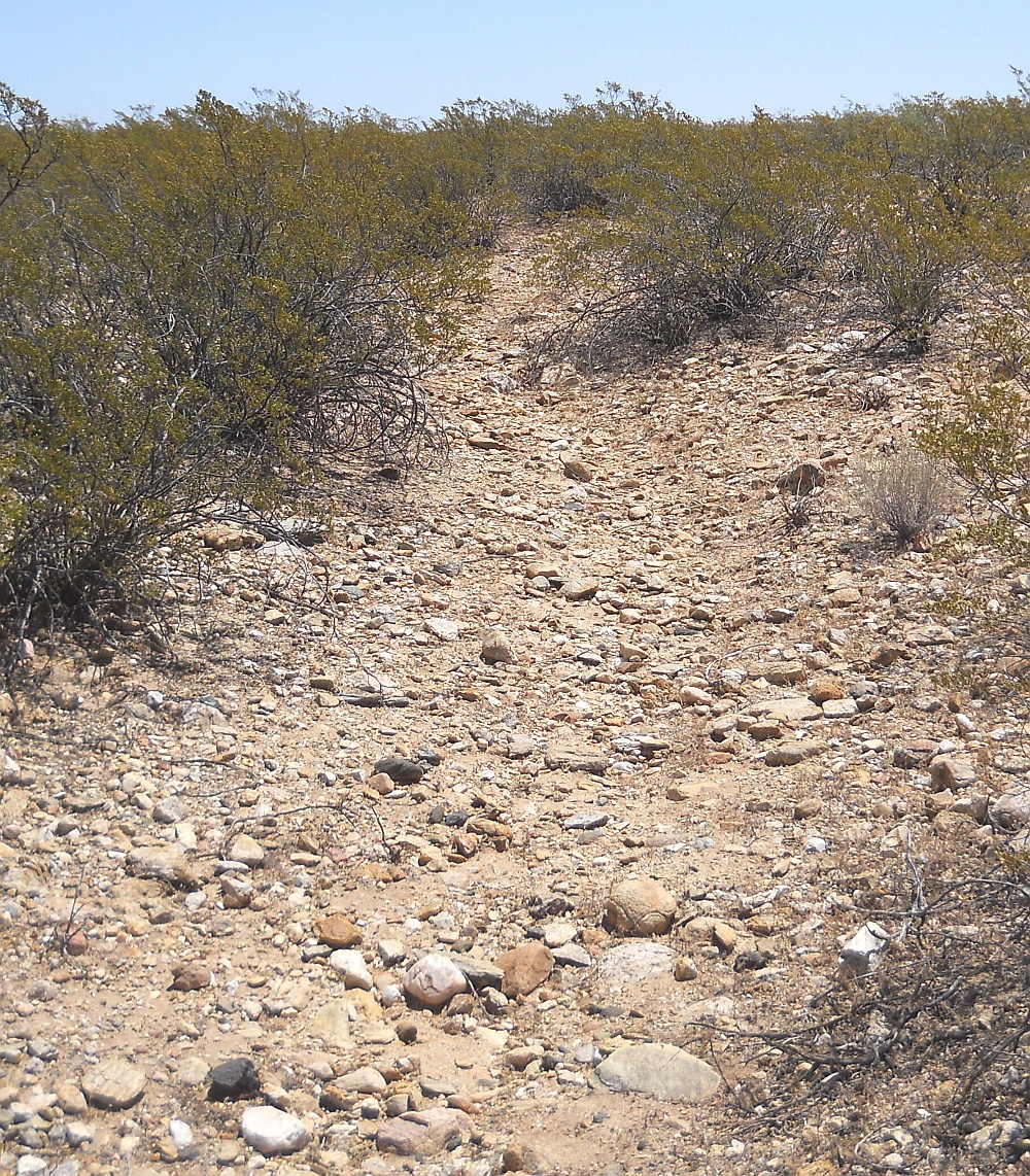
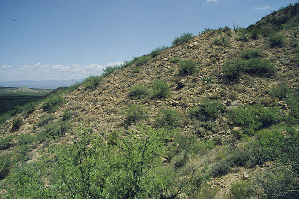
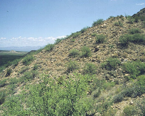
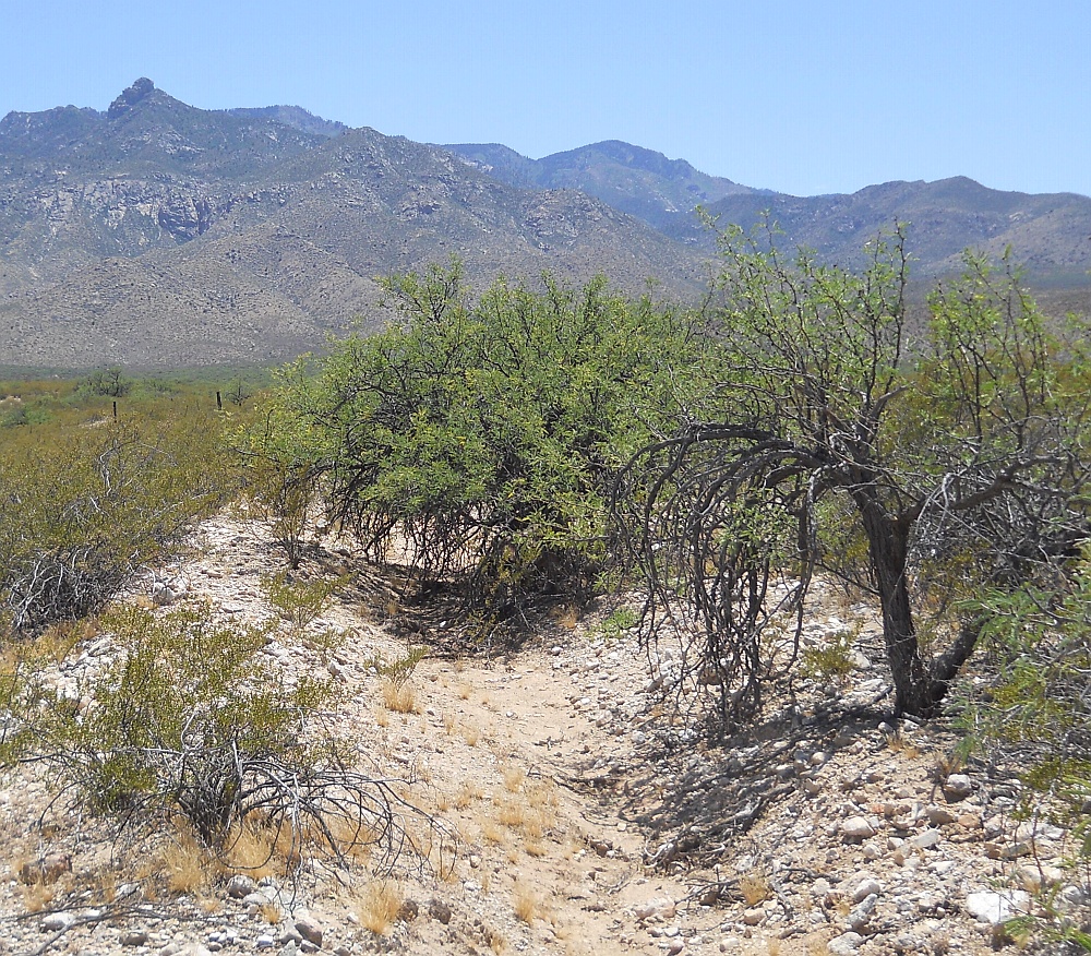
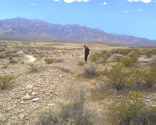
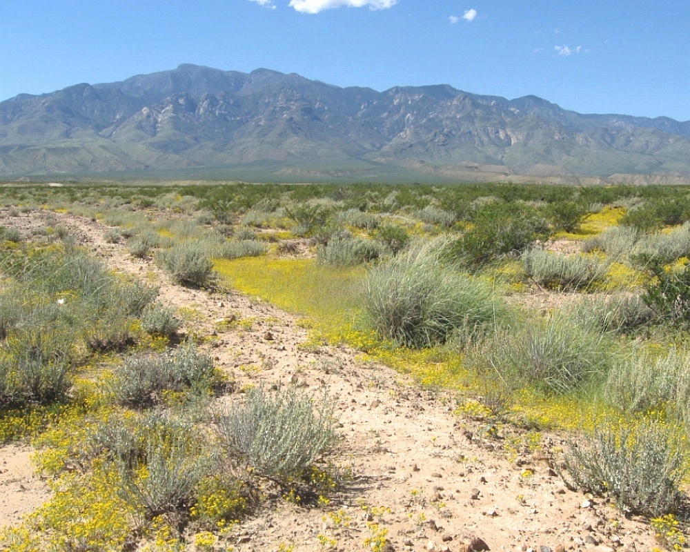
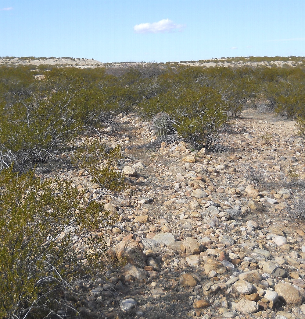
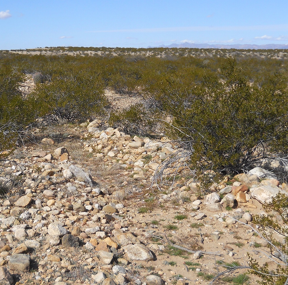
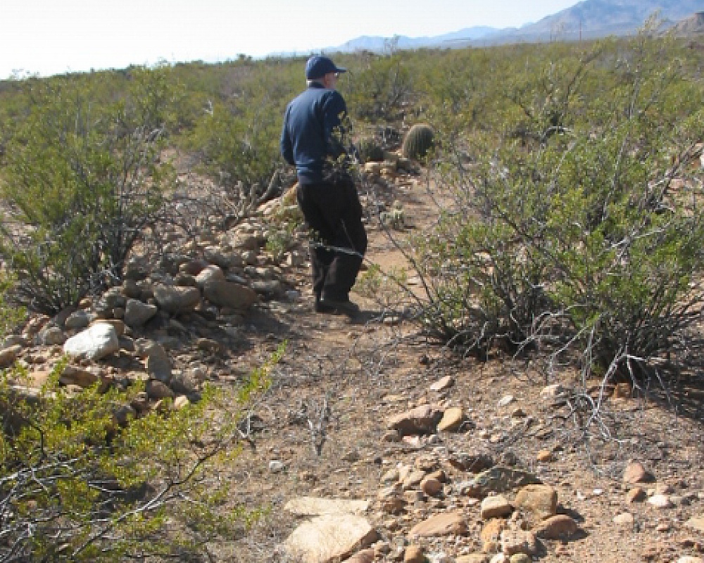
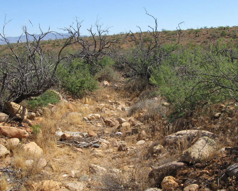
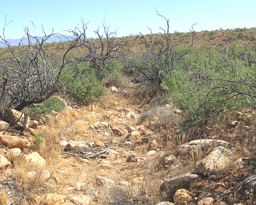
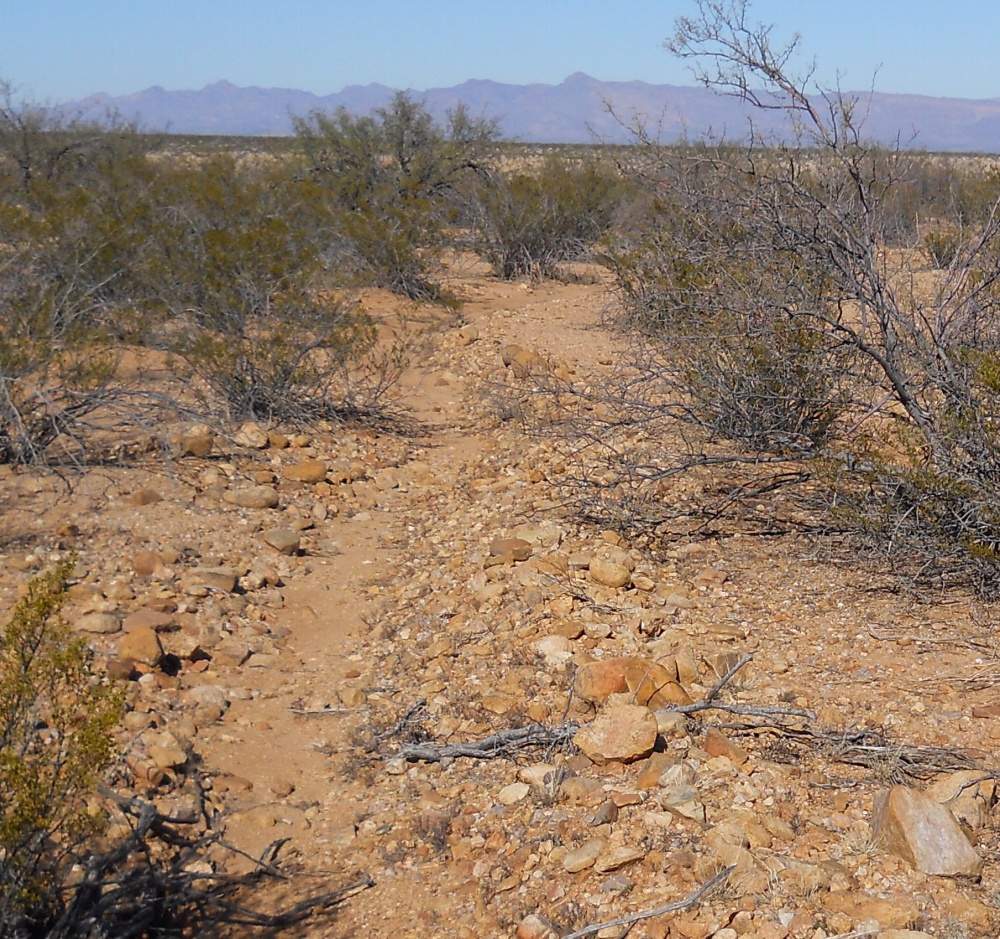
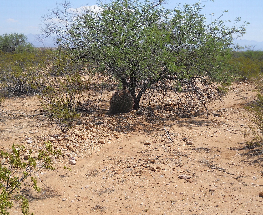
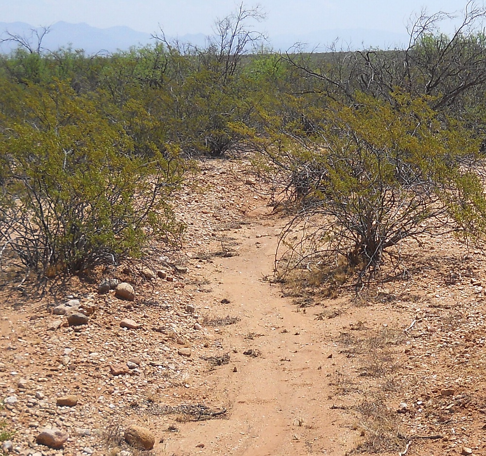
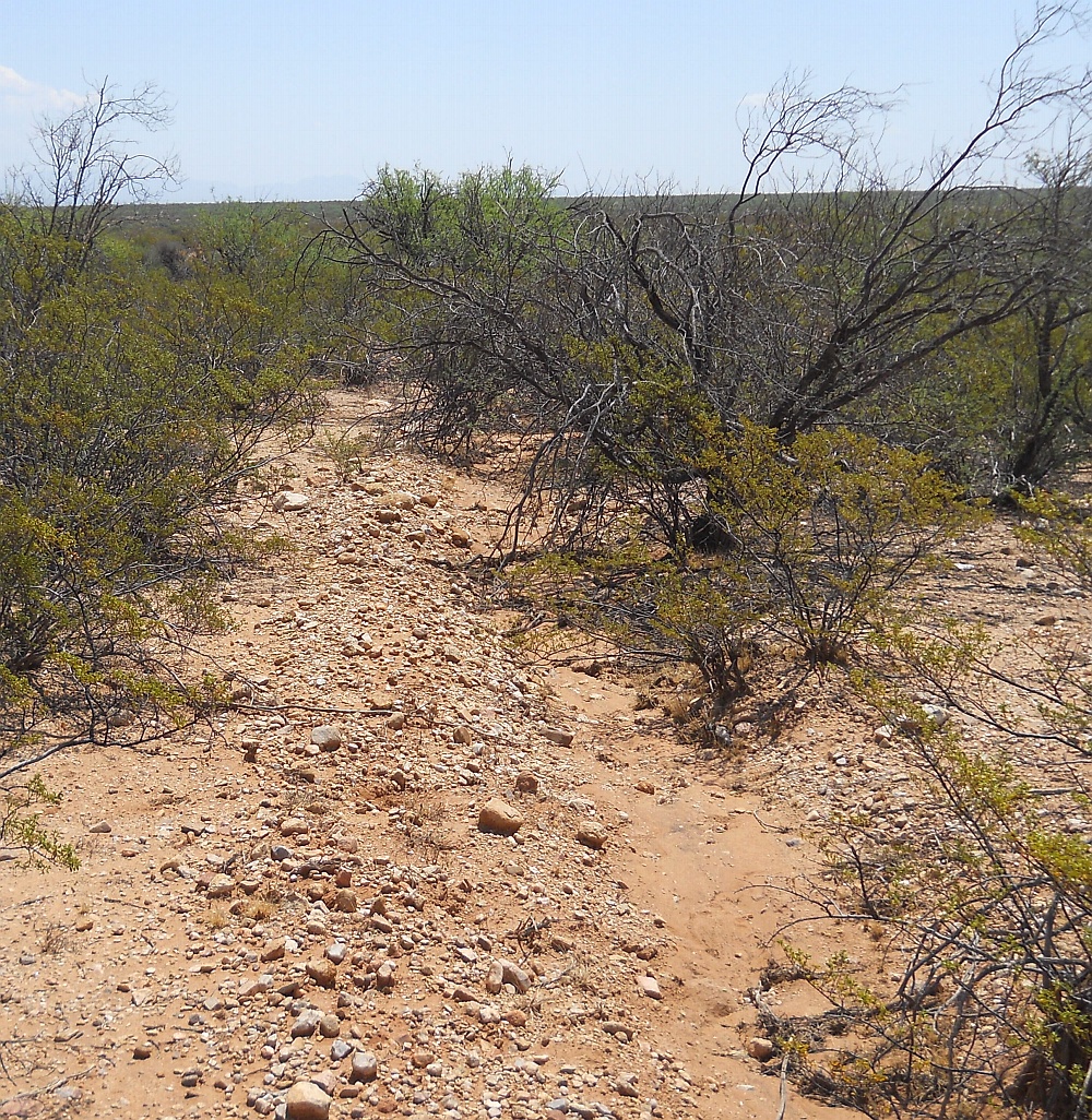
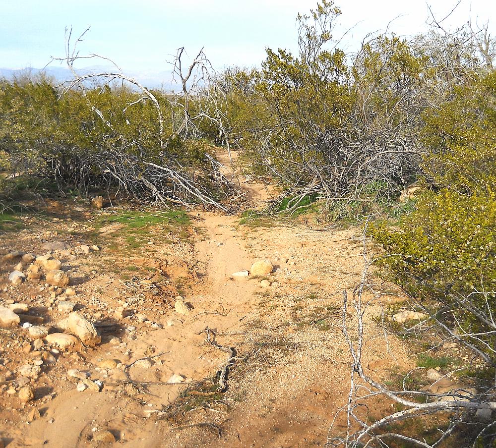
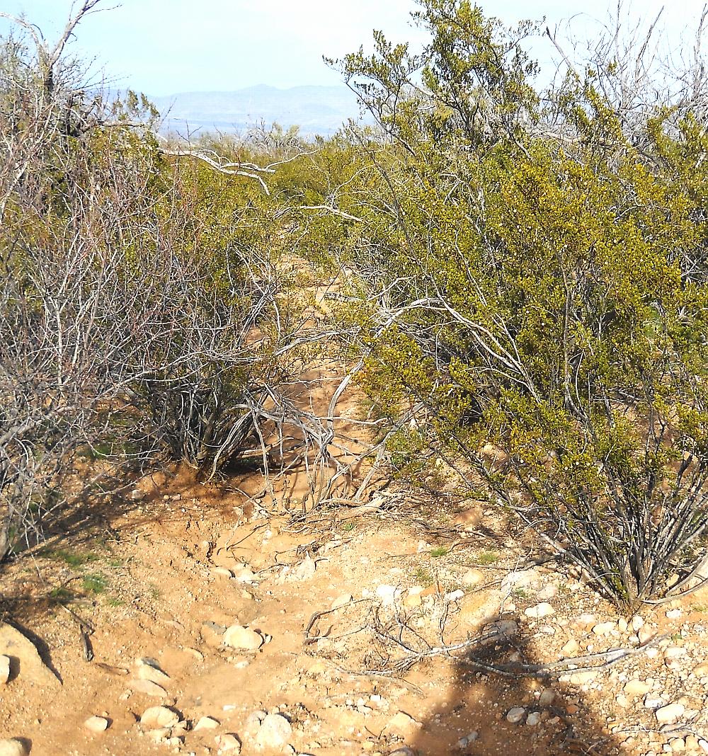
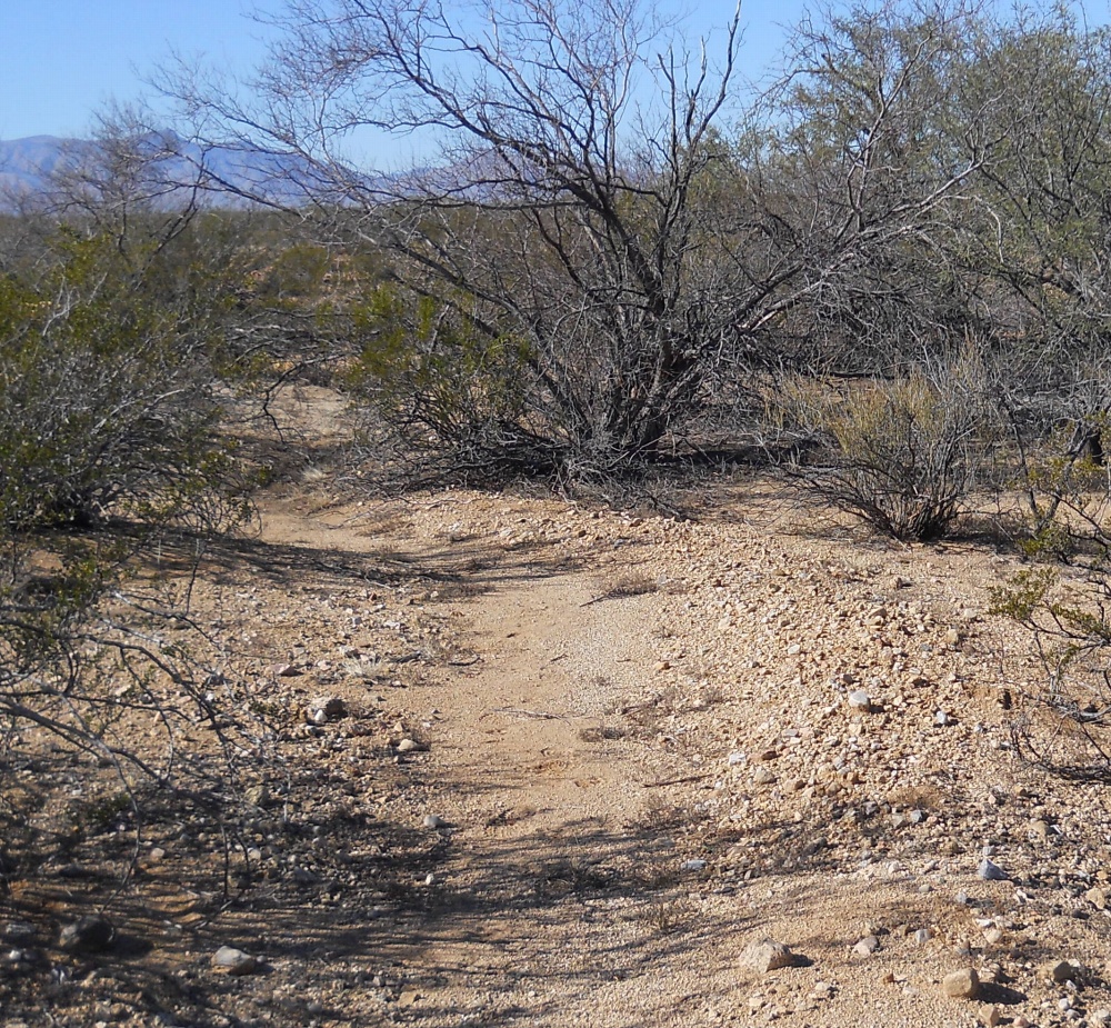
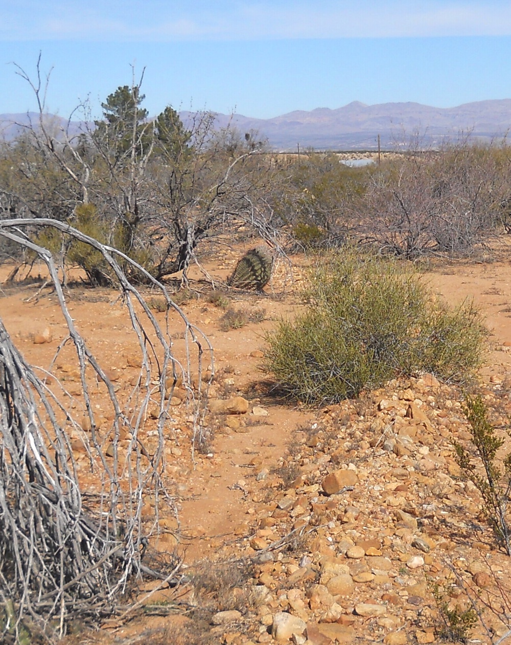
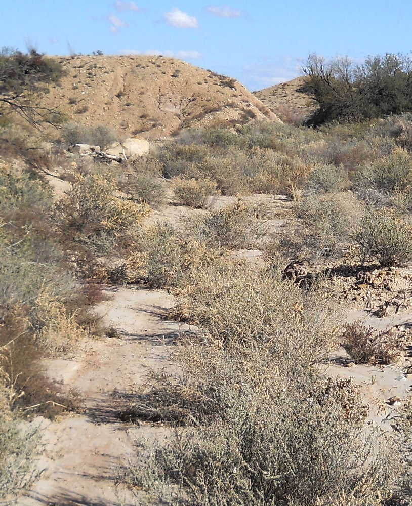
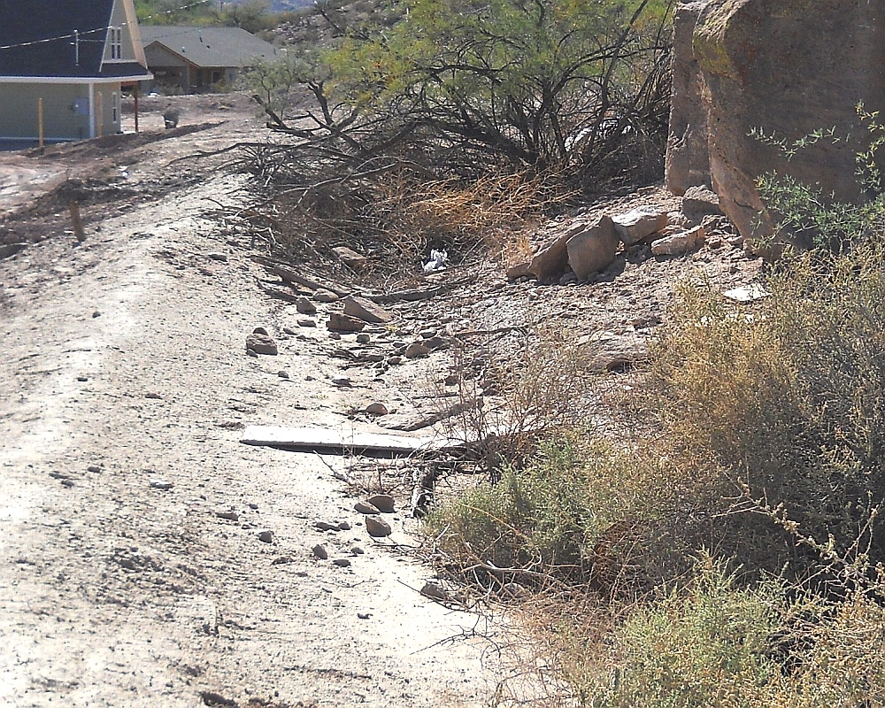
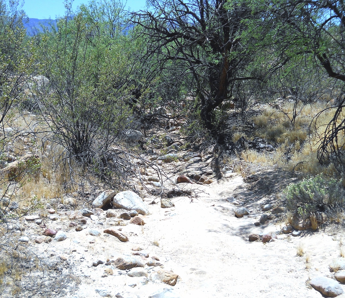
Preservation is often exceptional. It seems an attempt was
made to exploit literally every drop of mountain stream water.
Along with some related artesian sources.
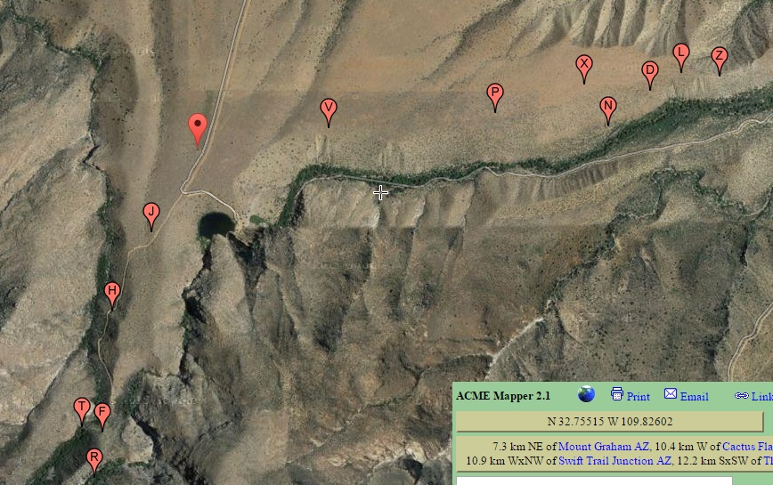
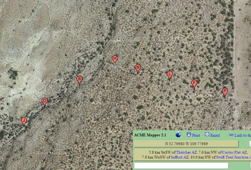
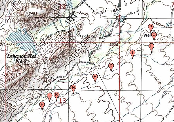
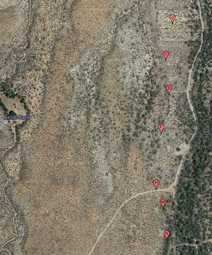
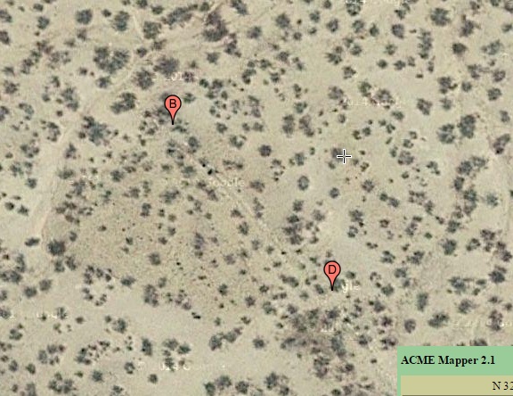
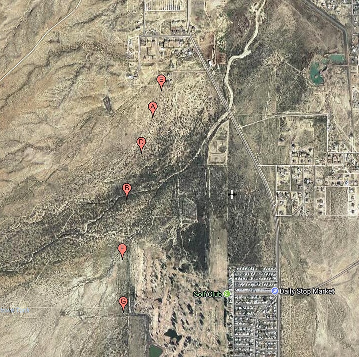
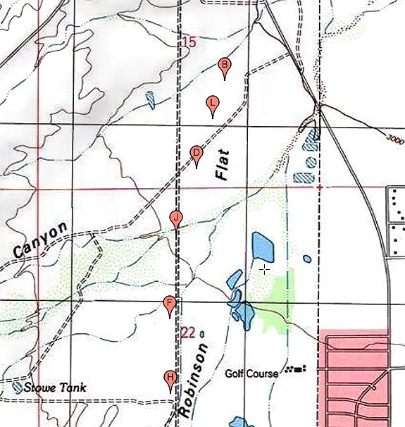
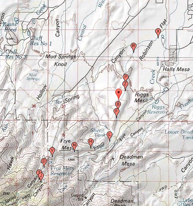
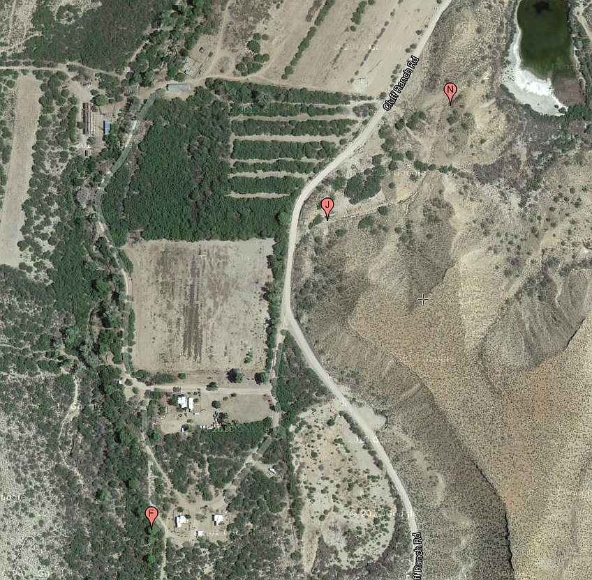
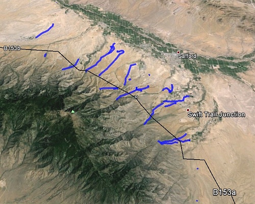
Amazingly, the system appears "complete" and free of any
apparent mistakes or failures. Other involved examples of
stunning engineering include a significant aqueduct, watershed
crossings (!), routings along the highest of available terrain, and
"counterflowing" where canal slopes drop into rising terrain.
While the vast majority of canals favor the wetter northeast
slopes, examples also literally surround Mount Graham. Which
has the highest  elevation differential of any Arizona range.
Combined with an unusually high number of perennial streams.
Other instances of area ag development include Hohokam style
riverine  canals, extensive gridded fields, mulch rings, field  houses,
rock alignments and aproned check dams.


Area Locations: deeplink   top   bot   respond

Here is the general study area...
And here is an older and click expandable map of some
of the northeastern canals...
Yes, we are working on a much better and a more complete
"flyable" KML map. Which is turning into a major project.
In general, KML is preferable to GIS in that it can be "flown"
and has all the resources of Google Earth behind it.
Both Acme Mapper and Google Earth have proven enormously
useful in our canal work.
Sadly, satellite imagery presently can only hint at the presence
of a small fraction of the canals.


Third Party Pubs deeplink   top   bot   respond

Always start here.

 
  Archaeology Southwest I
  Archaeology Southwest II

  AZ Archaeological Society
  AZ Central Story
  AZ Republic Story
  Gila Watershed paper I
  Gila Watershed paper II

  Glyphs Paper
  Lafayette Magazine Story
  Lair Mt. Graham Survey

  Safford Valley Grids
  USA Today Story
  Wikipedia Coverage


Our Own Pubs deeplink   top   bot   respond

Always start here.


  Gila Watershed Paper 
  Prehistoric Hanging Canal Engineering
  Prehistoric Hanging Canal Engineering (sourcecode)
  Prehistoric Bajada Hanging Canals
  Prehistoric Bajada Hanging Canals (sourcecode)
  Prehistoric Hanging Canal Image Tour 
  Prehistoric Hanging Canal Image Tour (sourcecode)
  Prehistoric Hanging Canal Summary
  Prehistoric Hanging Canal Summary (sourcecode)
  Prehistoric Hanging Canal Paper III
  Prehistoric Hanging Canal Paper III (Sourcecode )
  Prehistoric Hanging Canal Lecture III
  Prehistoric Hanging Canal Lecture III (Sourcecode )
  Wikipedia Coverage

  More Dr. Neely papers here, here, and here.

  Gila Valley Dayhikes
  Little Known Dayhikes
  Allen Dam Failure

  Tramway History
  Tramway Show
  Tramway Specs

  Gonzo Utilities ( needed for above sourcecodes )
       Support here. Tutorial here. Reference here.


Index & Directory: deeplink   top   bot   respond

The prehistoric Bajada "hanging" canal study areas are
listed here in roughly east to west order. A few "losers" do
remain in this listing in order to divert any future duplication.
Many of the names were somewhat arbitrarily assigned.

1. Veech
2. Goat Tank
3. Ledford Tank
4. Low Jacobson
5. Upper Marijild
6. Main Marijilda
7. South Feeder
8. The Aqueduct
9. Lebanon Hang
10. Sixpack
11. Henry's
12. Roper Lake
13. Rincon
14. Tranquility
15. Discovery Prk
16. Twin East
17. Twin West
18. TB Ponding
19. Bear Flat
20. Goat Hydro?
21. Deadman West
22. Water Spread
23. Bigler Canal
24. Mulch Rings
25. Aproned Check
26. Alberto's Sign
27. Longview
28. Upper Frye
29. Mid Frye Delv
30. Low Frye Pond
31. HS Canal
32. Early Freeman
33. Blue Ponds
34. Riggs Mesa
35 Golf Course
36. Twin Artesian
37. Robinson
38. Allen canal
39. Allen D Failure
40. Culebra Cut
41. Ash Creek Fed
42. Mud Springs
43. Troll House
44. MudJern Bch
45. Mud Tank
46. Jernigan
47. Lower Mud
48. Smith Tank
49. Cluff Southwest
50. Cluff Northwst
51. Minor Webster
52. Tugood
53. Main Lefthand
54. Lefthand West
55. South Lefthnd
56. Lamb Tank
57. Mystery Rech
58. Sand Wash
59. Nuttall Divers
60. Bear Springs
61. The Grids
62. Bandelier
63. UFO Fish Filts
64. P Ranch
65. Spear Ranch
66. Sand West
67. Sand Center
68. Deadman East
69. Taylor
70. Lower Frye
71. Bandelier Ext
72. Canal nr UFO
73. Hog Canyon
74. Grant Creek
75. Low Frye Extn
76. Tailwater
77. Artesian #1
78. Artesian #2
79. Lopez
80. Reay Canal
81. Thunderbird
82. Lower Rincon
83. Deep Vee Mys
84. Henry's Fields
85. Thunbird Rwk
86. Int Supercanal
87. Cottontail Arts
88. Frye Pipeline
89. In Process
90. San Jose Rivn
91. Jernigan Ext.
92. Freeman Filds
93. Tripp Canyon
93. Levada
95. Sunny Flat
96. Aravaipa
97.    ----
98.    ----
99.    ----
100.  ----

Preliminary Field Notes: deeplink   top   bot   respond

Our present bajada hanging canal docs on Researchgate,
on our website, and elsewhere do include...


Allen Canal

Bear Springs Canal 
Cluffnw Canal 
Deadman Canal 
Frye Complex
Henry Canal
Jernigan Canal
 
Longview Area 


Lower Frye Construct

Mud Springs 
Reay Canal 
Robinson Canal  
Tranquility Canal 
Tugood Canal 
Veech Canal


Intended for priority major upgrade are...


Freeman Canal
Lefthand Canal
Minor Webster
Riggs Mesa

Sand Canal 
Smith Canal 
TB Ponding Area

This list is currently only preliminary and incomplete.
Availability of new field notes are often announced here.
Proof the Canals are Real: deeplink   top   bot   respond

While no single factor by itself can unambiguously prove that the
canals are both in fact real and prehistoric, evidence from multiple
independent sources collectively overwhelms other possibilities...
Factors that the canals are man made...

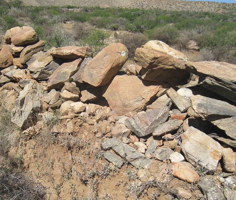
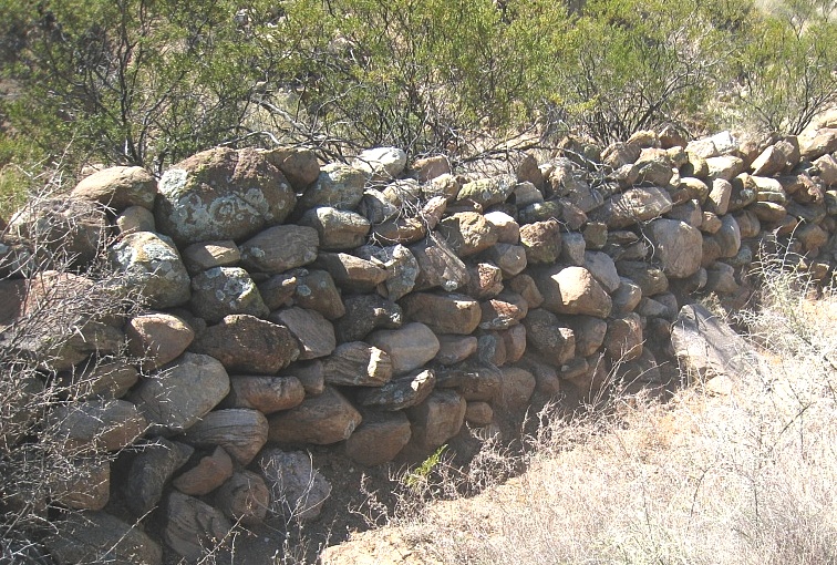
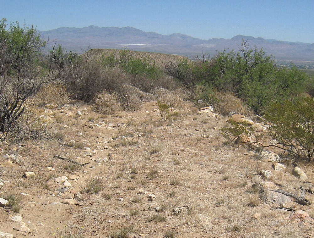
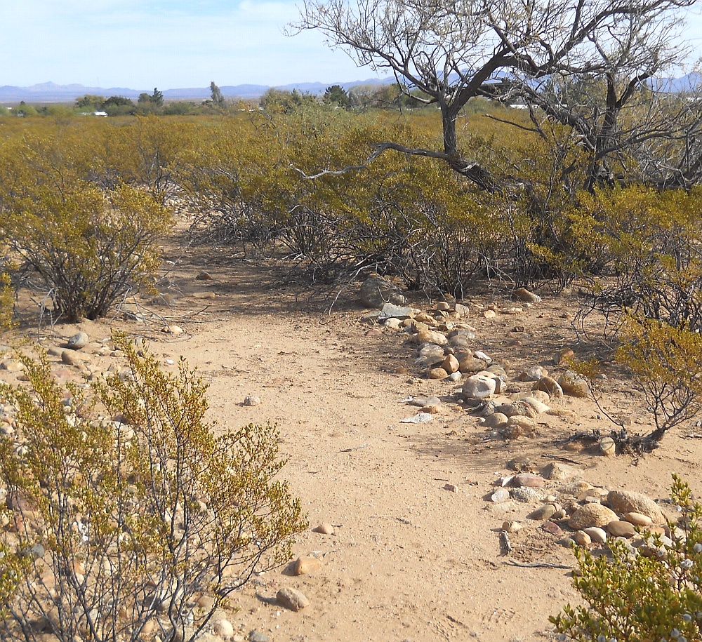
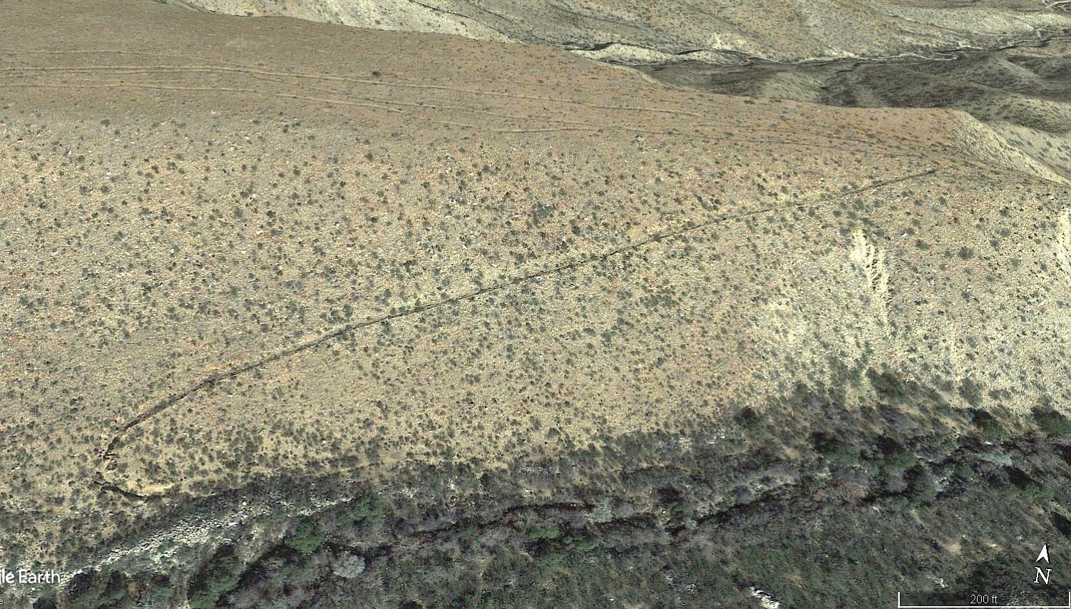
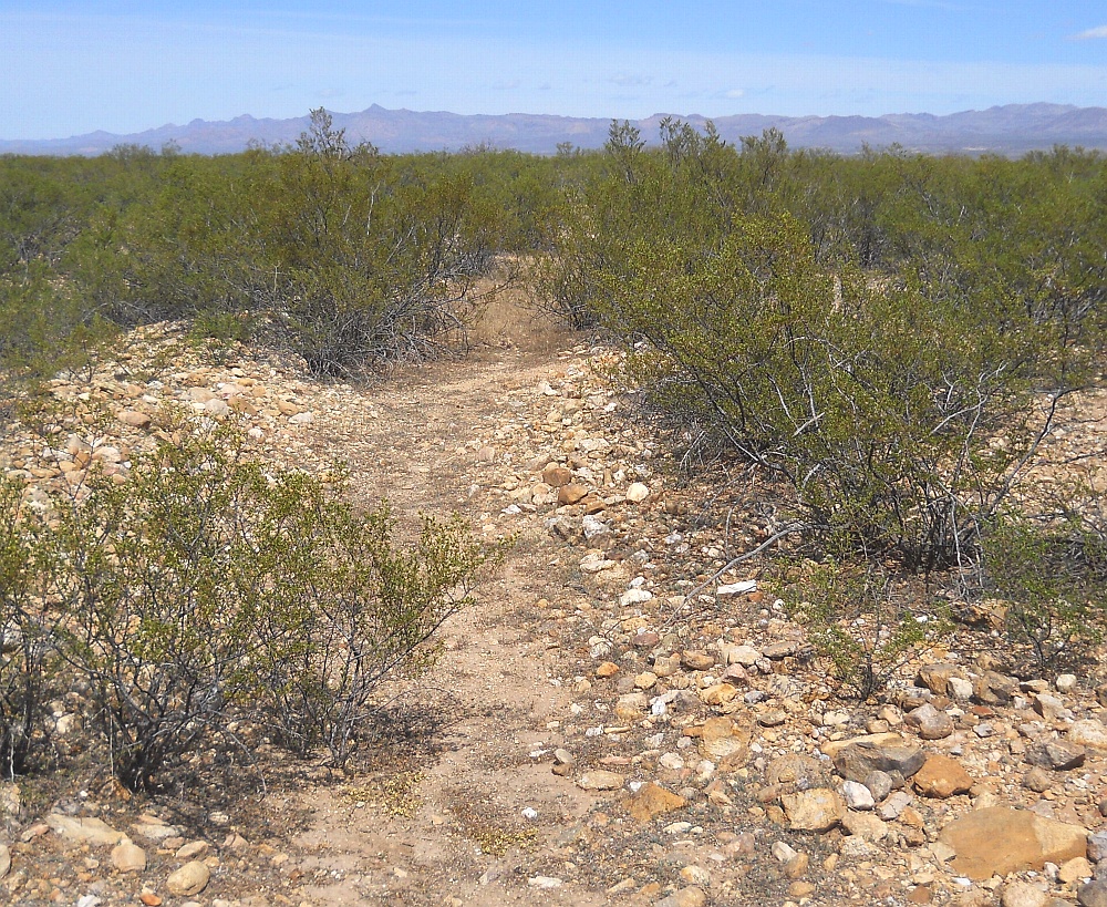
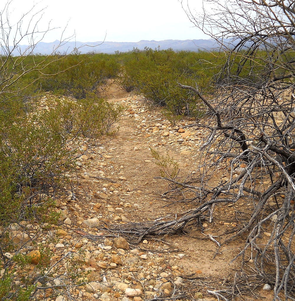
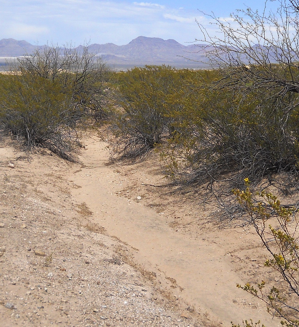
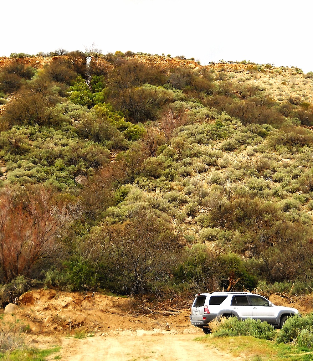
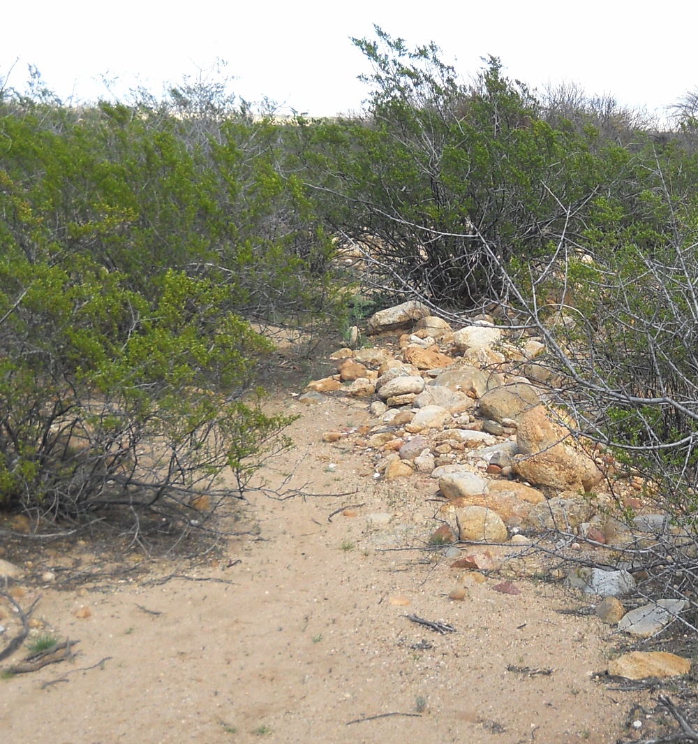
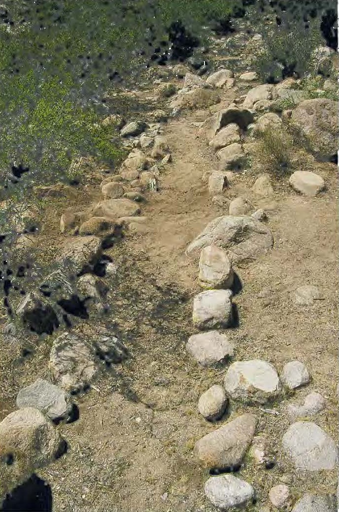
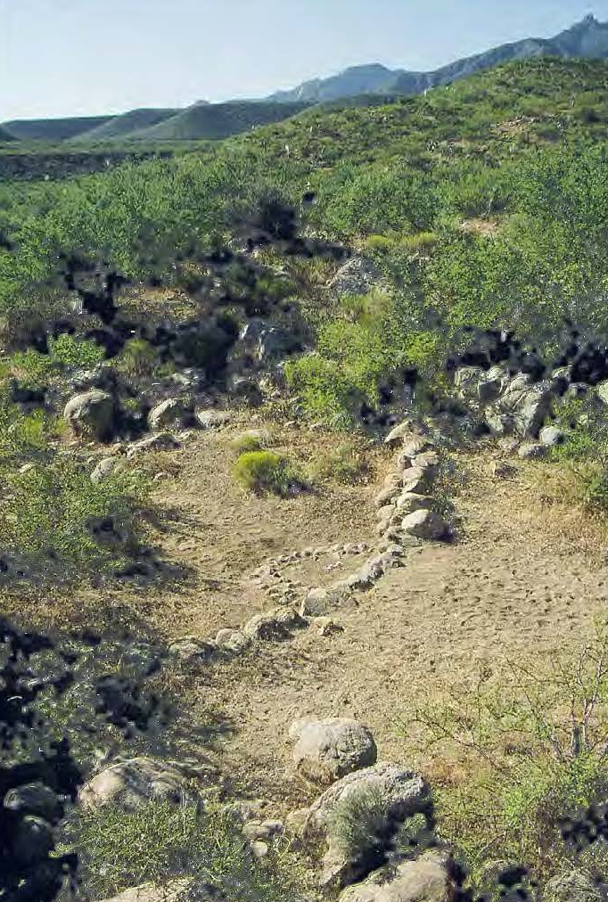
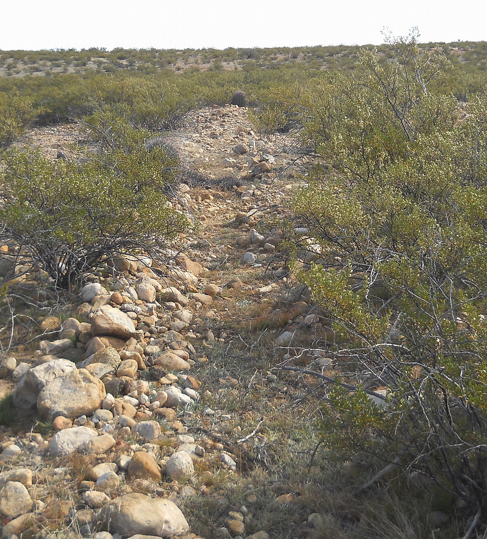
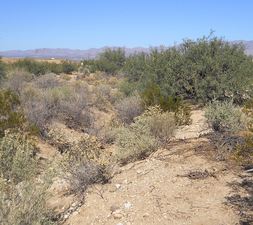
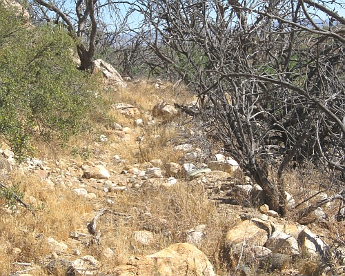
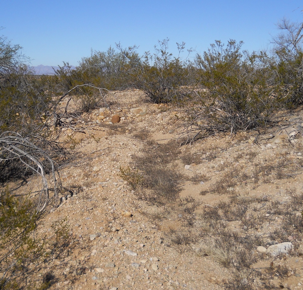
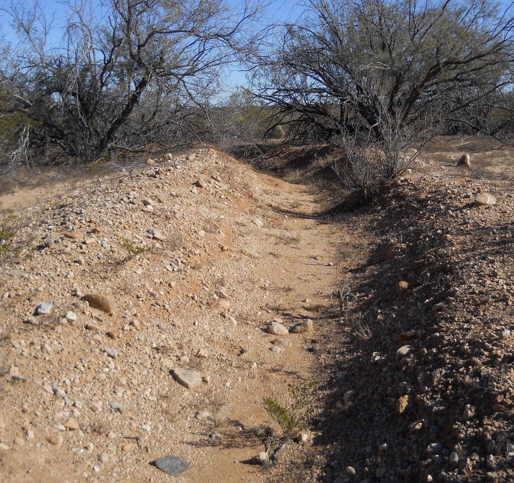
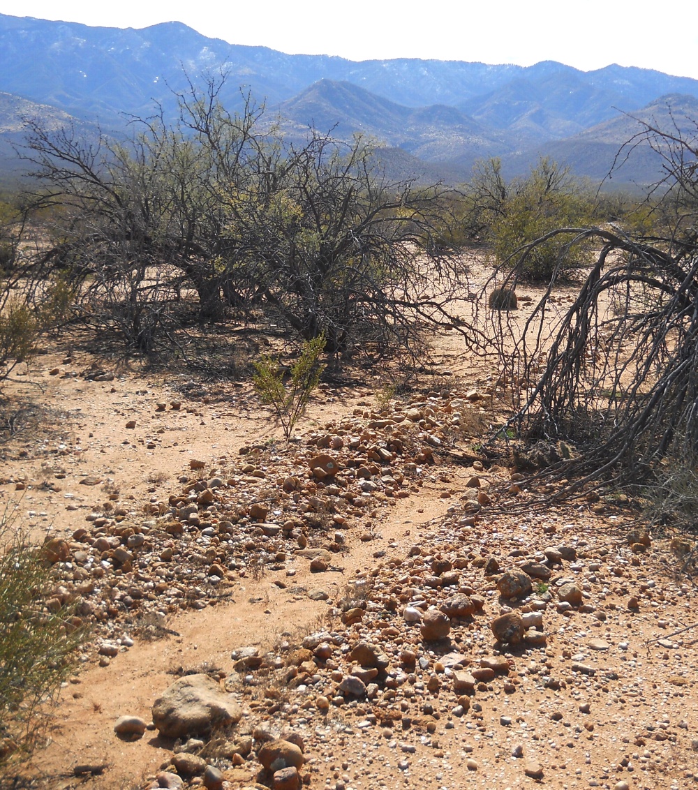
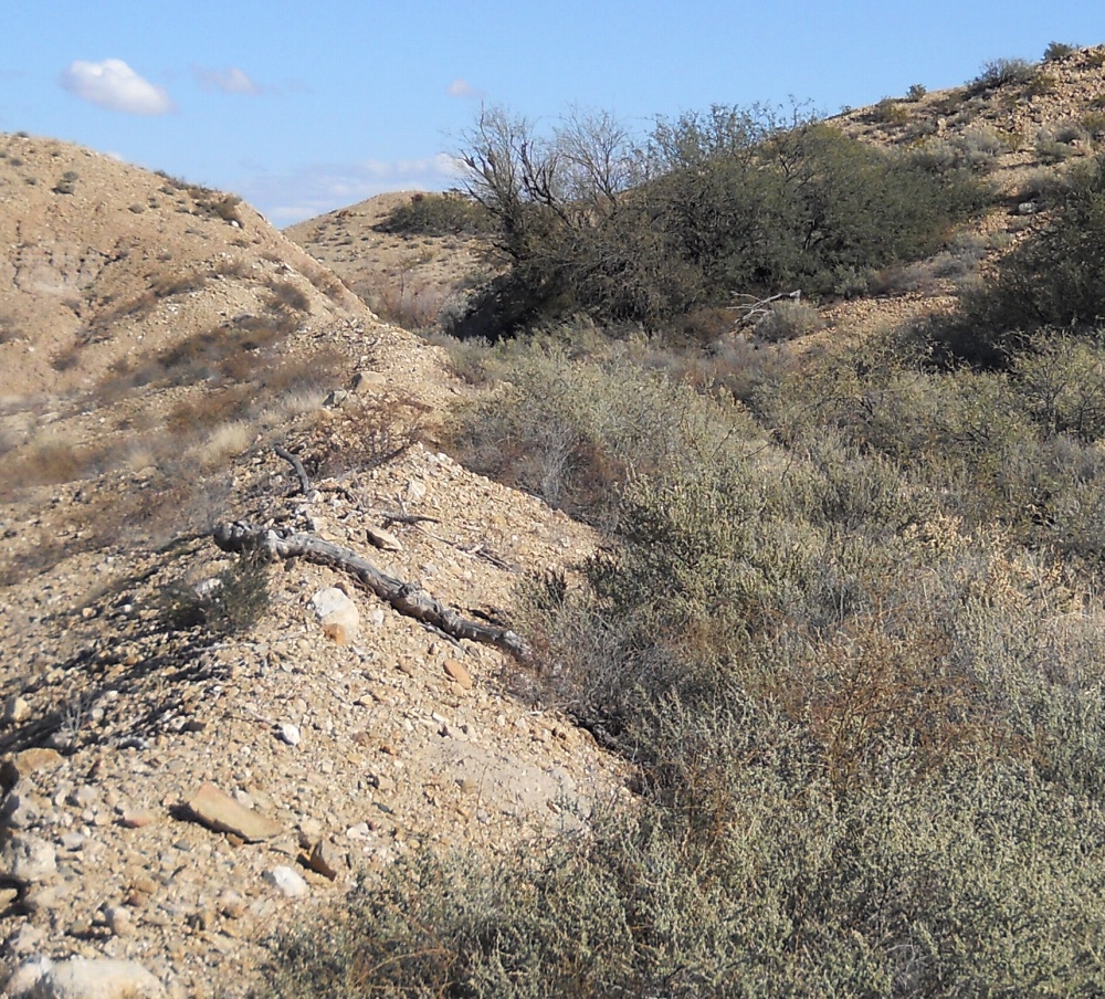
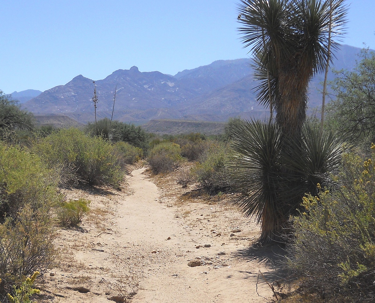
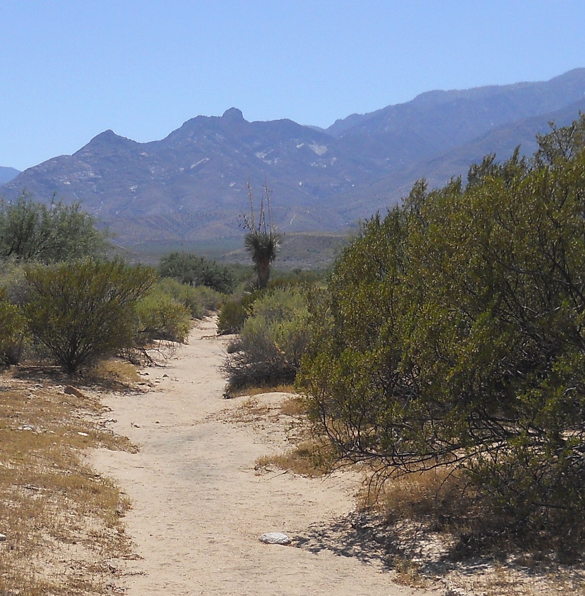
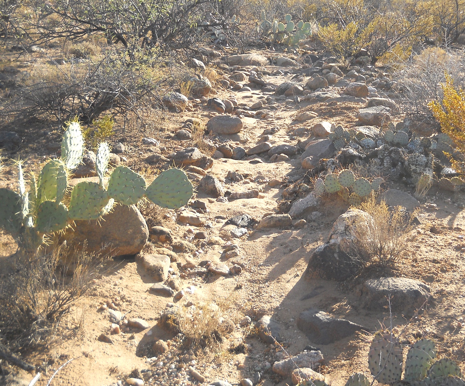
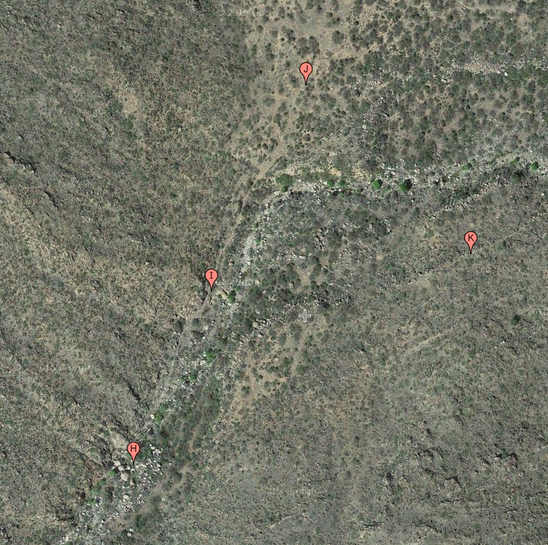
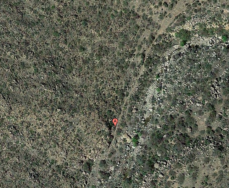
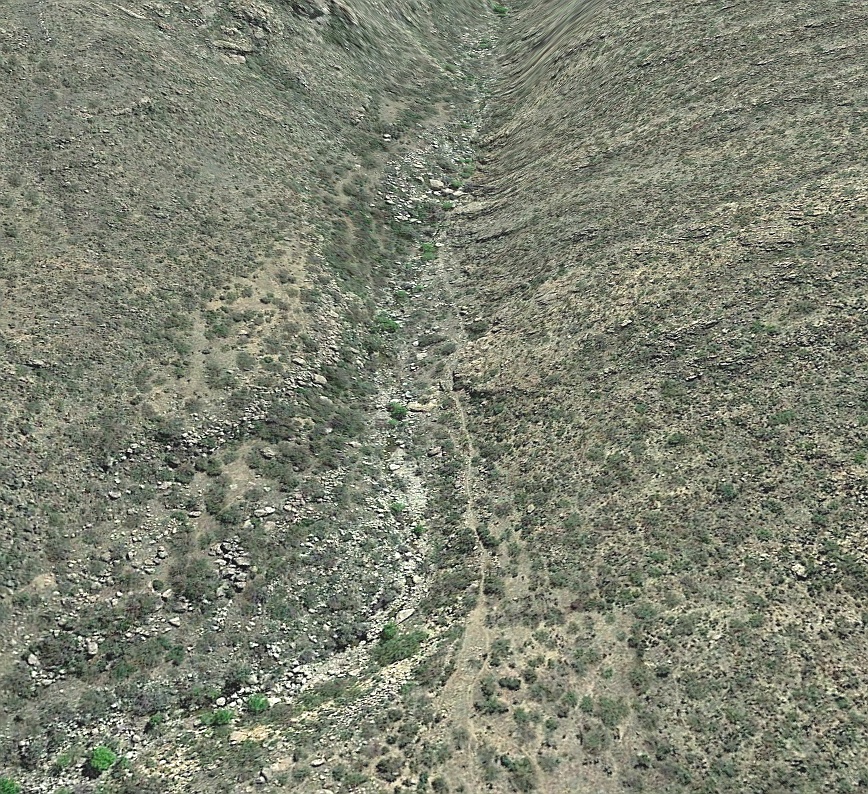
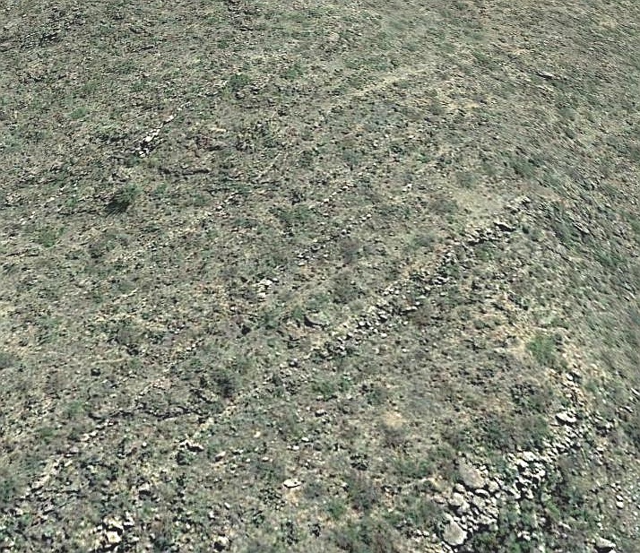
1. Unvaringly optimal constant slope.
2. Often along the highest available terrain.
3. Significant hanging portions present.
4. Credible water oriented sources and destinations.
5. Slopes often nearly independent of local terrain.
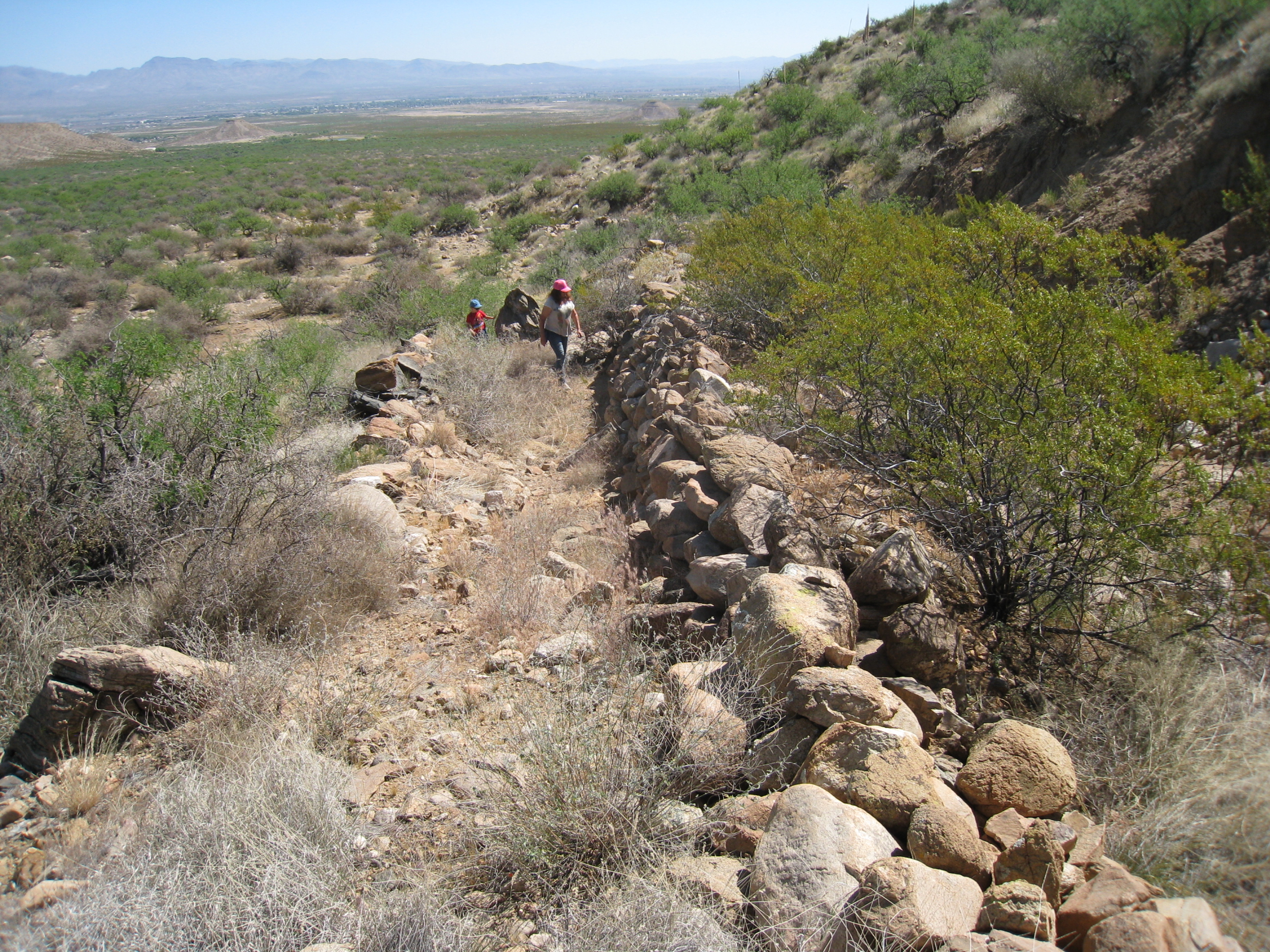
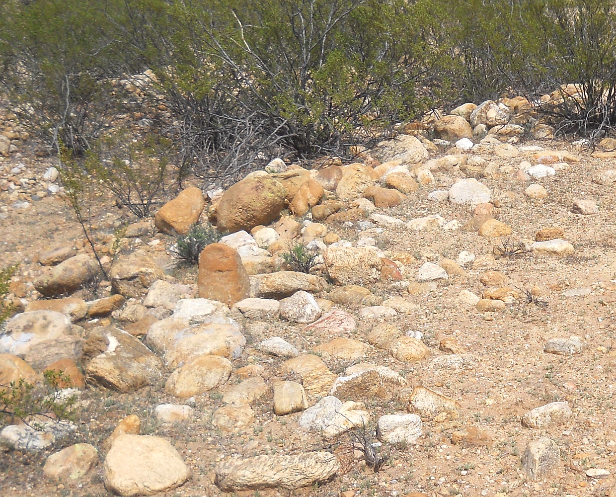
6. Spoil banks typically present.
7. Obvious extreme purposefulness.
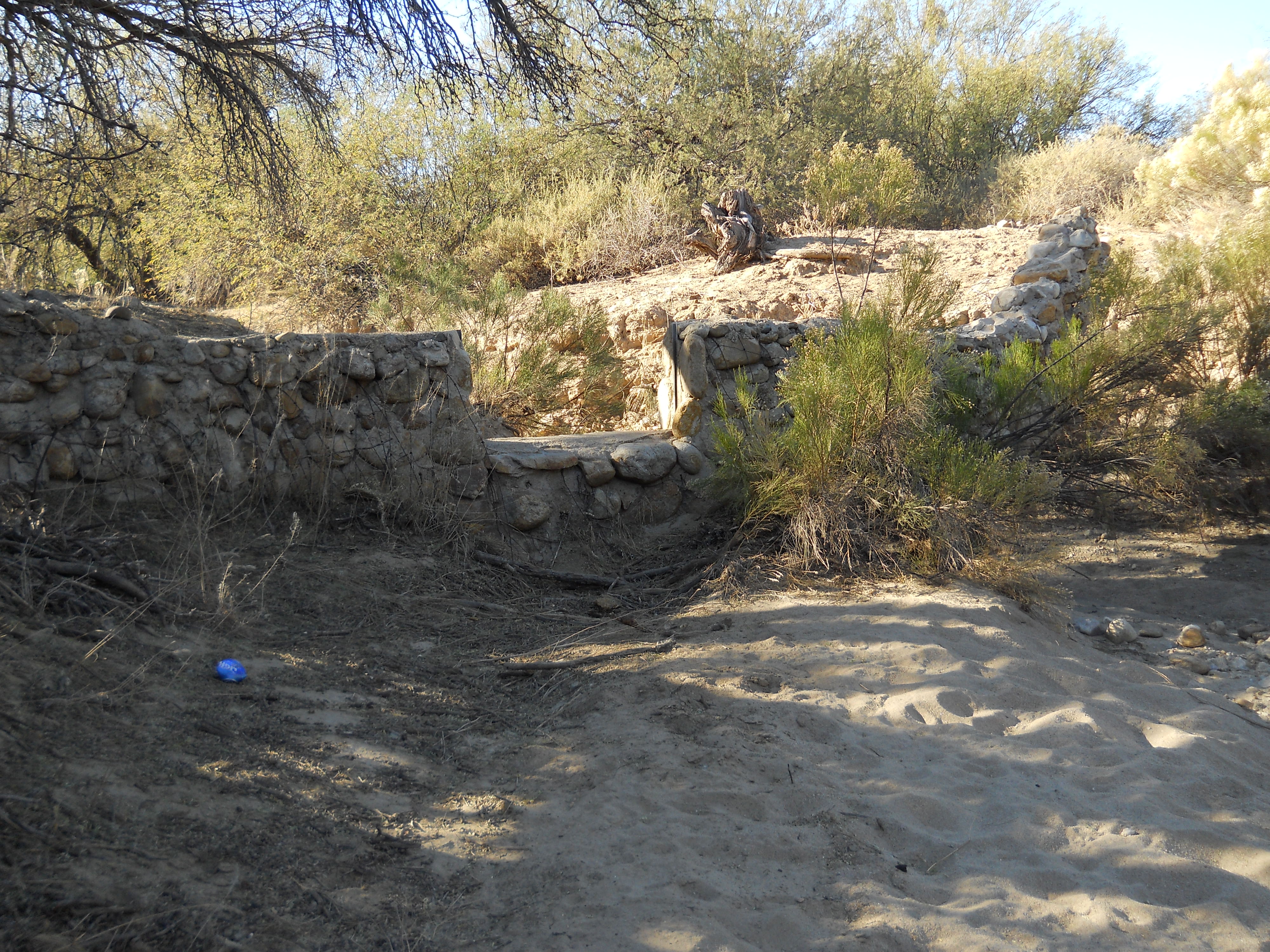
8. Consistent width and depths over long distances.
9. Lack of braiding or sudden channel changes.
10. Nearly straight alignments.
11. Absence of sinuous or dendritic natural features.
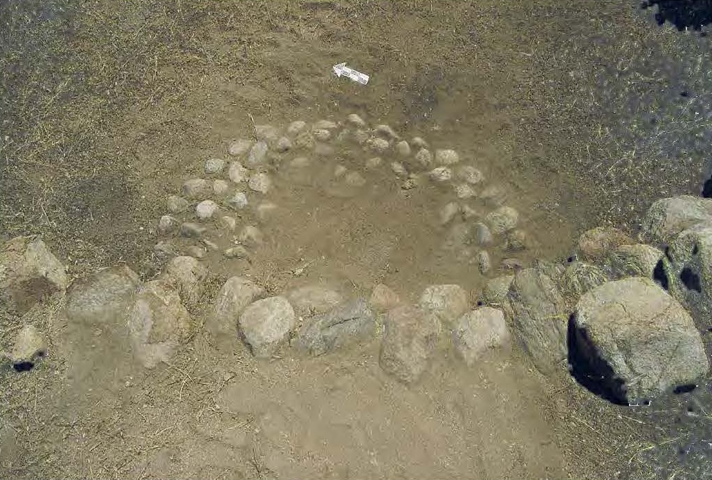
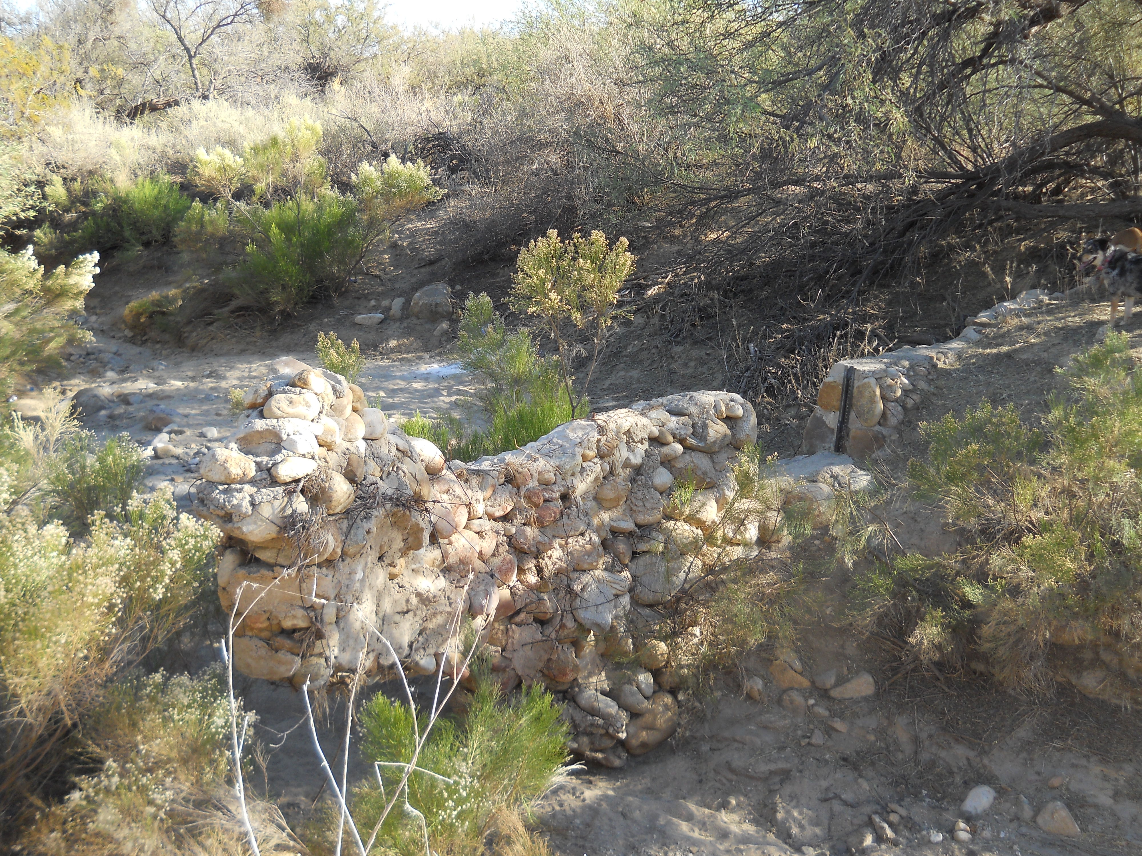
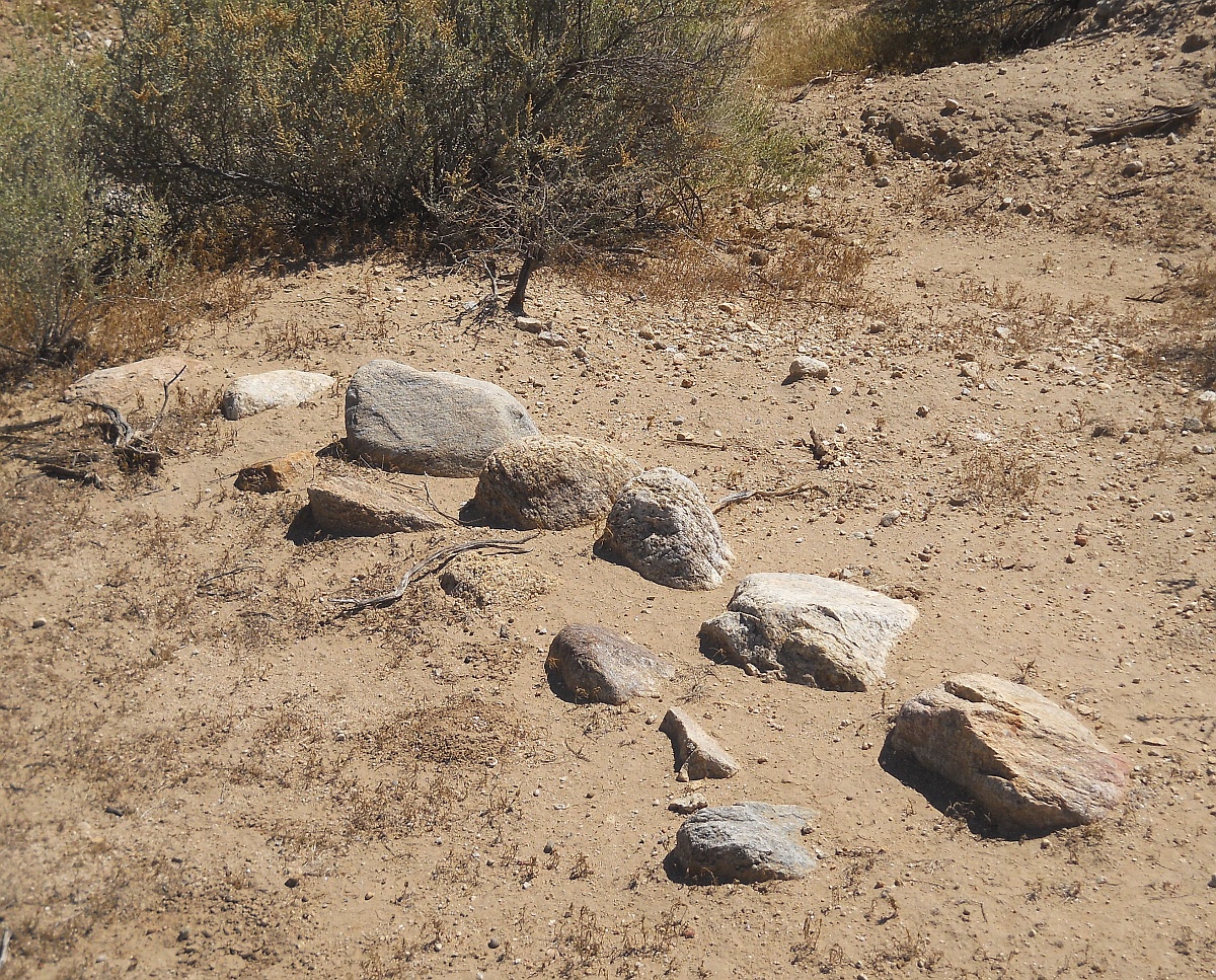
12. Obviously human placed cobbles and boulders.

13. Some evidence of clay linings.
14. Instances of counterflowing into rising terrain.

Factors that the canals are prehistoric...

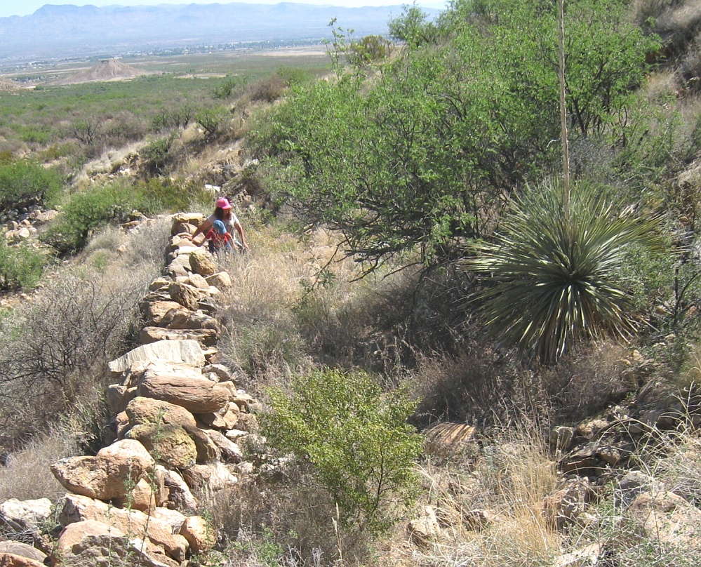
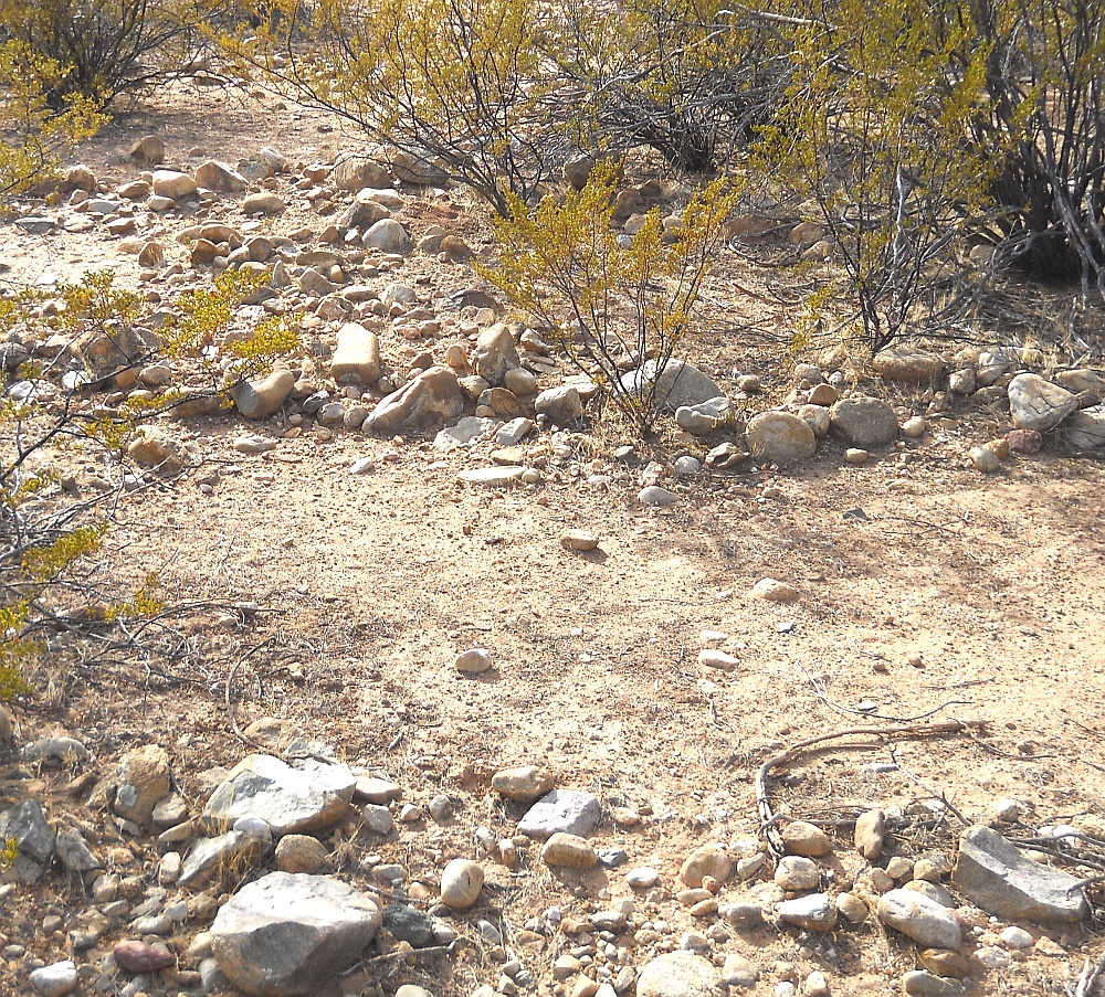
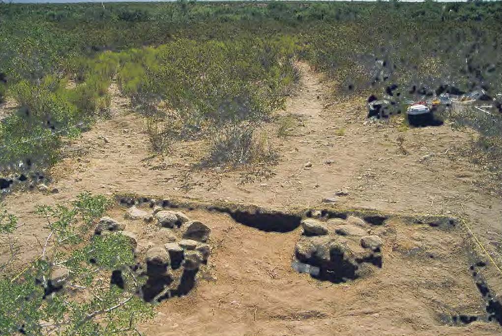
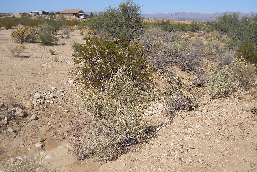
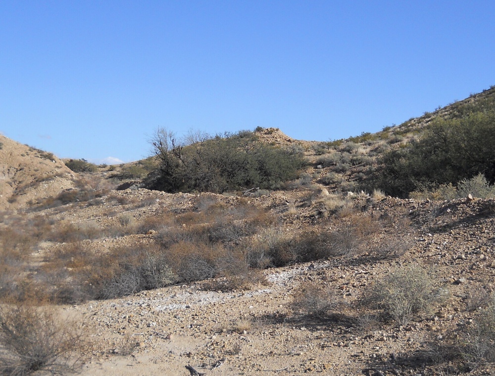
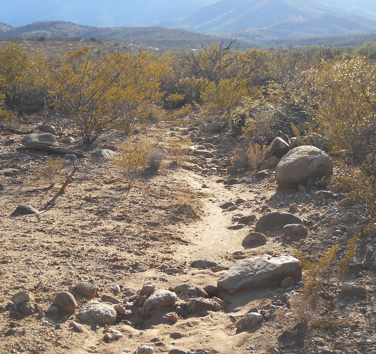
1. Extreme construction energy awareness.
2. Overrun by roads, dams, and even cemeteries.
3. Lack of historic records by an aware community.
4. Consistent patina, lichens, and desert varnish.
5. Mature trees and cacti mid channel.
6. Prehistorically oriented original purposes.
7. Significant lack of "non-human liftable" constructs.
8. No obvious long distant construct transport.
9. Lack of any obvious modern tool use.
10. Lack of ongoing modern or initial historic use.
11. Termination in verified prehistoric sites.
12. Refurb typically only to an original fraction.

13. Presence of sherds, artifacts, and digging tools.  
14. Non-cardinal alignments.

We can now turn to a few of the...


Key Spectacularousities: deeplink   top   bot   respond


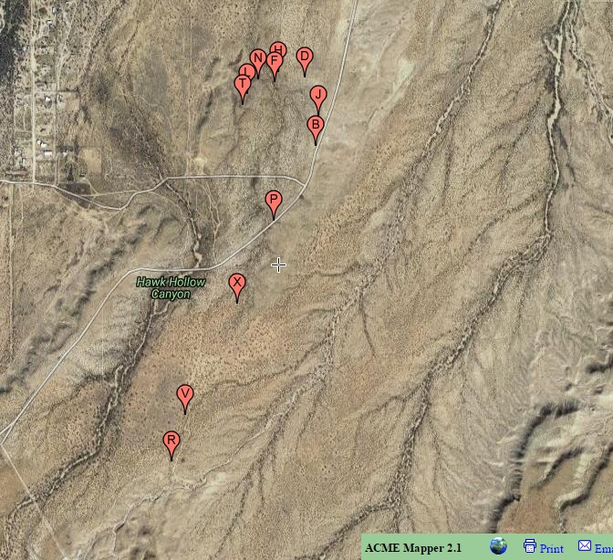
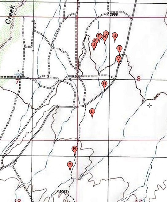
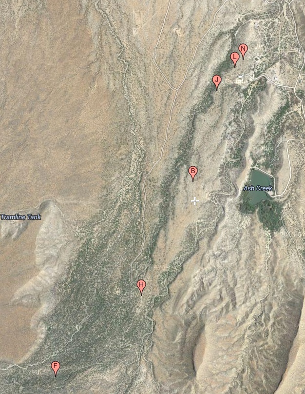
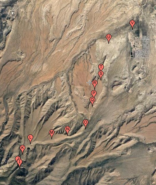
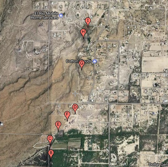
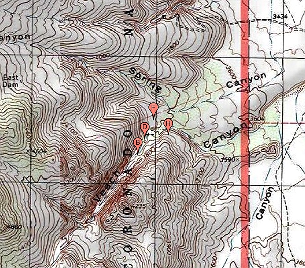
High Lebanon Hanging Canal
at 32.73351 -109.75685


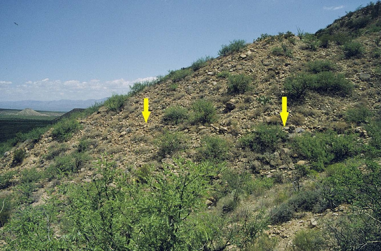
The High Lebanon in 3D
at 32.73418 -109.75654


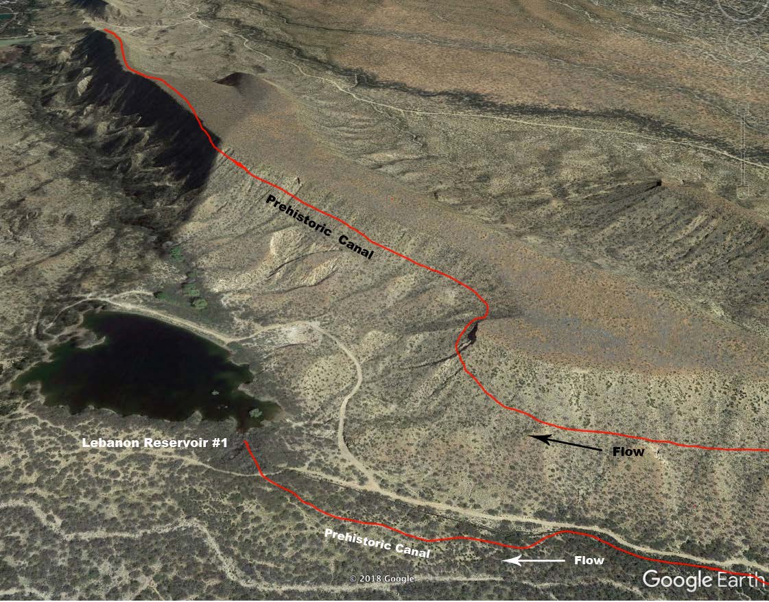
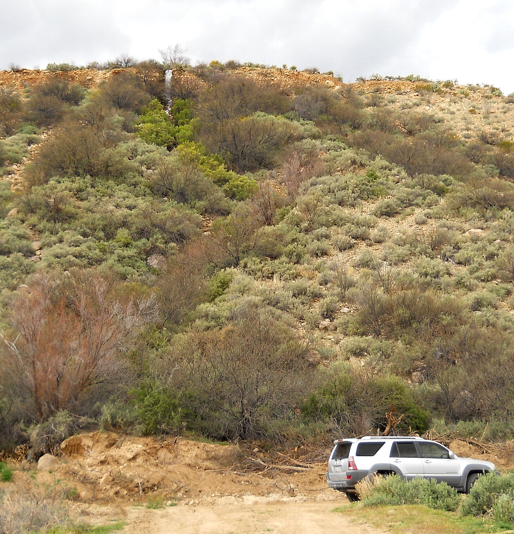
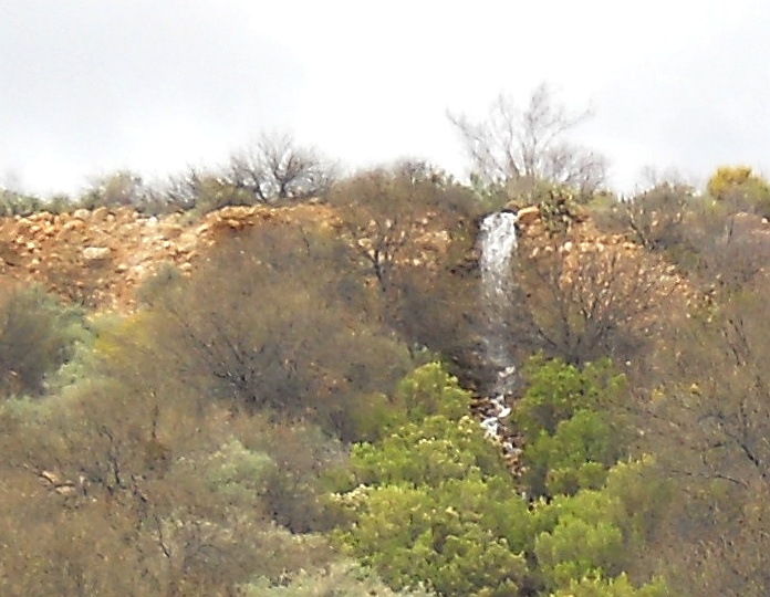
A "Water Flows Uphill" Illusion
at 32.77371 -109.79646


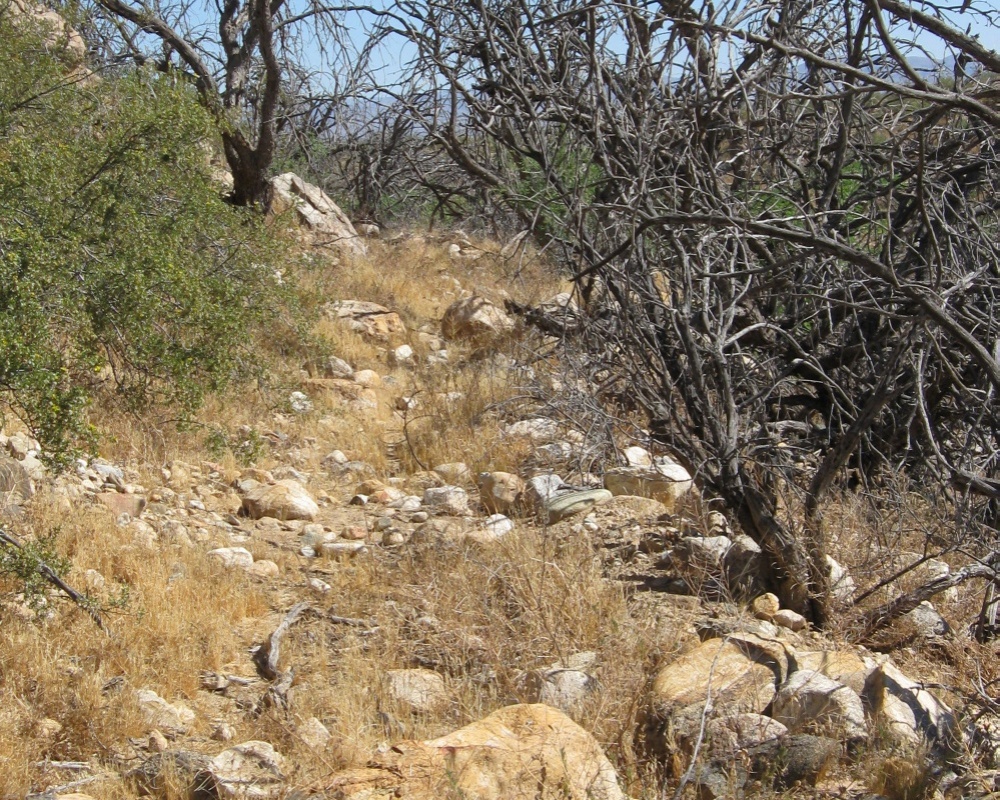
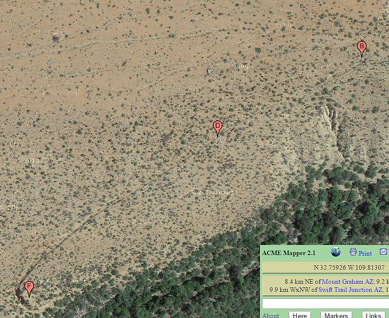
The "HS" Counterflowing Canal
at 32.75907 -109.81376


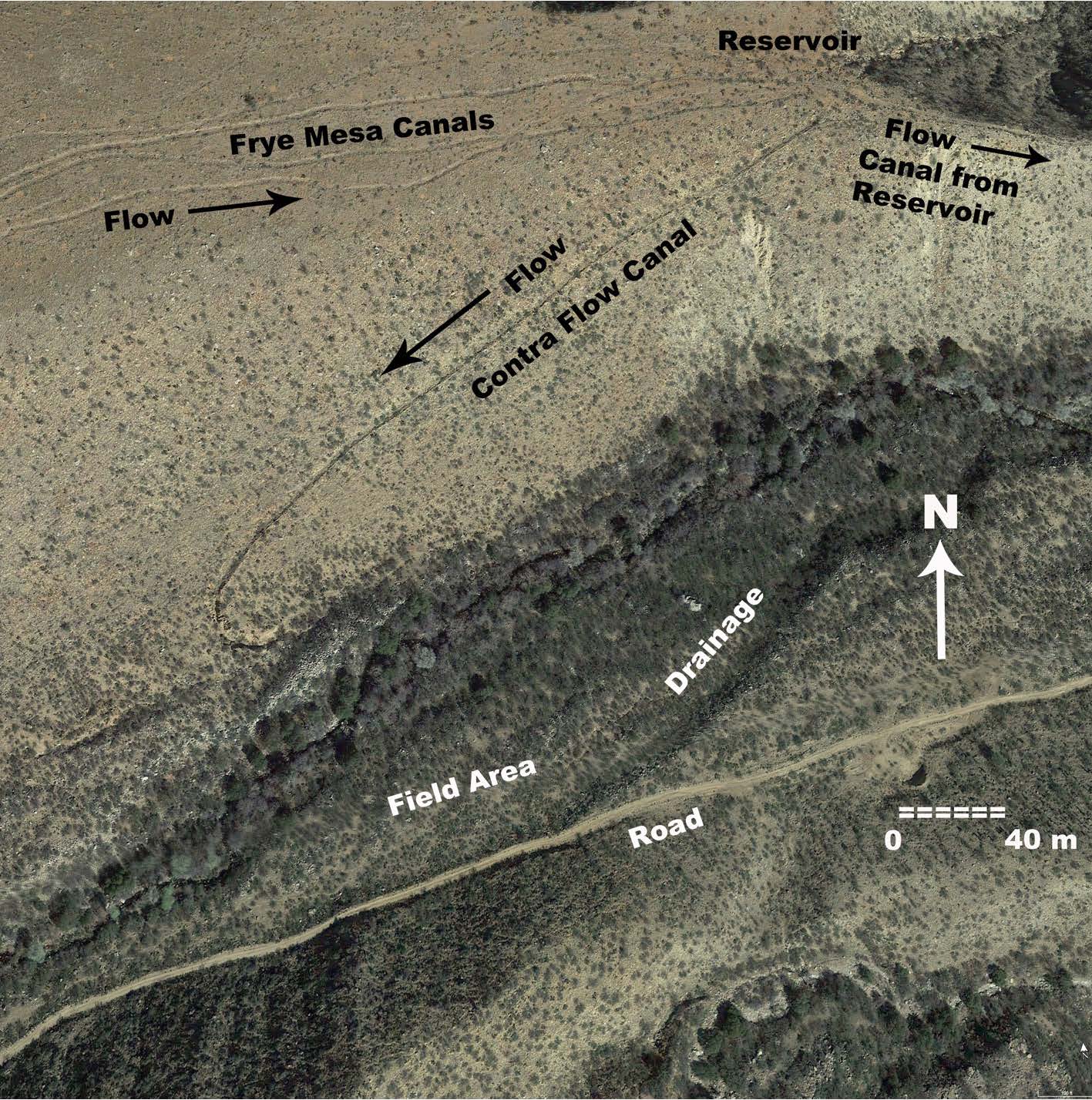
The Allen Cuelbra Cut
at 32.83568 -109.79803


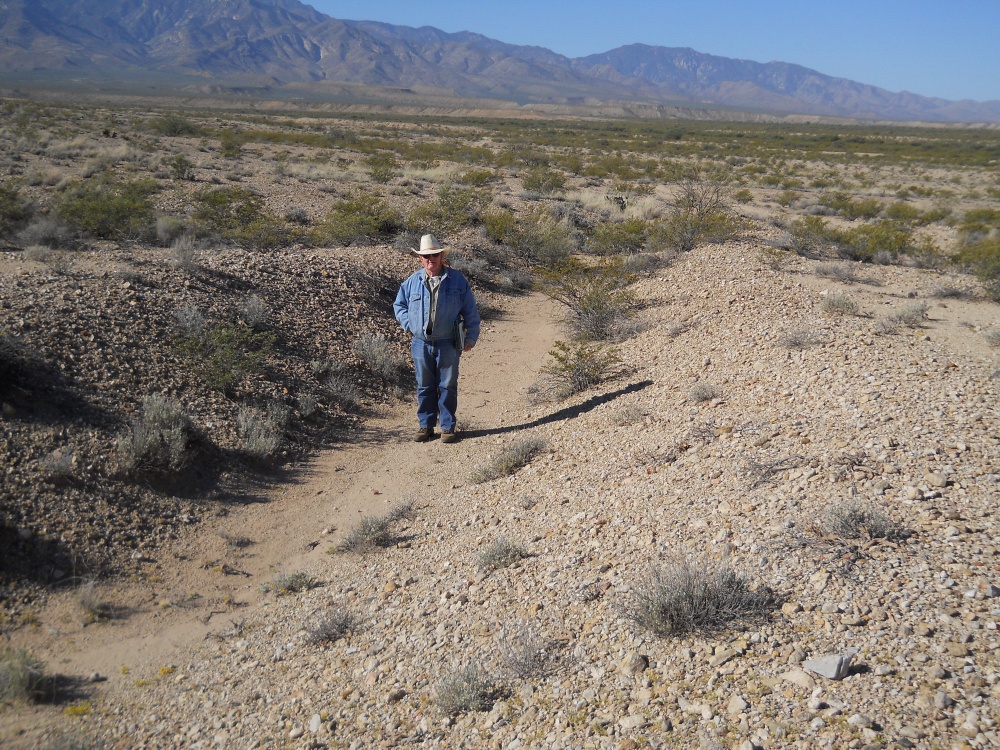
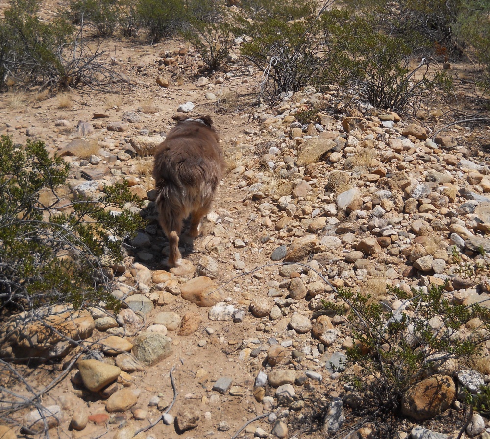
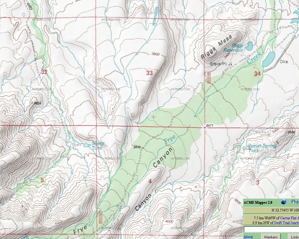
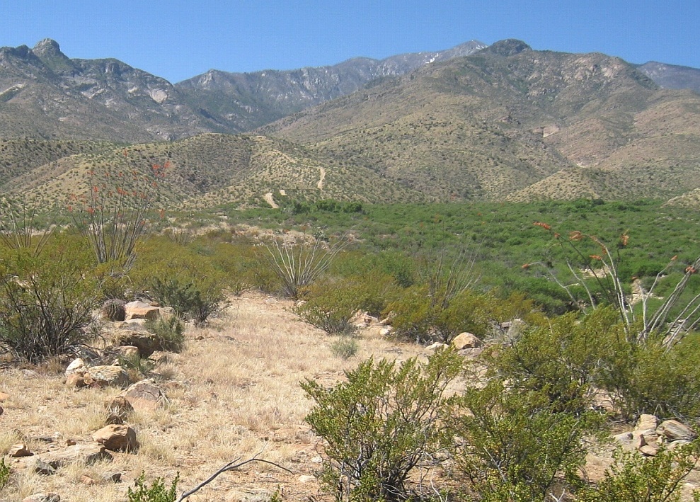
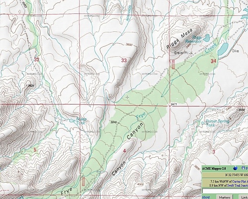
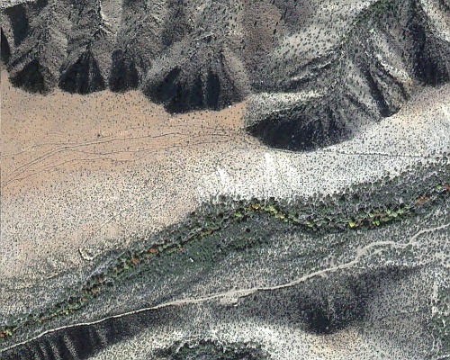
The Lower Frye Complex
at 32.76794 -109.79193

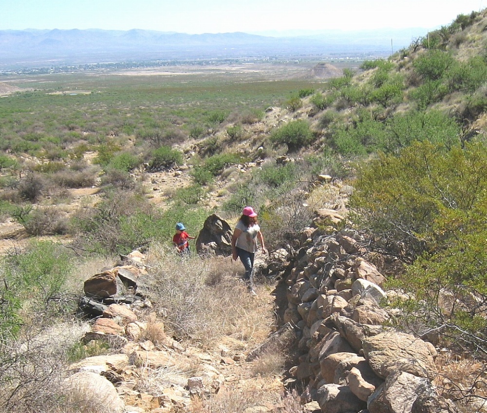
The UFO Fish Fillets
at 32.81511 -109.97060


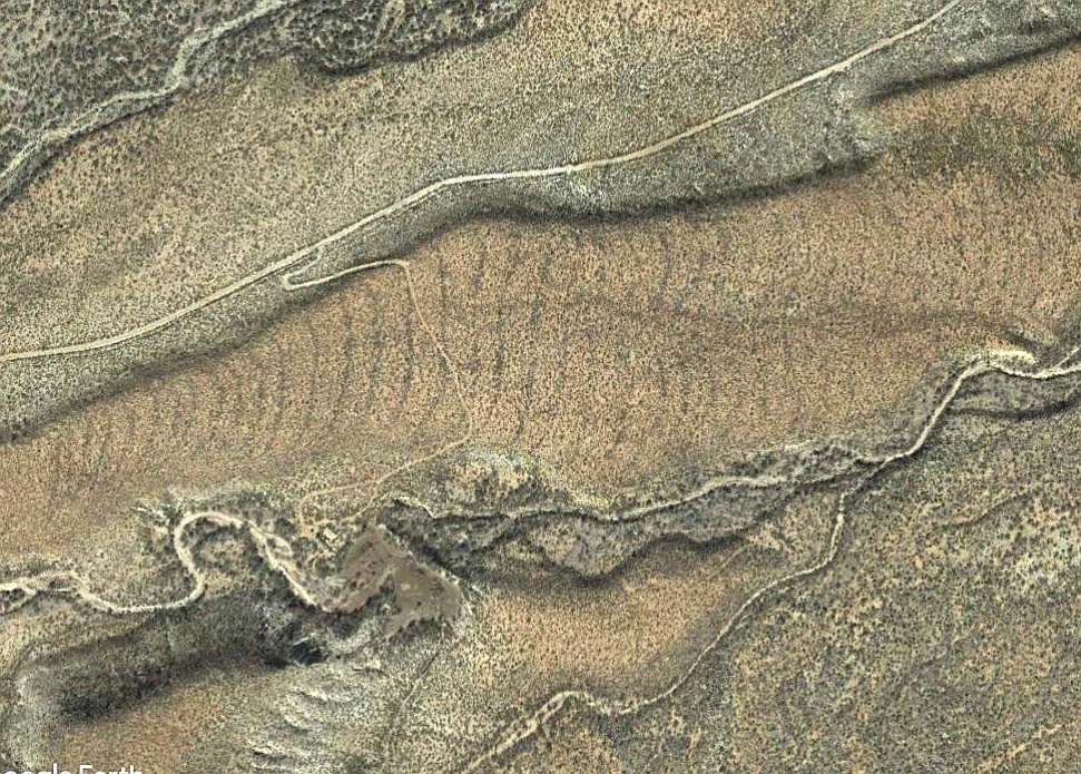
Troll House / Adena Embassy
at 32.82538 -109.82281


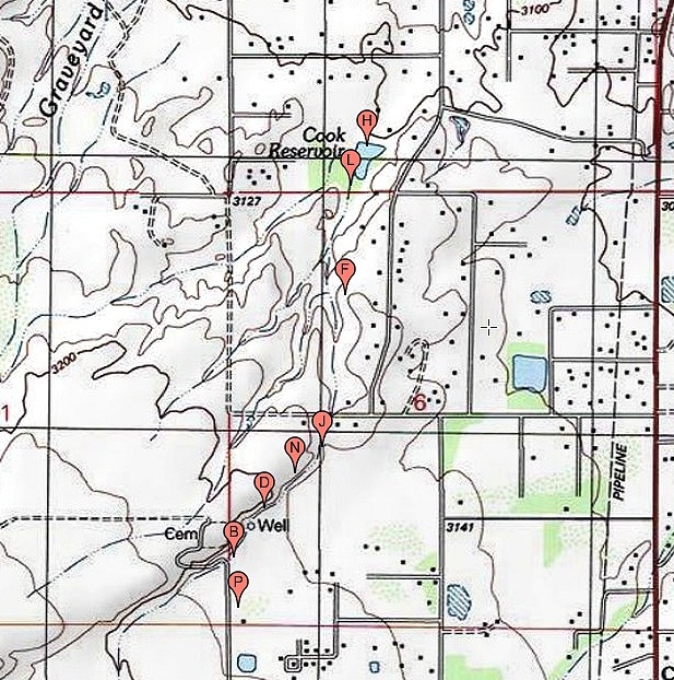
Mud Springs Watershed Cross
at N 32.79159 W 109.85379


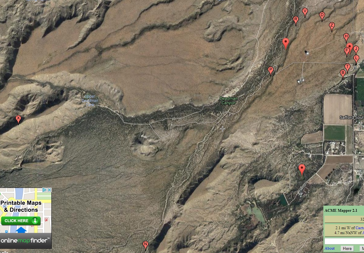
Deadman East Canal
at N 32.75510 W 109.78052


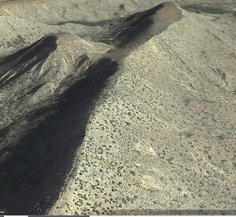
Northern Grids
at N 32.93213 W 109.80717


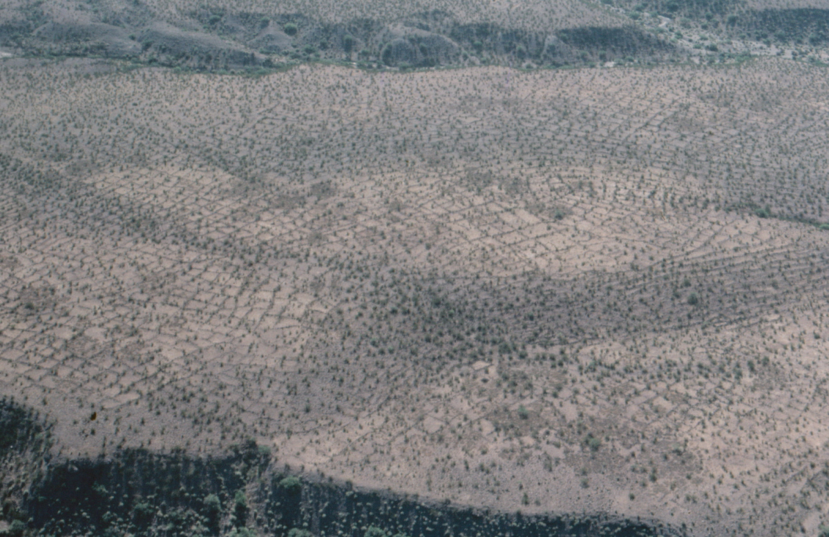
Mud Springs Mid Route
at N 32.82681 W 109.81953


Aproned Check Dams
at N 32.81406 W 109.91849


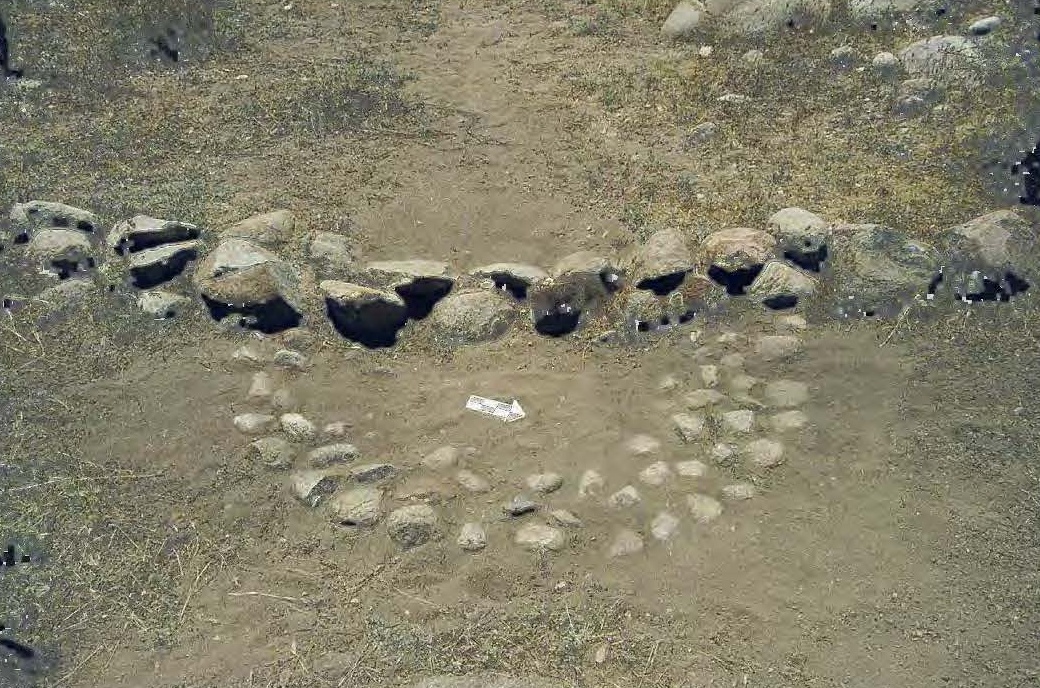
Lefthand Canal
at N 32.81405 W 109.91849


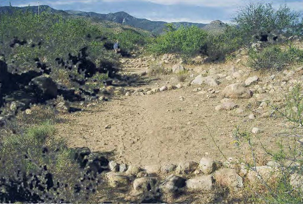
The Aqueduct
at 32.72398 -109.76241


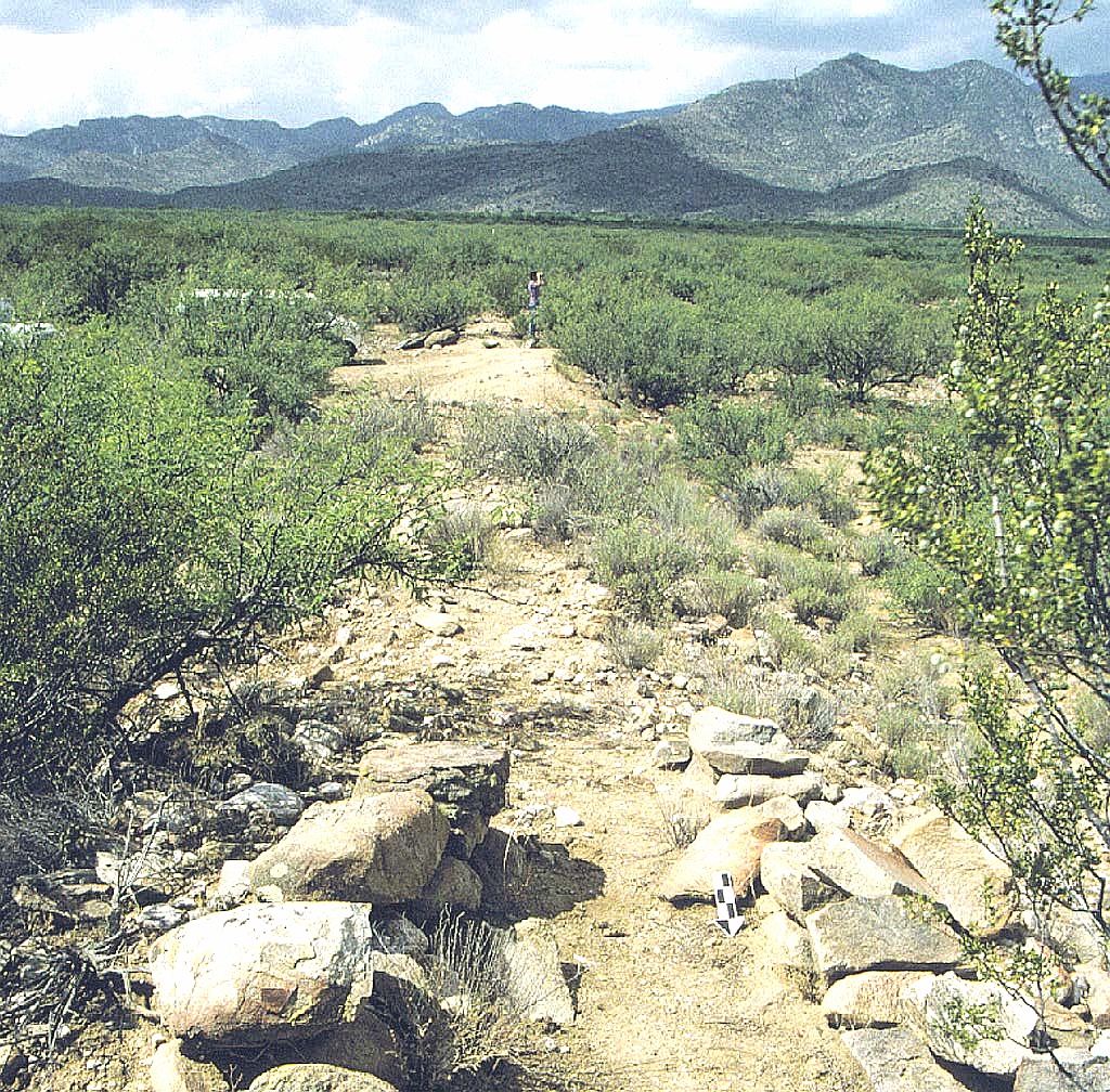
The Sand Canal Takein
at 32.81259 -109.946989
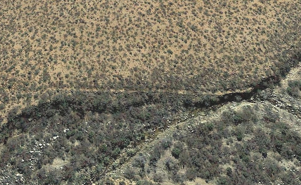
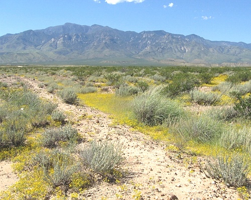
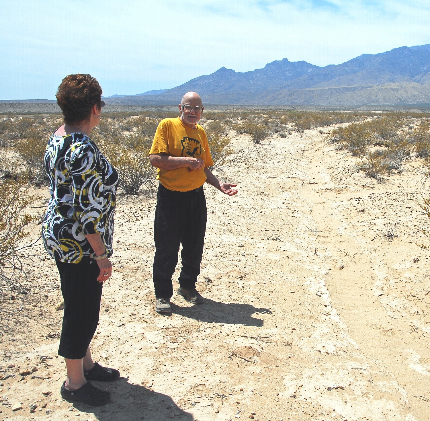
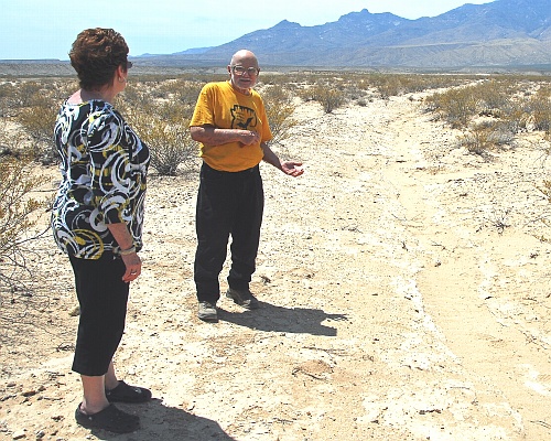
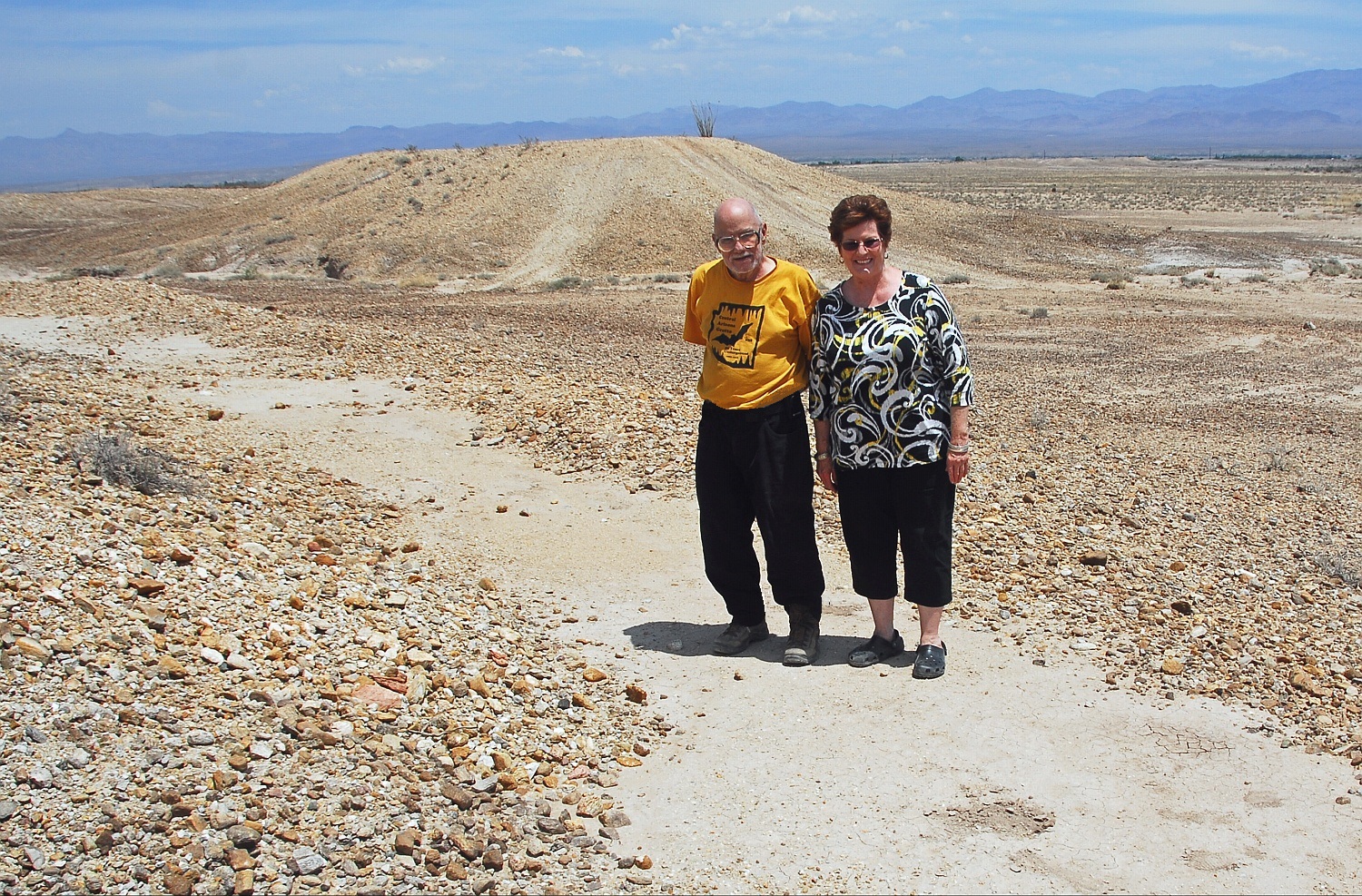
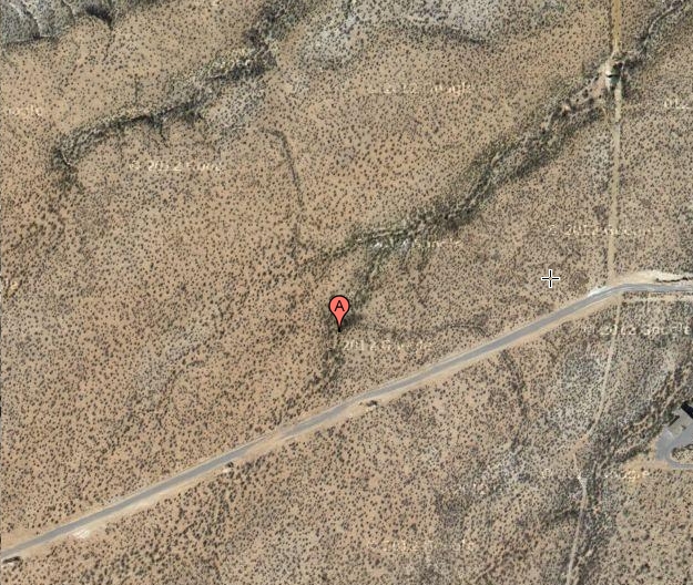
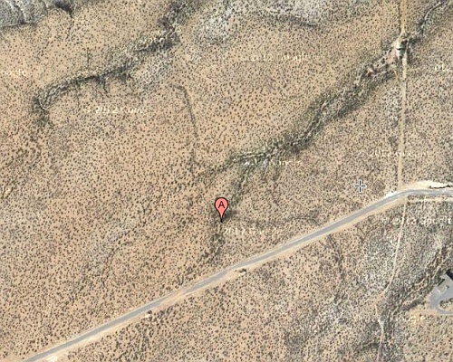


Images: deeplink   top   bot   respond

The master bajada hanging canal image directory is
shown below. You can click through to view any image.
More details in the field notes or the spectacularosities.
Or click here to open an image name cross reference.
Or you can contact us for access details, tours, or lectures.

hc000
hc001
hc002
hc003
hc004
hc005
hc006
hc007
hc008
hc009
hc010
hc011
hc012
hc013
hc014
hc015
hc016
hc017
hc018
hc019
hc020
hc021
hc022
hc023
hc024
hc025
hc026
hc027
hc028
hc029

hc030
hc031
hc032
hc033
hc034
hc035
hc036
hc037
hc038
hc039
hc040
hc041
hc042
hc043
hc044
hc045
hc046
hc047
hc048
hc049
hc050
hc051
hc052
hc053
hc054
hc055
hc056
hc057
hc058
hc059

hc060
hc061
hc062
hc063
hc064
hc065
hc066
hc067
hc068
hc069
hc070
hc071
hc072
hc073
hc074
hc075
hc076
hc077
hc078
hc079
hc080
hc081
hc082
hc083
hc084
hc085
hc086
hc087
hc088
hc089

hc090
hc091
hc092
hc093
hc094
hc095
hc096
hc097
hc098
hc099
hc100
hc101
hc102
hc103
hc104
hc105
hc106
hc107
hc108
hc109
hc110
hc111
hc112
hc113
hc114
hc115
hc116
hc117
hc118
hc119

hc120
hc121
hc122
hc123
hc124
hc125
hc126
hc127
hc128
hc129
hc130
hc131
hc132
hc133
hc134
hc135
hc136
hc137
hc138
hc139
hc140
hc141
hc142
hc143
hc144
hc145
hc146
hc147
hc148
hc149

hc150
hc151
hc152
hc153
hc154
hc155
hc156
hc157
hc158
hc159
hc160
hc161
hc162
hc163
hc164
hc165
hc166
hc167
hc168
hc169
hc170
hc171
hc172
hc173
hc174
hc175
hc176
hc177
hc178
hc179

hc180
hc181
hc182
hc183
hc184
hc185
hc186
hc187
hc188
hc189
hc190
hc191
hc192
hc193
hc194
hc195
hc196
hc197
hc198
hc199
hc200
hc201
hc202
hc203
hc204
hc205
hc206
hc207
hc208
hc209

hc210
hc211
hc212
hc213
hc214
hc215
hc216
hc217
hc218
hc219
hc220
hc221
hc222
hc223
hc224
hc225
hc226
hc227
hc228
hc229
hc230
hc231
hc232
hc233
hc234
hc235
hc236
hc237
hc238
hc239

hc240
hc241
hc242
hc243
hc244
hc245
hc246
hc247
hc248
hc249
hc250
hc251
hc252
hc253
hc254
hc255
hc256
hc257
hc258
hc259
hc260
hc261
hc262
hc263
hc264
hc265
hc266
hc267
hc268
hc269

hc270
hc271
hc272
hc273
hc274
hc275
hc276
hc277
hc278
hc279
hc280
hc281
hc282
hc283
hc284
hc285
hc286
hc287
hc288
hc289
hc290
hc291
hc292
hc293
hc294
hc295
hc296
hc297
hc298
hc299


Evidence is strong and compelling that most, if not all, historic
canal rework were adaptions of prehistoric originals.
First,
because it is is infinitely easier to "dig out an old ditch" or
"steal the plans" or "borrow the blueprints" than to engineer
a new canal from scratch.
And second , because nearly all of the decent canal locations
were already and nearly exclusively prehistorically taken. And
third, because historic rework often only applied to a smaller
portion of the entire canal reach.
Finally, Ockham's Razor can be used to add credibility to any
missing canal portions. In which the simplest explanation will
often likely be found to be the correct one. 

Other Dr. Neely Pubs: deeplink   top   bot   respond

Ancient Hanging Canals
Archaic Paleo Wells
Calcified Microbial Mat
Drop-tower Gristmills
Debating Oaxaca Prehistory
Deh Luran Early husbandry

Friable Iran Pigments
Gila Canals Paper *
Hohokam Canal Irrigation
Intrusive anurian Pithouses
Iran Settlement Patterns *
Lefthand Canyon Paper *
Mesoamerican Irrigation

Monte Alban Survey
Preservation Archaeology *
Purron Dam Paper *
Radiocarbon Sediment Age
Safford Agricultural fields
Safford Bajada Canals *
Safford Basin Canals *
Safford Dry Farming
Safford Valley Grids
Tehuacon Canals
Tecoatles Paper
Tracking Safford Basin
Xosocotlan Piedmont Survey

* Papers are available at www.tinaja.com Other Dr. Neely
publications appear at Academia,
at ResearchGate and the
Arizona State Museum
, and elsewhere.
A James Neely bio here. And a Don Lancaster bio here.
Don Lancaster publications can be found here, here, here,
and here. With free ebooks here. And classic reprints here.
With email assistance here.
Blog Excerpts: deeplink   top   bot   respond

Our blogs found below often give a timeline and details on
initial hanging canal discoveries and speculations. We have
excerpted these here, retaining only the entries of possible
hanging canal and related interest...
---
 2011 Blog Excerpts
2014 Blog Excerpts
2017 Blog Excerpts
---
2009 Blog Excerpts
2012 Blog Excerpts
2015 Blog Excerpts
2018 Blog Excerpts
---
2010 Blog Excerpts
2013 Blog Excerpts
2016 Blog Excerpts
2019 Blog Excerpts
---
Blog excerpts are usually compiled yearly.
Possible Projects: deeplink   top   bot   respond

The following bajada hikes could greatly assist the world class 
research on our hanging canals. Typical total and return lengths 
are one to three miles, often in very difficult or brushy terrain.
Needed are field verification, drone work, photos, and GPS...


Allen Off Mesa -32.82088 -109.80470
Allen Destination -32.83309 -109.80482
Ash Creek Source - 32.78602 -109.85499
Deadman East -32.75574 -109.77915
Discovery Park -32.79453 -109.72779
Frye Middle -32.75075 -109.83780
Frye Pipeline-32.76889 -109.79317
Frye Watershed -32.74526 -109.83888
Golf Course Mid -32.78502 -109.78708
Grant Creek -32.59249 -109.96686
Henry's Source -32.73713 -109.74231
Hog Canyon -32.55380 -109.76431
Jernigan Gaps- 32.84140 -109.81260


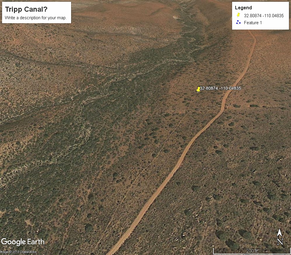
Lamb Tank Canal - 32.81368 -109.92292
Middle Freeman - 32.76971 -109.79022
Minor Webster - 32.80758 -109.86857
Mud Springs Gap - 32.79170 -109.85312
Mud Springs Dest - 32.84785 -109.81104
Spear Ranch Area - 32.83613 -109.91437
Stockton Wash - 32.61429 -109.72799
Taylor Canyon - 32.81620 -109.97316
Tripp Canyon -  32.81133 -110.04680
Tugood North -32.82087 -109.86675
Tugood South - 32.80923 -109.87116
Veech Canyon -32.64279 -109.74278


Please send results to don@tinaja.com or (928) 428-4073.
More details on some of these here or via email.
USB Collected Works deeplink   top   bot   respond

   DON  LANCASTER  CLASSICS USB
An "all we have" archive of our website.
Includes all ebooks and reprints. Well
over 2 Gigabytes of content and often
updated. Easily searched.
             Click on the image to access.

    BAJADA "HANGING" CANALS USB
  Definitive summary of most of our Gila
  Valley prehistoric bajada hanging canal
  research. both our own and from third
  parties. Internally sourced where possible.
        Click on the image to access.

Build Time Estimates: deeplink   top   bot   respond

Given some useful stone age tools and an "average" canal
run, it would seem feasible to build one foot of canal per person
hour. Which might translate to fifteen feet of canal per person
day or one mile per person year.
More difficult areas might involve half a mile per person year,
and "management" and "diet energy" might need included.
Thus, a possible WAG of 250 man years for 150 miles of canal.

Which, while clearly a major undertaking, this does not seem
remotely near a "pyraminds" class project.


Some Useful Resources: deeplink    top    bot    respond


Academia

Acme Mapper Topos

Allen Dam Failure Docs
Arizona GIS Land Owners
Arizona Place Names
Arizona State Museum
Arizona Stream Gauges
Arizona Water Atlas III
Bird Watching
Bureau Land Management
Coronado National Forest
Discovery Park
Fewkes 1897 Arch Report
Gila Valley Dayhikes
Gila Valley Hiking Club
Gila Watershed Partnership
Google Maps
GPS Format Conversions
Guru's Lair
Graham County Birds
Graham County Dams
Graham County Lakes
Graham County Hist Society
Graham County Minerals
Graham CountyPeaks
Graham Cty Plc Names
Historic USGS Maps
Hodge's Arizona as it is
Heliograph Maps
Hanging Canal Projects
Hanging Canal Directory
Hanging Canal Image Tour
Hanging Canal Library
Hanging Canal Resources


Hanging Canal Slide Show
Hanging Canal Summary
Hanging Canal AZ Rep Vid
Highway Milepost Markers
Hiking Clubs
Hinton's Arizona Handbook
Hot Springs Directory

Little Known Dayhikes
Magic Sinewaves
Map of Allen Canal
Map of Mud Springs Canal
Mine and Mineral Data
More Website Links
More Fossil Stuff
Multipurpose Trail Map
Natural Arch & Bridge Soc
Neely Prehistoric Ag Paper
One Each of my Everythings
Our eBay Sales
Research Gate

Reay Lane Wetland Birds
Safford Basin Canals
Safford Basin Water Atlas
Safford BLM Paleontology
Safford Prehistory
San Carlos Minerals
San Simon Valley Fossils
Stream Gauges
USFS Fire Lookouts
Walnut Grove Dam Disaster
Wesrch
Wikipedia Hanging Canals
Wilderness Net
 
Zeolite Paper


Attention Reviewers: deeplink   top   bot   respond

From time to time, we have papers in prepress with traditional
publishers who may have very restrictive ip rights.
If you wish to know the status or possibly access these docs,
email us with your bonafides as a potential peer reviewer.
The use of a NDA non disclosure agreement may be involved.


Survey Instruments deeplink   top   bot   respond

No survey instruments as such are known to exist, so
what follows remains as rank speculation.
It would appear possible that static water level techniques
could be used. In which a small pilot ditch could be extended
and then filled with just enough water to measure its start-
-to-end differential. This could be compared to an optimal
slope and corrected before completing the full size ditch.

For instance, something like "one fist per five paces"
might be deemed a "correct" two percent slope.

As to "best" overall canal routes, there are many hillocks
or prominences common to Mount Graham
that oversee
potential routes. This conceivably could have given the
equivalent of an "aerial photo" suitable for determination
of useful earlier canal orientations.
As an example, there are several locations where nearly the
entire length of the Mud Springs Canal can be simultaneously
viewed.
This might seem to raise the possibility of the Mud Springs
Canal being an earlier prototype.
Your Involvement: deeplink   top   bot   respond

You are invited to participate in this world class bajada
hanging  canal research. Specific needs are for GPS
literate gonzo hikers and ATV enthusiasts, live video
drone operators, and a KML specialist. And perhaps
a sedimentologist or climatologist or nearly any other
utterly arcane specialist. Plus, of course, cash in small bills.
You are welcome to support us by picking up our USB research
summary as detailed above. Or participate in our eBay offerings.
Ongoing current goals are to improve and complete the field
notes, produce one or more Youtube videos, dramatically
update and upgrade "flyable" mapping, and convince "them"
to set up significant ongoing field schools. Or simply to pick
up new hiking partners. Or individuals we can mentor.
Please send results to don@tinaja.com or (928) 428-4073.
More details on some of these here or via email.
Discovery emails deeplink   top   bot   respond


Intended here is a compilation of early discovery emails.
It remains very much a work in process.


Study Proposals: deeplink   top   bot   respond

A copy of a proposed interdisciplinary Safford Basic research
program can be found here. And is authored here.
.
For More Help deeplink   top   bot   respond

Pick your blog year...
1997 1998 1999 2000 2001
2002 2003 2004 2005 2006
2007 2008 2009 2010 2011
2012 2013 2014 2015 2016
2017 2018 ----- ----- -----
The original tinsamp1.shtml can still be found here. The
original tinaja01.shtml can still be found here. Or you can
return to our home page. Or use your back arrow. Or...
You can click here to...
Ask a Technical Question. Pick up Surplus Bargains.
Download our Free eBooks. Request a Lecture.
Explore Magic Sinewaves Schedule a Canal Tour.
Find out what a Tinaja is. Send an email to Don.
Get a Lancaster Classics USB. Solve a Research Problem.
Hang with Marcia Swampfelder. Study our Recommended Books.
Learn Patent Alternatives. Take a Gila Valley Dayhike.
Look into Energy Efficiency. Visit the Marbelous Pancakes.
Master Bezier Cubic Splines. Watch a PostScript Video.
View our Classic Reprints. Get a Hanging Canals USB.


Note that right clicking can give you several tab or window options.

J im Neely can be reached at (575) 686-0098 or neelyja@utexas.edu
.
Don Lancaster can be reached at (928) 428-4073 or don@tinaja.com.

An acrobat .PDF version of this file can be found here.
Reposting and/or linking welcome per Creative Commons.