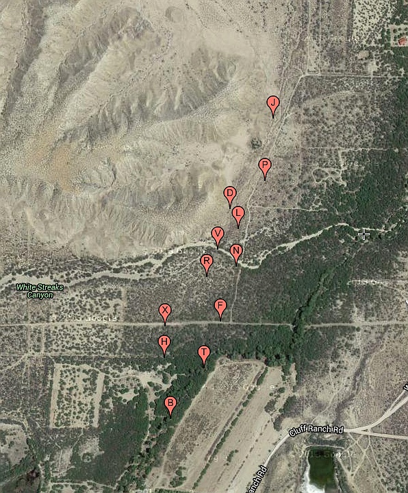
#HC041 _cluffnw_map.jpg image access Satellite Image Map of the CluffNW Canals.
Shown "north = up" near N 32.82647 W 109.84577.Both prehistoric and historic portions begin near
"B" with their Ash Creet Takeins. The prehistoric
reach starts westerly over path BHXRVL and then
has a branch or original routing at P. The historically
rebuilt portion starts easterly over path BTFNDJ and
includes siphons and weirs. It continues well north of
J. It is not yet clear whether a prehistoric original
exists under this northern historic extension.
Nearest 4WD track is at N 32.82647 W 109.84577.
Click to expand the image.
Possible field notes here.