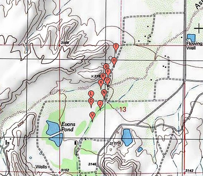
#HC042 _cluffnw_topo.jpg image access Topo Image Map of the CluffNW Canals.
Shown "north = up" near N 32.82647 W 109.84577.The Cluff NW canals are unusual in that the historic
version does not exactly follow the prehistoric one. And
thus provides exceptionally strong evidence of historic
adaptions. Route VDLXFH seems prehistoric, while
route VJNBT is clearly historic in its pipeline, weirs,
size, and siphon. It is not presently known if H is a
branch or the main prehistoric canal. Areas to the
north are restricted and need further work.
Nearest 4WD track is at N 32.82647 W 109.84577.
Click to expand the image.
Possible field notes here.