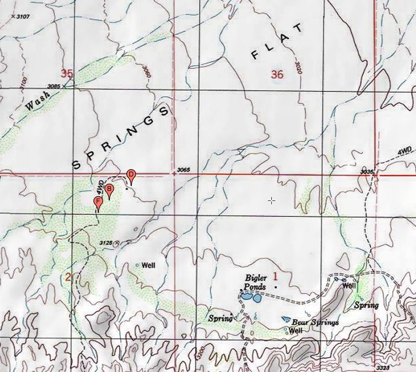
#HC015 bearflat2_topo.jpg image access Topo map showing routing of the Bear Flat Canal.
Interest area is near N 32.85790 W 109.96120
Shorter canal somewhat west of the Bear Springs and
Bigler Ponds area. Flag "F" is its currently its artesian
source, "B" a mid-routing, and "D" a likely destination.
Canal flows to this day but appears unused. The scope and
standards both appear prehistoric but remain unproven.
Field notes here.
The nearest rough 4WD starts at N 32.84051 W 109.96720
Click to expand the image.
Possible field notes here.