Prehistoric Bajada
"Hanging" Canals
"Hanging" Canals
|
Don Lancaster don@tinaja.com ( 928 ) 428-4073 |
Jim Neely neelyja@utexas.edu (575) 686-0098 |
|
|
||
|
Prehistoric Bajada
"Hanging" Canals |
||
| ||
|
|
Click here for the latest updates!
Some recent Safford AZ area discoveries have now located many dozens of Mt. Graham mountain stream fed prehistoric CE 1350 "hanging" canals that represent utterly mind boggling world class stone age engineering.
An apparently unique hallmark of the entire complex system is that the canals are often literally "hung" on the extremely difficult terrain of steep bajada mesa edges. In a clear attempt to make their routings and carefully controlled slopes fully independent of local typography!
Land Ownership is primarily Bureau of Land Management, Arizona State Lands, Coronado National Forest, and some private inholdings. A few of the canals are severely endangered, but the vast majority simply remain woefully ununderstood and wildly unappreciated.
Over 110 canal study areas have already gotten identified, with a projected total length likely well in excess of 150 miles or 250 kilometers.
Preservation is often exceptional. It seems an attempt was made to exploit literally every drop of mountain stream water. Along with a few related artesian sources.
Amazingly, the system appears "complete" and free of any apparent mistakes or failures. Other involved examples of stunning engineering include a significant aqueduct, watershed crossings (!), routings along the highest of available terrain, and "counterflowing" where canal slopes drop into rising terrain.
While the vast majority of canals favor the wetter northeast slopes, examples also literally surround Mount Graham. Which has the highest elevation differential of any Arizona range. Combined with an unusually high number of perennial streams.
Other instances of area ag development include Hohokam style riverine canals, extensive gridded fields, mulch rings, field houses, rock alignments and aproned check dams.
| home | new | rss | eBay | xml | top | bot |
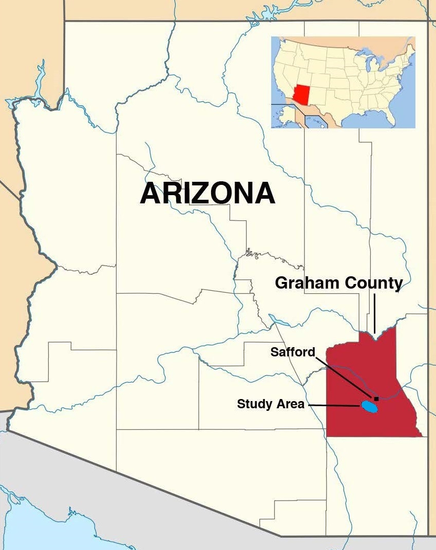
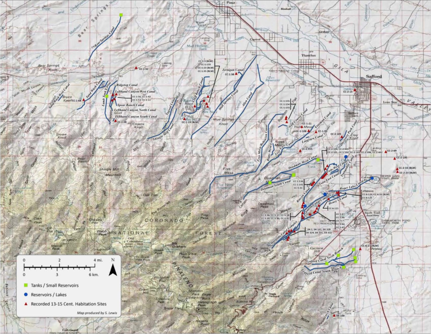
Area Location Maps
deeplink •
top •
bot •
respond
Here is the general study area...
And here is an older and click expandable map of some of the northeastern canals...
Yes, we are working on a much better and a more complete "flyable" KML map. Which is turning into a major project. In general, KML is preferable to GIS in that it can be "flown" and has all of the resources of Google Earth behind it
Acme Mapper and Zoom Earth and Google Earth have all proven enormously useful in our canal work. Sadly, satellite imagery resolution presently can only hint at the presence of a small fraction of the canals.
The prehistoric Bajada "hanging" canal study areas are listed here originally in roughly east to west order. A very few darkened "losers" do remain in this listing in order to divert future duplication. Many of the names were somewhat arbitrarily assigned.
Our present bajada hanging canal docs appear on Researchgate, on our website, and elsewhere. This above list is currently only preliminary and woefully incomplete. Availability of new field notes are often announced here.
Many dozens of these canal field notes still remain pending or else sorely in need of major updates. Your help requested.
Proofs of Canal Validity
deeplink • top • bot • respond
While no single factor by itself can unambiguously "prove" that the canals are both in fact real and prehistoric, evidence from multiple independent sources collectively overwhelm any other possibilities...
Factors that the canals are man made..
1. Unvaringly optimal constant 2% slope.
2. Often along highest available terrain.
3. Significant hanging portions present.
4. Credible water sources and destinations.
5. Slopes often local terrain independent.
6. Spoil banks typically present.
7. Obvious extreme purposefulness.
8. Consistent width and depth over distance.
9. Lack of braiding or sudden changes.
10. Nearly straight alignments.
11. Lack of sinuous or dendritic features.
12. Obviously human placed boulders.
13. Some evidence of clay linings.
14. Some counterflowing into rising terrain.
Factors that the canals are prehistoric...
1. Extreme building energy awareness.
2. Overrun by roads, dams, and cemeteries.
3. Lack of community historic records.
4. Consistent patina, lichens, and varnish.
5. Mature trees and cacti mid channel.
6. Prehistorically oriented original purposes.
7. A lack of "non-human liftable" constructs.
8. No obvious long distant transport.
9. Lack of any obvious modern tool use.
10. Lack of ongoing modern or historic use.
11. Termination in verified prehistoric sites.
12. Refurb typically only to a fraction.
13. Presence of sherds, artifacts, stone tools.
14. Overwhelmingly non-cardinal alignments.
15. No concrete or iron unless a rebuild.
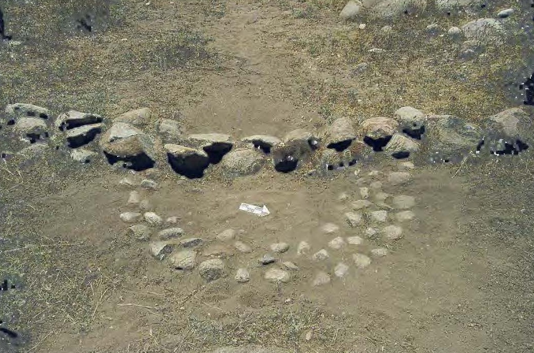
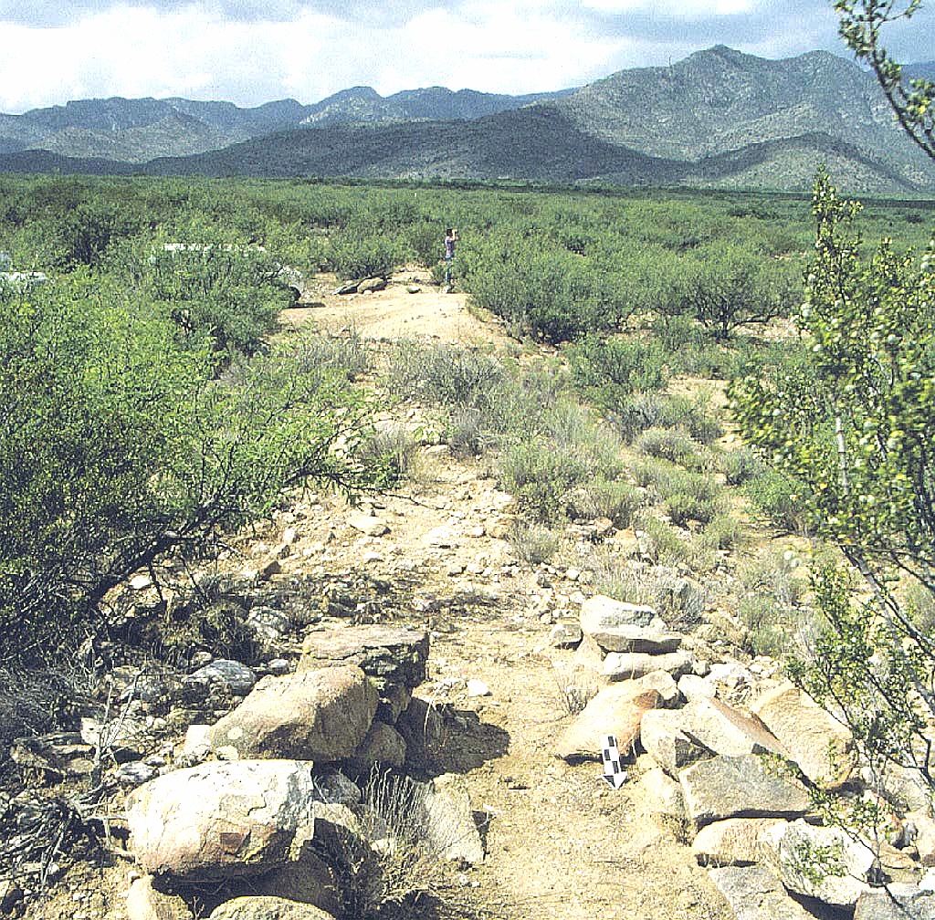
Prime Photo Gallery
deeplink • top • bot • respond
You can click expand these for more detail.
The complete image gallery can be found here.
|
High Lebanon Canal 32.73351 -109.75685 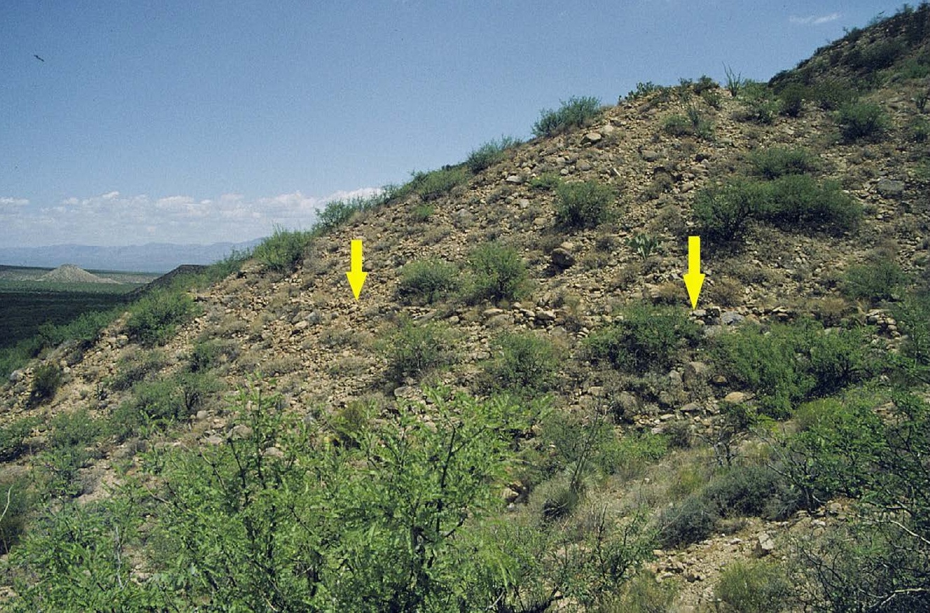
|
High Lebanon in 3D 32.73418 -109.75654 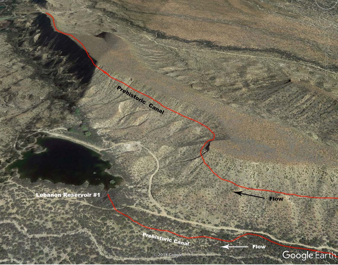
|
|
"Water Flows Uphill" 32.77371 -109.79646 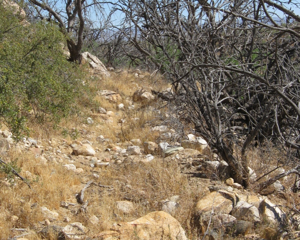
|
HS Counter Flowing 32.75907 -109.81376 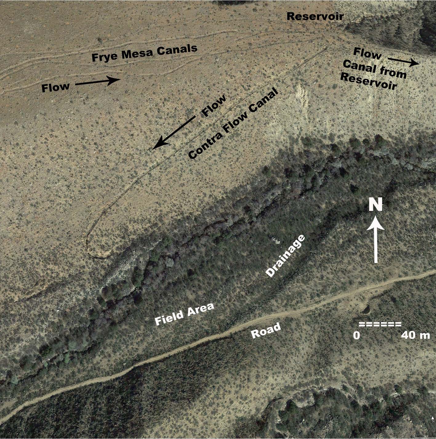
|
|
Allen Cuelbra Cut 32.83568 -109.79803 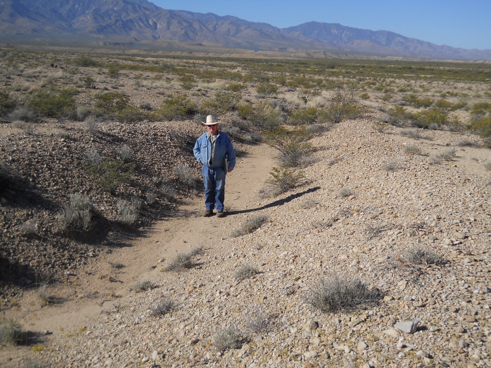
|
Lower Frye Complex 32.76794 -109.79193 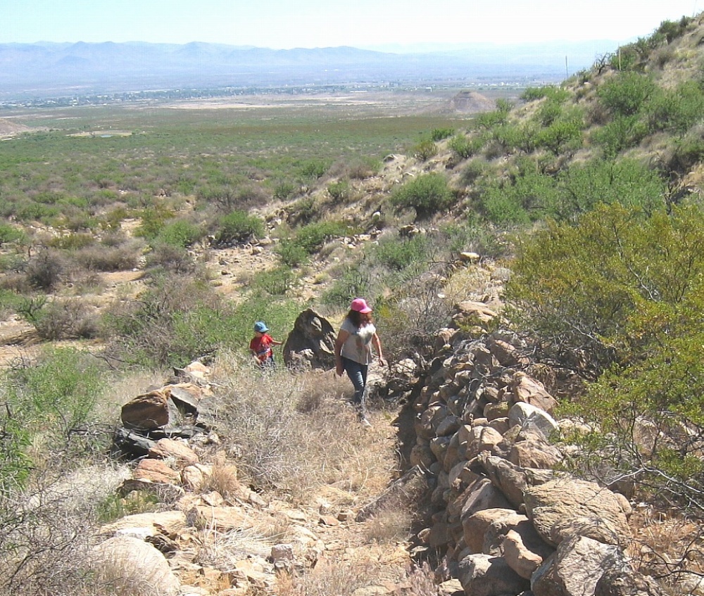
|
|
The UFO Fish Fillets 32.81511 -109.97060 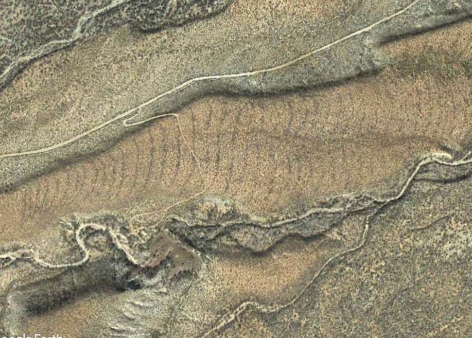
|
The Adena Embassy 32.82538 -109.82281 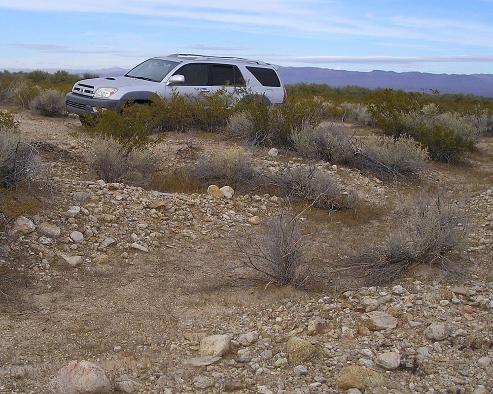
|
|
Watershed Crossing! 32.79159 -109.85379 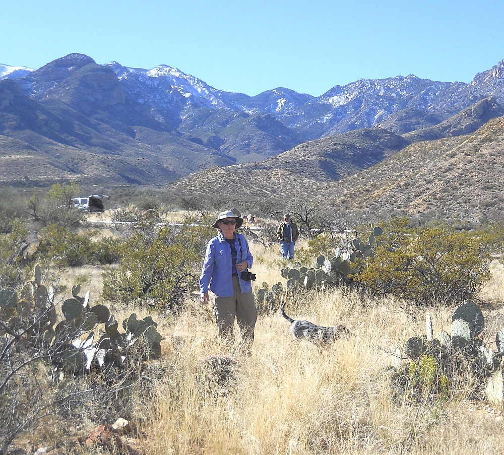
|
Deadman East Canal 32.75510 -109.78052 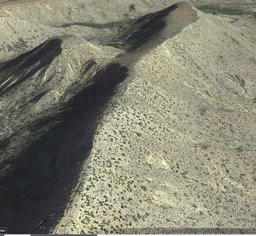
|
Northern Grids 32.93213 -109.80717 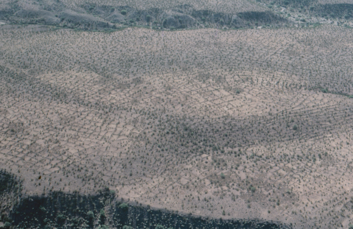
|
Mid Mud Springs 32.82681 -109.81953 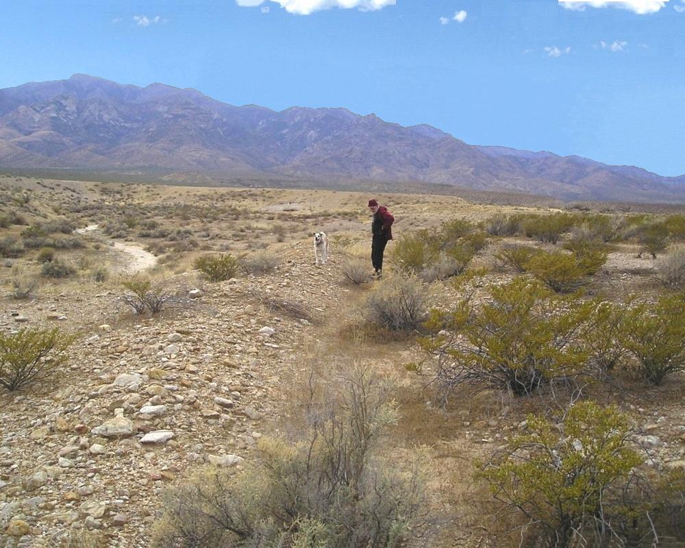
|
|
|
Left Hand Canal 32.81405 -109.91849 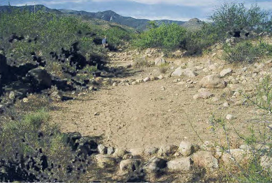
|
|
|
Sand Canal Takein 32.81259 -109.946989 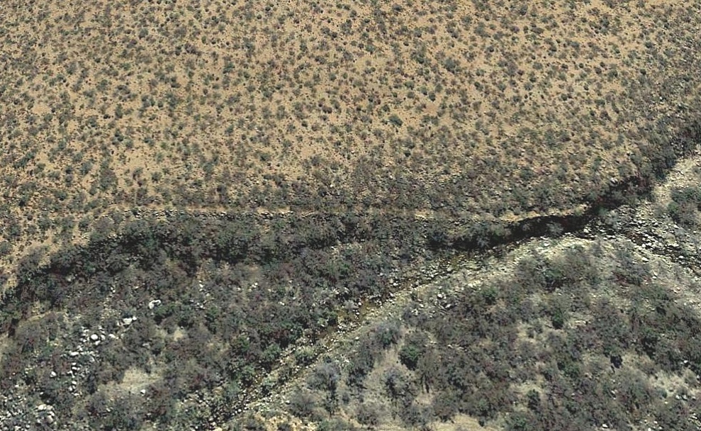
|
Survey Instruments
deeplink • top • bot • respond
No survey instruments as such are known to exist, so what follows remains as rank speculation.
It would appear possible that static water level techniques could be used. In which a small pilot ditch could be extended and then filled with just enough water to measure its start-to-end differential. This could be compared to an optimal slope and corrected before completing the full size ditch.
For instance, something like "one fist per five paces" might be deemed a "correct" two percent slope.
As to "best" overall canal routes, there are many hillocks or prominences common to Mount Graham that oversee potential routes. This conceivably could have given the equivalent of an "aerial photo" suitable for determination of useful earlier canal orientations.
As an example, there are several locations where nearly the entire length of the Mud Springs Canal can be simultaneously
viewed.
This might seem to raise the possibility of the Mud Springs Canal being an earlier prototype.
Watershed Crossings
deeplink • top • bot • respond
Several of the more spectacular engineering features of the hanging canals involve watershed crossings. In which a canal goes "up" out of one canyon or drainage, works its way across a saddle, and then heads "down" a second. All the while carefully maintaining a precise optimal constant slope of just under two percent.
The most studied watershed crossing starts in Ash Creek, crosses a very narrow and well defined saddle, and then routes "down" Mud Springs Canal.
A second and somewhat still largely unexplored watershed crossing starts in Tripp Canyon and apparently ends in a possible ponded destination in Tunnel Canyon. A possible candidate watershed crossing in Nuttall Canyon seems to have been declined when a better route was chosen for Sand Canal that combined with Carter Canyon..
But the potentially most impressive watershed crossing routes from above the falls in Frye Canyon to Spring Canyon. This would appear to be the only possible point to extract Frye Creek water. Only to have it returned downcanyon by the HS Canal to become the Lower Frye Complex.
The upper Frye watershed crossing remains unproven, but would seem to be an essential concept for sourcing both Allen Canal and Lower Frye water, among many others.
Historic Canal Rebuilds
deeplink • top • bot • respond
Evidence is both strong and compelling that most, if not all, historic canal rework were adaptions of prehistoric originals. First, because it is is infinitely easier to "dig out an old ditch" or "steal the plans" or "borrow the blueprints" than to properly engineer a new canal from scratch.
And second , because nearly all of the decent bajada canal locations were already and nearly exclusively prehistorically taken. And third, because historic rework often only was cattle oriented and clearly applied to a smaller portion of the entire canal reach.
Several "Rosetta Stone" situations exist where prehistoric and historic canal segments are closely related. Particularly on Minor Webster and Cluff Northwest.
Finally, Ockham's Razor can be used to add credibility to any missing canal portions. In which the simplest explanation will often likely be found to be the correct one.
One exception appears to be the Roper Lake canal, which did not seem to exist before the 1950's, had partial cardinal alignments, and actually tried to cross a prehistoric Henry's Canal.
Estimating Build Times
deeplink • top • bot • respond
Given some useful stone age tools and an "average" canal run, it would seem feasible to build one foot of canal per person hour. Which might translate to fifteen feet of canal per person day or one mile per person year.
More difficult areas might involve half a mile per person year, and "management" and "diet energy" might need included.
Thus, a possible WAG of 250 man years for 150 miles of canal. Which, while clearly a major undertaking, this does not seem remotely near a "pyraminds" class project.
| Pick your blog year... | /tr>||||
| 1997 | 1998 | 1999 | 2000 | 2001 |
| 2002 | 2003 | 2004 | 2005 | 2006 |
| 2007 | 2008 | 2009 | 2010 | 2011 |
| 2012 | 2013 | 2014 | 2015 | 2016 |
| 2017 | 2018 | 2019 | 2020 | 2021 |
| 2022 | ---- | ---- | ---- | ---- |
| deeplink • top • bot • respond | ||||
Discovery Timeline
deeplink • top • bot • respond
Many of our bajada hanging canal discoveries first appeared in our timeline of ongoing yearly blogs....
A Safford Study Proposal
deeplink • top • bot • respond
A copy of a proposed interdisciplinary Safford Basic research program can be found here. And is authored here.
Your Involvement
deeplink • top • bot • respond
You are invited to participate in this new world class bajada hanging canal research. Specific needs are for GPS literate gonzo hikers and ATV enthusiasts, live video drone operators, and a KML specialist. And perhaps a sedimentologist or climatologist or hydrauligist or nearly any other utterly arcane specialist. Plus, of course, cash in small bills.
You are welcome to support us by participaing in our eBay offerings
Ongoing current goals are to improve and complete the field notes, produce one or more additional videos, ramatically update and upgrade "flyable" mapping, and convince "them" to set up significant ongoing field schools. Or simply to pick up new hiking partners. Or individuals we can mentor. Please send results to don@tinaja.com or (928) 428-4073. More details on some of these here or via email.
| We Need Your Help On These Projects deeplink • top • bot • respond | |
|
Allen Off Mesa 32.82088 -109.80470 |
Allen Destination 32.83309 -109.80482 |
|
Ash Creek Source 32.78602 -109.85499 |
Deadman East 32.75574 -109.77915 |
| Discovery Park
32.78602 -109.85499 |
Frye Middle
32.75075 -109.83780 |
| Frye Pipeline 32.76889 -109.79317 |
Frye Watershed 32.74526 -109.83888 |
| Golf Course Mid 32.80432 -109.77849 |
Grant Creek 32.59249 -109.96686 |
| Henry's Source 32.73713 -109.74231 |
Hog Canyon 32.59323 -109.95044 |
| Jernigan Gaps 32.84140 -109.81260 |
Lamb Tank Canal 32.81368 -109.92292 |
| Middle Freeman 32.76971 -109.79022 |
Minor Webster 32.80758 -109.86857 |
| Mud Springs Gap 32.79170 -109.85312 |
Mud Springs Dest 32.84785 -109.81104 |
| Spear Ranch Area 32.83613 -109.91437 |
Stockton Wash 32.61429 -109.72799 |
| Taylor Canyon 32.81620 -109.97316 |
Tripp Canyon 32.81133 -110.04680 |
| Tugood North 32.82087 -109.86675 |
Tugood South 32.80923 -109.87116 |
| Veech Canyon 32.64279 -109.74278 |
--- |
The above bajada hike projects could greatly assist the world class research on our hanging canals. Typical total and return lengths are one to three miles, often in very difficult or brushy terrain. Needed are field verification, drone work, photos, and GPS.
Arizona Pinstriping on your vehicle is a must.