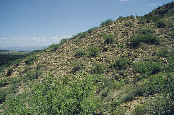
#HC150 mary2.jpg image access Marijilda hanging canal.
Viewed east from N 32.73158 W 109.76269.
One of the first views of the Marijilda/Lebanon hanging
Canals seems to be "hung" to make its slope largely
independent of the local terrain. This would appear
to show a brilliant mastery of water engineering.
As is often ( but not always ) typical , the canal
routes "down" to the "top" of the mesa.
Nearest 4WD track is N 32.73231 W 109.76196.
Click to expand the image.
Possible field notes here.