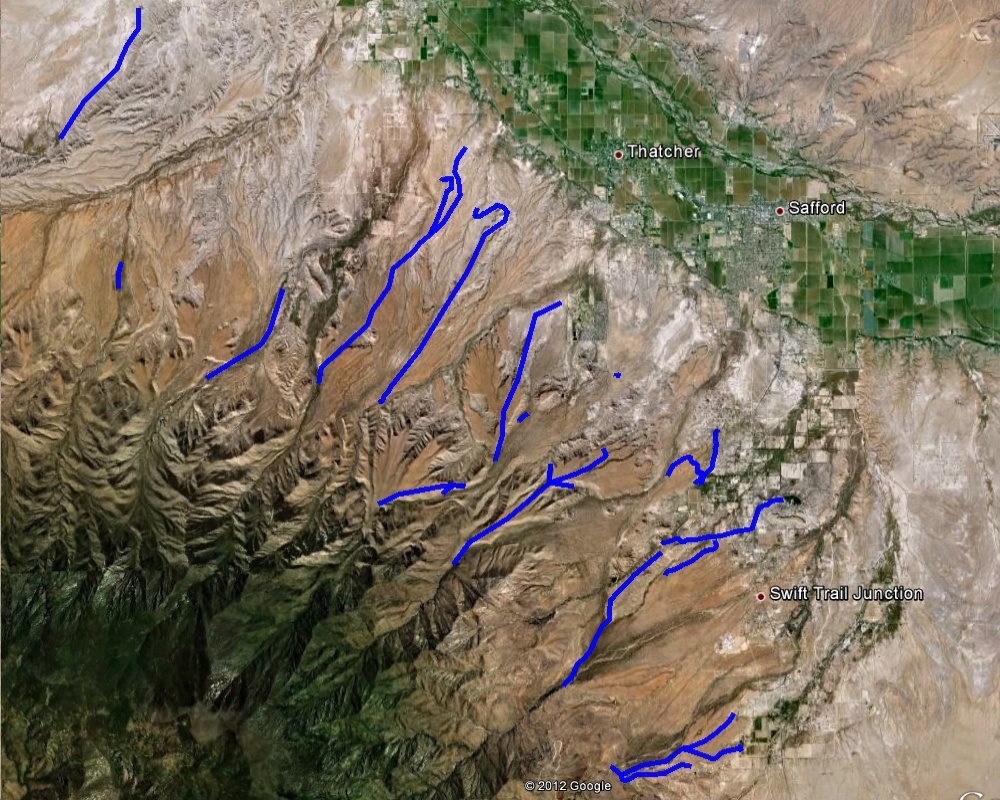
#HC147_ map2.jpg image access Earlier map of some of the northeast canals.
Viewed down from N 32.80459 W 109.77076
An earlier satellite image map of many of the hanging canals.
This is sorely in need of updating and KML conversion.See individual images for best vehicle access.
Click to expand the image.
Possible field notes here.