#HC146_ map1.jpg image access Earlier map of some of the northeast canals.
Viewed down from N 32.80459 W 109.77076
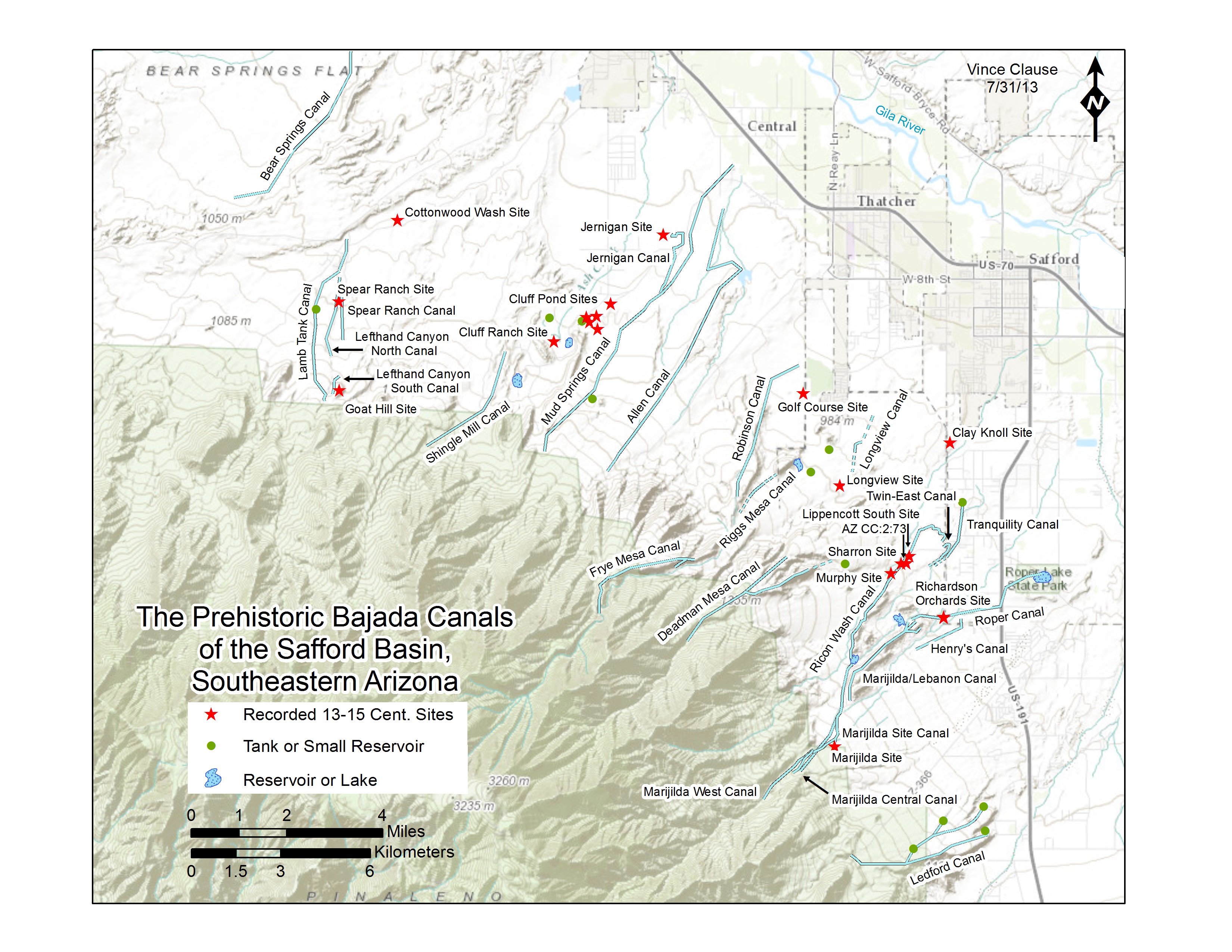
While the prehistoric hanging canals completely surround
Mount Graham, they are most concentrated to the northeast
where many of the runoff streams and the artesian sources are
located. This earlier map also shows other cultural features
but omits later discoveries. It needs a KML upgrade.See individual images for best vehicle access.
Click to expand the image.
Possible field notes here.