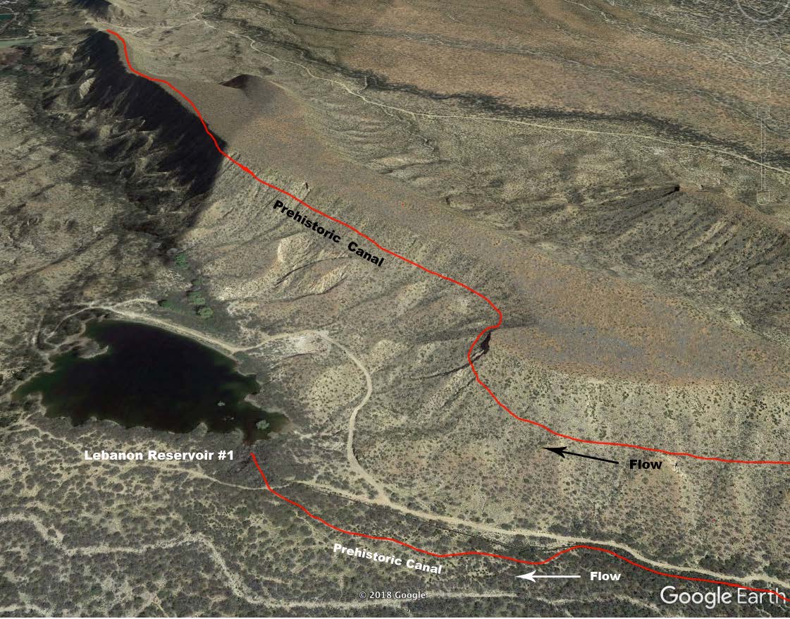
#HC105_ highleb3D.jpg image access "3D" Image of High Lebanon hanging canal.
Viewed east from N 32.73236 W 109.76057.
Google Earth image of this canal has been tilted and
enhanced to show how it climbs "down" to the "top" of
the mesa, all the while maintaining a near perfect slope of
just under two percent. While this is among the largest,
numerous other "hanging" routes are common nearby.
Nearest 4WD access: N 32.73236 W 109.76057.
Click to expand the image.
Possible field notes here.