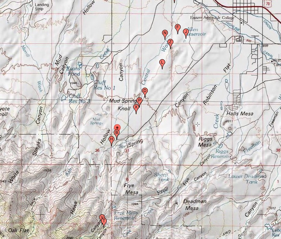
#HC074 allen1_topo_map.jpg access Topo Map of the Allen Canal..
Looking down from N 32.80754 W 109.81529.The canal begins in the spring in spring canyon, possibly
( but still unproven ) aided by Upper Frye Creek water. A
natural drainage is used for its initial reach, followed by a
rather extensive mesa top northerly expanse to the failed
Allen Reservoir. It than goes through the massive Culebra
cut, and likely serviced use fields near Central Dam.
Nearest 4WD tracks are at
N 32.78166 W 109.83377
N 32.80205 W 109.81681
N 32.83575 W 109.79798
Click to expand the image.
Possible field notes here.