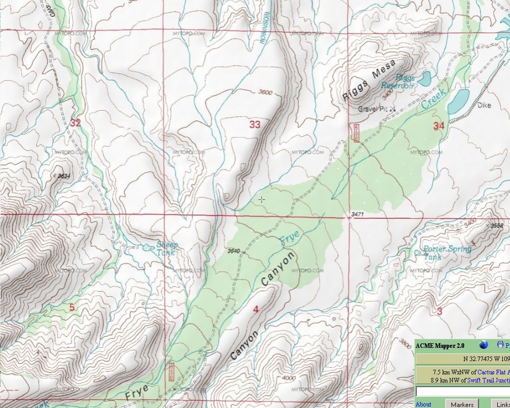
#HC062 frye1.jpg image access Possible route of Golf Course Canal.
Shown down from N 32.78237 W 109.78739
The Golf Course canal is thought to route through
the drainage west of Riggs Mesa, and there are some
minor hints of a canal in this area. While believed to source
from the HS canal, an intermediate route is still unknown.
Enigmatic braided channels are found to the south, and
historically rebuilt Blue Ponds canal to the east. The
Robinson Canal is up mesa towards the west.
Nearest 4WD track is at N 32.77934 W 109.78494
Click to expand the image.
Possible field notes here.