 |
Don Lancaster's What's New? 2010 Blog Excerpts |
 |
| ||||||||
|
fast access usb classics bajada canals on site stuff off site stuff free ebooks video links gila hikes more help |
| Welcome to the Blog Excerpts: new? home email rss top bot |
Pick your excerpt year... 2009 2010 2011 2012 2013 2014 2015 2016 2017 2018 2019 ---- ---- ---- ----
These files provide excerpts from our Guru's Lair Blogs
mostly to provide a historic time line and discovery record
for our Prehistoric Bajada Hanging Canals. Some other
outdoor stuff has also been included.
| January 01, 2011 | deeplink top bot respond |
Closed out the 2010 Archive and started the 2011 one.
| December 27, 2010 | deeplink top bot respond |
Once again expanded and updated our Gila Valley
Day Hikes library page.
| December 26, 2010 | deeplink top bot respond |
Here's a list of links to our Wesrch papers. They sort
of form a "the best of" for our website...
Machine Language Programming Cookbook Classic Sampler
Restoring faded or scuffed text for web use
TV Typewriter eBook
An "Un-Halftoning" scheme to improve eBook Images
Remastering a Technical Book for Web Distribution
The Incredible Secret Money Machine
Allen Reservoir Failure Docs
RTL Cookbook Classic Reprint
IC67 metal locator classic reprint
Hanging Canal Slide Show
Remastering video for web distribution
Stability Issues in Gauss-Jordan Solutions
Gauss-Jordan Solution of nxn linear equations
Staliiking the Wild Paradigm
Prehistoric Hanging Canals of the Safford Basin
Recent Developments in Magic Sinewaves
Enhancing your eBay skills VIII
Website Link Checking Tools
Secrets of Recent Technical Innovation
Lessons Learned During a uv Lamp DebuggingSome Possible Book Scanning "Gutter Math"
Utilities for HTML & XHTML Revalidation
eBay buying secrets
eBay selling secrets
Pseudoscience Bashing Secrets
Isopod Energy Monitor
Enhancing your eBay Skills V
Build this TV Typewriter
The next big things
Elegant SimplicityEnhancing your eBay Skills VI
Cubic Spline Mininum Point Distance
pv photovoltaic panel intro & summary
Energy Fundamentals Intro & Summary
Real Time Acrobat PDF Animation
A Solid State 3 Channel Color Organ
When to Patent
Exploring the .BMP file format
150 Gila Valley Day Hikes
A Gonzo PostScript Powerpoint EmulatorEnhancing your eBay tactical skills VII
Synthesis of Digital Power Sinewaves
Graham Tram Plan and Profile
Some fifth generation Magic Sinewaves
Drawing a Bezier cubic spline through 4 data points
.BMP Bitmap Circular Lettering
An expanded ultra fast magic sinewave calculator
How to trash a vehicle hydrogen electrolysis
A Partial History of the Gila Lumber and Milling Company
Some bitmap perspective lettering algorithms & utilities
How to bash pseudoscience
An Improved Bitmap Typewriter
Using Distiller as a PostScript Computer
Some Architect's Perspective Algorithms and Utilities
Successful eBay Buying Strategies
Why Electrolysis Ain't Gonna Happen
The math behind Bezier cubic splines
Some Image Post Processing Utilities
The Case Against Patents
Some eBay Selling StrategiesA Digital Airbrushing Algorithm
Don't Get Sick!
Some More Energy Fundamentals I
How to scam a student paper
Some Inverse Graphic Transforms
Nonlinear Graphics Transforms
Three Phase Magic Sinewaves
Bitmap to Acrobat PDF Image Conversions
The way things were -- an unauthorized autobiography
A review of some pixel image interpolation algorithmsSome possible false color and rainbow improvements
An Executive Guide to Magic Sinewaves
The worst of Marcia Swampfelder
Acrobat PDF Post Document Editing Tools
A new method of solving electromagnetic fields
A Newbie's Intro to the Web
Gonzo PostScript Tutorial and Directory
An Ultra-fast Magic Sinewave Calculator
Some Energy Fundamentals
Secrets of Technical Innovation
| December 24, 2010 | deeplink top bot respond |
I was asked if there was not a recent drop in eBay
sales.
It is just that usual little dip between the fall slump
and the winter slack period.
More eBay resources here.
| December 22, 2010 | deeplink top bot respond |
Found a few hundred more feet of the Mud Springs
Canal, acutally inside the "black hole of Central". The
full story is eventually likely to unfold as follows:The Mud Springs canal is 7 miles long and a feeder to
a 3 mile long Jernigan Canal. It likely sources from far
up Ash Creek. Its early portions remaiin unverified, But
a rancher's PVC pipe verifies the route credibility and
there is no sane alternative to "Where else could it
have come from?"
A case can be made that this was possibly the first of
at least a dozen prehistoric canals. Owing to its entire
route being viewable at once from certain points. And
to the absence of certain fancier features, unusual
terrain, and nonobvious routes of the others.There is a short stub canal that apparently dumps into
a wash midway at the Mud Springs Expressway crossing.
A possible explanation is that this is for mud control or
dealing with flood overflows.
Further downstream is a large and failed flood control dam.Smaller and different from Allen Reservoir. The dam completely
runs roughshod over the canal without any accomodation of
any type. Which suggests extremely strong evidence that the
canal is in fact prehistoric.
A very well definied "hanging" portion follows, going "up"
a wash wall to continue. Just past where the canal once
again reaches the bajada is a strange circular structure.
Very pithouse looking, but probably centuries newer. And
only half a meter from the canal. Until proven otherwise,
this is the "troll house".Somewhat further southeast, the canal appears to branch to
source the Jernigan Canal. Evidence in this area is somewhat
weak and consists primarily of long linear arrays of dead flowers
combined with the same linear array studiously avoided by the Creosote
Bushes. But all three ends connect to more credible evidence.
A small spur in this area leads to a small and obviously Anglo
tank. This is presumed to be a "steal the plans" and "dig
out an old ditch" similar to Hawk Hollow Tank.The two canals parallel each other for a surprisingly long time
over very minor spacing. Presumably this was needed as a
"setup" to maintain slope on the two routes. The canals
never seem to get more than 800 feet apart. Sometimes
much closer.
The west spur vanishes into the Black Hole of Central to
emerge as the well defined Jernigan Hanging Canal. The
east spur also vanishes into the Black Hole of Central to
emerge as a well defined continuance that appears to
be headed for river bottomland near the Union Canal.
The final thousand feet is indistinct and largely trashed.
Slopes and terrain inside the Black Hole are eminently
credible. Possible explanations for the absence of hard
evidence are incomplete exploration, sheet flooding, or
stream piracy.
Meanwhile, the Allen Canal enters the Black Hole of Central
from the east. Where it goes and whether it merges with the
Mud Spring canal has yet to be determined. The only other
route would be unlikely as it is heading towards a cineaga.
Kiddies, we are dealing with utterly spectacular world class
stone age engineering here. Orders of magnitude beyond
beyond.
Yet, with one or two grateful exceptions, I cannot seem
to interest the powers that be in the Southwestern
Archaeology hierarchy. Just because I skipped one too
many compulsory faculty teas half a century ago.
| December 19, 2010 | deeplink top bot respond |
I had a kangaroo joke, but I forgot the paunchline.
| December 14, 2010 | deeplink top bot respond |
Picked up a Garmin eTrex H personal GPS navigator.
It is proving extremely useful in the Prehistoric Canal
explorations.
Ferinstance, I can get the GPS coordinates of a place
I want to go off of Acme Mapper. And then go to it
with the eTrex. Or record where I was, again to
Acme Mapper. Or set a waypoint for my 4Runner
in heavy brush and be able to return right to it.Or purposely cover a loop route to explore twice
the terrain without worrying about exactly where you
are at all times. There also seems to be a highly
subjective "focus factor" that makes it easier to
cover more ground faster with less energy.
List price is around $100. Accuracy is typically
about ten feet. But you can dramatically improve this
by going to differential GPS. Either with a second
unit or a web or commercial service. Differential GPS
works by tracking the reported position of a known
fixed position over time. Correnctions are useful over
tens or even hundreds of miles.
The five buttons make entering alphanumeric data a
pain, but are otherwise intuitive and ergometrically
useful. While the buttons are intentionally hard to
press, I feel they overdid this "feature".
Also nice is reporting such stuff as distance and speed
traveled. As with most GPS, the altitude resolution is
rather crude and largely useless. Hundreds of waypoints
can be saved and stored for later analysis.
More on similar projects here.
| December 11, 2010 | deeplink top bot respond |
Expanded and updated our Prehistoric Hanging Canals
of the Safford Basin presentation to include the latest
Mud Springs Bajada developments.
| December 09, 2010 | deeplink top bot respond |
The plot thickens till it clots.
There is a 3000 foot or so square patch here I think I'll
call the Black Hole of Central.Two prehistoric canals clearly go in, and two clearly
come out. But there is not the slightest trace so far
of anything inside.
Possible explanations......1. I could not find a pig in a dishpan.
2. Looking for the wrong things in the wrong place.
3. Massive sheet flooding in the past.
4. Stream piracy.
5. Modern trashing.
6. There never was anything there.I guess I'll try full transects over the non-obvious portions
next.
What is really frustrating is that straight line extrapolations
suggest the two canals cross at right angles!
Your participation welcome. Your Draganfly can be delivered
to 3860 West First Street, Thatcher AZ, 85552.
| December 03, 2010 | deeplink top bot respond |
Did you know that Paul McCartney had a group
before Wings?
| December 02, 2010 | deeplink top bot respond |
I'm thinking about adding several new pages to our
Gurur's Lair. Perhaps one that is eBook specific and
one on Gila Valley History & Prehistory.
eBooks currently available include RTL Cookbook,
the Incredible Secret Money Machine, TV Typewriter
Cookbook, and the Metal Locator thesis. With
parts of the Micro Cookbook scheduled next.
Some of the Gila Valley stuff would include the
Hanging Canals paper, the Hanging Canals slide show,
a Neely paper, the Allen Failure Docs, the Tramway
story, the Tramway slide show, and, of course, our
Gila Valley Day Hikes.Let me know what else you want to see.
| November 28, 2010 | deeplink top bot respond |
Updated and expanded our Gila Valley Day Hikes
library page.
| November 26, 2010 | deeplink top bot respond |
One of the foremost hallmarks of a good employer is
their not drawing that much of a distinction between
casual dress days and the clothing optional ones.
| November 23, 2010 | deeplink top bot respond |
One of the principle indicator species of overgrazing
is ----> cows.
| November 20, 2010 | deeplink top bot respond |
I still do not have conclusive proof that the prehistoric
Mud Springs canal exists. IF it exists, it would be
one of the most significant of Mt Graham water
exploitations. Routing the highest flow rate stream
of Ash Creek "up" and over the largest and most
obvious bajada.
For a projected length of five miles! A case can be
made that this might have been the earliest of the
canals. Based on the entire route being visible from
its starting point. Which would vastly simplify its
engineering.
The evidence so far: There is an obvious and
( largely ) unarguable half mile solid chunk of the
canal halfway along the route. It even includes
a diversionary canal stub presumably used for
flood control or mud removal.
The Jernigan Canal provides an obvious teminus
for the Mud Springs System. It too is well defined
and unambiguous, but only a quarter mile long. But
any intermediate evidence has yet to be found.
And another canal is within 800 feet but defies
any and all interconnect attempts.
The only rational source for such a large canal
system would seem to be Ash Creek. And a
rancher has laid a PVC pipe along the route,
both proving its feasibility and raising "stole
the plans" issues.
But once again, any early or diversionary
evidence has yet to be found. The topography
is certainly feasible. 4WD access is rough.
Miles are foot only.
Field mice are very much needed on this project.
email me if you have any interest.
And your contribution of a Draganfly can be shipped
directly to 3860 West First Street, Thatcher, AZ.
| November 16, 2010 | deeplink top bot respond |
Found a rather strange local cienega. One that gives
credence to the theory that there were a lot more
springs in the area and they were a lot larger than
present.
This one is strange. It has reeds and breifly flowing
water. The water does not appear bitter or warm.
There are no obvious signs of anything prehistoric,
although it is only a thousand feet from a fairly major
habitation site. Curiously, there are no signs of modern
development as well. Such as fences, traps, dams,
or diversions. It is "just there".
An interesting question is whether the Allen Resevoir
was once part of a fairly major cienega. The Golf Course
and Cluff poinds may also have had similar origins.
| November 15, 2010 | deeplink top bot respond |
"Truth is stranger than fiction" gets even more bizarre
when you wander into Western New Mexico.
The Brushy Mountain Radar Station is South of Mule
Creek at the end of a secret mountain laboratory road
whose access is easily controlled. It started life as a
cold war facility and presumably still sees use for drug
interdiction activity.
Little known is that it includes oversize kitchen and
dormitory facilities. It was supposedly used as a remote
retreat by both the Kennedy and Johnson presidental
administrations. Since then it occasionally has seen such
mundane uses as BLM team building excercises.
BUT and IF you needed to stash some super secret stuff
( such as, say, some extraterrestrial aliens ), the facility is
virtually ready to go.
Even stranger is Terrortown, once known as Playas. This
began as a company town for a long defunct smelter
and was bought by a New Mexico school and funded by
the Department of Homeland Security for a training
facility for counterterrorism and urban hostage situations.
More here, here, and here.
| November 14, 2010 | deeplink top bot respond |
Truth can certainly be stranger than fiction. As a bunch
of Gila Valley happenings over the years can attest.
One of the most blatant scams was the McEniry Tunnel,
a scheme to tunnel all the way through Mt. Graham.
The gold and silver could simply be scraped off the ceiling
into ore cars, greatly simplifying extraction. At the same
time, zillions of acre feet of water could be recovered,
along with lots of electricity. Plus lots of timber.
The entire prospectus, of course, was an outright lie. The
Grahams are precambrian intrusives with virtually zero
mineral content whatsoever. The site today is a plain old
short mining tunnel.
BTW, all the locals have their own favorite spelling and
pronounciation of "McEniry". And love to argue about it.
I'll stick with his signature on the above prospectus. This
is also sometimes called the "Triumph Tunnel Site".
Somewhat further west was the Spenazuma Mine, shortened
from getting "them" to "spend their mazuma". And a
classic example of blatant salting. Today, this is on a private
ranch on which visitation is strongly discouraged.
What might or might not have been a scam was the Bear Flat
Irrigation District. In which artesian water was run over a
long series of canals and lakes in what today is totally barren
and dry as a bone.
More modern is the saga of the Banana Farm scam. Which older
Thatcher residents do not want to talk about. Also, for some
strange reason, nobody but nobody in the entire Gila Valley
wants to talk about the "Golden Letter" scam whose pyramind
scheme flushed out the entire area during the 1980's.
| November 10, 2010 | deeplink top bot respond |
Welcome to hell.
Here is your accordian.
| November 09, 2010 | deeplink top bot respond |
I have a hollow feeling that I've missed many of the
obvious candidates in our Gila Valley Day Hikes. Or
that my own personal interests or biases are tinting
the collection.I just added a few obvious omissions that should have
gone in long ago. Please email me with new suggestions
of your own. No, not that one.
A reminder that there will be a talk on many of these
this saturday at 6:30 PM in the Discovery Park Jupiter
Room .
| November 08, 2010 | deeplink top bot respond |
Yesterday's canal chasing was more or less a debacle,
missing the intended locations by a few hundred feet.
We did more or less prove that the Mud Springs Bajada
route seems viable and that a rancher ran a pvc pipe
over pretty much the same terrain in what sure looks
like "steal the plans" to me.
The premise so far: If "they" in fact were to exploit every
drop of Mt Graham water, their crown engineering jewel would
be routing Ash Creek water "up" and "over" the Mud
Springs bajada.
So far, there is a half mile of mid canal "proven" to well beyond
acceptable on-ground evidence. And the Jernigan Canal
"needs" a water source that is topographically compatible.
But any linking proof remains elusive.
Meanwhile, the only feasible source for the mid canal would
in fact be Ash Creek. But, again, linking proof remains elusive.
| November 07, 2010 | deeplink top bot respond |
Expanded, updated, and added bunches of new links
to our Gila Valley Dayhikes library page.
A reminder that I'll be talking on this Saturday at 6:30 PM
in the Discovery Park Jupiter Room. See you there.
| November 03, 2010 | deeplink top bot respond |
At one time, the only popular ways to emphasize text were
underlining, italics, or bolding. Of these, underlining was the
only reasonable option available for hand writing or an
ordinary typewriter.These days, of course, underlining should be tolerated in the
second grade, strongly discouraged in the third, and severely
punished in the fourth. Fortunately, most compulsive underliners
eventually grow so much hair on the palms of their hands that
they no longer can type.
Since color is now essentially free, it has largely replaced
traditional emphasis forms. We will often use blue for links,
brown or aqua for plain old emphasis, purple for sourcecode,
and a rare red for urgency.
It turns out you can simply fake an italic font in PostScript,
largely eliminating any need for them. There are two ways
to specify a PostScript font. One is to simply state the size
as an integer. The other is to use a six element array of
[ wide climb lean high xshift yshiftt ] to create your font.
Ferinstance, /Fontname findfont [10 0 2 12 0 0 ] makefont
setfont would create a slightly compressed italic font. As
would my Gonzo Utilities equivalent of /font1 /Fontname
[10 0 2 12 0 0 ] gonzofont.
Many more font tricks here.
| November 02, 2010 | deeplink top bot respond |
I'm wondering what our prehistoric hanging canal explorations
can tell us about climatic reconstruction.
The evidence seems to be accumulating that ( even factoring
in our present severe drought ) things seemed wetter then.
And possibly very much so.
Ferinstance, today there is not nearly enough water in Spring
Canyon to justify any canal project. Let alone a major seven
mile long one. Hand built with stone age technology.
And one credible explanation for an early lake in the failed
Allen Reservoir area could be a large cienega. To this day,
there are cienega hints there as well as both up and down
canyon.
Specialized interpretive help is obviously needed.
| October 31, 2010 | deeplink top bot respond |
The more engineering I become involved in and the more of it
I see, the more it gets down to its fundamental definition of
a sense of the fitness of things.
The local prehistoric canals I've been exploring are so utterly
beyond incredibly brilliant that they clearly blow away any high
tech in the Gila Valley to this day. Given the available tools
and technology.
The reason you hang a canal on the edge of a steep sided mesa
is that this makes your slope independent of terrain! Leading to
astonishing savings in energy and the amount of material that
needs moved.
One of their latest features to be pondered over are cutouts,
apparently used for flood control or mud removal. Of the eleven
canals of over 30 miles to date, at least three seem to include
these cutout features.
Even more amazing, if the premise was made that their goal
was to totally exploit every drop of mountain stream water,
an extremely conspicuous and difficult site seemed totally
absent. That site has now been found and verified. And appears
to route Ash Creek water "up " and "over" the Mud Springs
Bajada.We are now so ridiculously far beyond world class that terms like
"second only to Phoenix" or "second only to Tucson" can
clearly be dropped. Engineering a flatland river canal is utterly
trivial compared to mesa hanging.
Field mice are definitely needed. As are toys. Topping the toy
list is a precision MEMS altimeter and, of course, a Draganfly.Please email me if you want to be part of the team.
| October 30, 2010 | deeplink top bot respond |
I'll be doing an upcoming Discovery Park lecture on
365 Gila Valley Dayhikes. 6:30 PM in the Jupiter
Room on November 13th. Free admission.
| October 29, 2010 | deeplink top bot respond |
One of the continuing surprises of our hanging canal
studies is how much "they" relied both on micro and
mega topographic features. In many cases, an unusual
and highly localized topo feature that is totally counterintuitive
plays a key role in making an entire canal system possible.
One obvious example is where the Deadman Canal
purposely crosses the narrowest and highest point on its
mesa, exactly where a three way switch can be best
used to route water to three wildly different drainages.
Or the several instances where a canal makes a "U" turn
and purposely routes itself back UP canyon, contrary
to the predominate mega terrain direction.Or many instances where "up" is really "down" along a mesa
edge. The wonderments continue.
| October 27, 2010 | deeplink top bot respond |
The optimal grade for a prehistoric canal is often
something around two percent. Or Four feet of drop
for each 200 feet of reach.The canal will not work at all with positive slope, and might
self destruct with stronger negative slopes.The resolution needed is much better than GPS,
especially with low angles on the birds. And older
sport altimeters also have limited resolution.It turns out there is a new generation of MEMS
pressure sensors that might do the job. Such as
a THREE CENTIMETER (!) one or this
NINE CENTIMETER (!) one. Prices for the
bare sensors themselves are in the $39 range.Differential operation should be trivial, since you
would simply walk back to your starting point.Finding suitable terrain would go a long way to deciding
exactly where the "missing" portion of a canal can
or cannot go.
| October 22, 2010 | deeplink top bot respond |
Just found another new mountain stream fed prehistoric
hanging canal!
It is much too early for even speculation, but it may
be five miles long, may source far up Ash Creek,
and may be the long sought delivery venue for
the Jernigan Canal fields.
Tentative Name is the Mud Springs Bajada Canal.
We are now up to at least eleven hanging canals
with a total length approaching thirty miles! The
engineering here is orders of magnitude beyond
stunning.Please email me if you want to help with the exploration.
You do have to be the type of hiker that brings
along your own catclaw, just in case there is not
enough along the route.
Next trip leaves Sunday morning.
| October 18, 2010 | deeplink top bot respond |
The weekend saw many new canal discoveries.
Which, as usual, created more questions than
they resolved.
Many deep cuts were found in the lower Marijilda
area. Which added strong credence and credibility
towards the Culebra Cut in the Allen Canal
being in fact prehistoric.
The mid portion of the Allen Canal was extended
nearly to the north mesa edge. But it raised a distinct
possibility that the upper and lower reaches are
in fact two different canals.
One question is whether the Allen Reservoir received
most of its obviously high inflow from the upper
Allen canal or from once large but now defunct springs.
The watershed is simply too small and runoff free to
offer other obvious alternatives.
Meanwhile, the upper Allen canal could in fact
end up as the missing source for Jernigan Canal
water. But link evidence to date is sorely lacking,
owing partially to sheet flood damage.If these two canals are distinct, we might
rename the upper Allen Canal as Spring Canyon
Canal.
More here and here.
| October 09, 2010 | deeplink top bot respond |
Latest GuruGram #113 is on the Allen Dam Failure Docs.
Its sourcecode is found here, and additional GuruGrams here.
| October 06, 2010 | deeplink top bot respond |
We always try to be prompt.
No matter how long it takes.
| October 02, 2010 | deeplink top bot respond |
Mathematicians usually accept that 2+2=4. But this
may not be true for extremely large values of two.
| October 01, 2010 | deeplink top bot respond |
Managed to get some very meager but apparently
accurate info on the Allen Reservoir. Which suggests
to me an utterly fascinating possible relationship between
it and the ( presumed ) prehistoric Allen Canal.
Many thanks to Nicole Spence Gibson and
Michael Johnson of the Arizona Department of
Water Resources for their valuable input.
First the apparent facts:
The dam was built by the Soil Conservation Service in
the 1930's using labor from the PWA and possibly
the CCC. This was part of the "Gila Project".In 1948, the overflow pipe became clogged and
nobody bothered to fix it. The dam failed spectacularly
twenty years later in the late 1960's after a heavy storm
overflowed the emergency spillway .
The local rancher/farmer involved was Gerald Clarridge.
It is not clear why the reservoir was named for a
different local historical clan. Use seemed to be
mostly as a large cattle tank and for recreation,
especially duck hunting. Plus flood control.No modern irrigation control structures seem
associated with the dam.
The dam held quite a bit of water most of the time,
and even unlikely "water skiing" was mentioned
as a common use. Curiously, the watershed for
the Allen Reservoir is quite dry and quite small,
being only a few square miles at most. There
are no obvious springs or access to Mount Graham
snowmelt or runoff. Heavy monsoon storms would
be limited to a week or two in July.
Followed by my rank speculations:
To me, the obvious cause of the dam's demise was
neglecting to clean the overflow pipe for twenty years.
The investigation of the failure appears perfunctory
and cursory at best. Specific immediate causes
of the failure appears to be poorly consolidated
materials and improper moisture control during
the dam construction.
Plus, just possibly, a very proud gopher.
To me, the ONLY credible water source for such a
large reservoir would have been cleaning out and
reusing the prehistoric Allen Canal! As sourced
from a Spring Canyon perennial reach.
The canal itself seems to have been completely covered
by the western abutment of the dam. Without any
attempt at piping, control, or preserving flow in any
manner. Obliterated at a level significantly above
the lake bottom.
A careful study of the canal immediately above
the dam might resolve some of these issues.
This area is fairly difficult to get to.
A plausible explanation for the name disparity is
that a pioneer member of the Allen clan diverted
an "old ditch" to create a duck pond or stock tank.
In the same manner that the nearby Robinson Ditch
did so to the east. Long before the dam construction.
And presumably, before the Hawk Hollow tank.
My present belief remains that the Allen Canal is
in fact prehistoric. And that its significant cut
is in fact world class. But that stronger proof is
still clearly needed.
| September 28, 2010 | deeplink top bot respond |
An excellent video on what caving is all about can be
found here.
Many years ago, I was involved in a major cleanup
project in earlier portions of this same cave. We had just
discovered that a weak acid solution seemed to work well
in removing the carbon from carbide lamps from formations.
Speaking of which, the Central Arizona Grotto is having
its 50th anniversary (!) dinner here this Saturday October
2nd. Anyone with an interest in Arizona caving is welcome
to attend.Particularly if you have a copy of the UAAC Songbook.
| September 27, 2010 | deeplink top bot respond |
Yesterday's trip extended the Allen Canal a few hundred
feet more into the sheet flood damaged area. And, as
usual, generated more questions than it resolved.
About 12,000 feet remains to be explored in eight areas.
These include...Tracing an obvious route from takein to
Hawk Hollow tank.
Resolving the transition from CCC
spillway to prehistoric continuance.
Determining which direction the canal
leaves Allen mesa.
Finding the continuance south of Allen
Reservoir
Resolving the route through the flood
damage area.
Finding a water source for the Jernigan
Canal.
Finding iron-clad absolute proof that the
Culebra-like "big dig"is in fact prehistoric.
Determining the north terminus of the
Allen Canal.You can email me if you want to participate or add your name and email
added to our continuing interest list.
Should you decide to contribute a much needed Draganfly, you
can ship it to 3860 West First Street, Thatcher, AZ, 85552. .
More on all this here and here.
| September 26, 2010 | deeplink top bot respond |
Many thanks to all of you that attended our Prehistoric
Hanging Canals of the Safford Basin lecture yesterday.
The turnout was surprisingly good, considering some of the
many competing events were giving away free food.
You can email me if you want your name and email
added to our continuing interest list. "Field mice" are
definitely needed to continue mapping and exploration.Normally, graduate students are used for field mice.
They are not at all endangered and nobody ever gets
emotionally attached to them. They are quite durable.
Surprisingly, many of them are even housebroken.
The presentation can be viewed here with its sourcecode
here. The original paper is found here with its sourcecode
here. A related Dr. Neely paper is found here, with his book
access here.
| September 25, 2010 | deeplink top bot respond |
Some limited info on the Allen Dam is hopefully on the
way to me.
Which is expected to reveal this is a combined SCS
and PWA project from the 1930's that failed spectacularly
in the late 1960's. It is also expected to not be in any manner
irrigation related.
Supposedly, the original drawings are available in
Phoenix. But they are on parchment and not readily
made web friendly. I'll try to repost what is available
on this. Probably to our Tinaja Questing or Gila
Dayhikes libraries.
Presumably the west abutment of the dam ran right
over the Allen Canal without any provision for access
or flow maint. Which reinforces my belief that the
Allen Canal is in fact prehistoric.It IS expected that the prehistoric Allen Canal was usurped
as a water source. This is the only feasible water supply
consistent with long term storage. Otherwise, the watershed
in only a few square miles at most. With no obvious access
to any springs, streams, or mountain runoff.
For obvious reasons, I am going to call the huge canal
cut just northwest of the Resovoir Culebra.
Although the amount of dirt moved is comparable to
the Marijilda aquaduct, the sheer size of this project
demands that exceptional effort be made finding absolute
and unquestionable proof of its prehistoric origins.
| September 23, 2010 | deeplink top bot respond |
Just got an email from a friend of some Fort Thomas residents
who have some strange rock alignments on their property. Could
these be prehistoric canals?
Sorry to disappoint, but these are almost certainly totally worthless
CCC busywork boondoggles from the 1930's that are almost ( but
not quite ) as bad as today's failed economic stimulus ripoffs.
These are usually piled six deep in Fort Thomas. Examples are easily
found on the Black Rock road near the old dump, or on Runway 32
of Eden International Airport. Or especially on bajadas to the North.
Just in the unlikely case the find is real, have them go to Acme Mapper,
and center the cursor on their location, do a page link, and then email
me the result .
The usual rule is: "If it is obvious, it is CCC."
More here.
| September 21, 2010 | deeplink top bot respond |
The deli was unable to collect their aviary bill, so
they took a tern for the wurst.
| September 20, 2010 | deeplink top bot respond |
Yesterday's trip pretty much proved that the Allen Canal
is in fact sourced by an apparently still perennial reach of
Spring Canyon. While there might be some possible modern
rework or maint, it remains primitive and totally free of
any concrete, rebar, or other modern constructs.
But many questions remain. Especially a strong and thorough
proof that this structure is in fact world class stone age prehistoric.
Most evidence to date clearly supports this conjecture.
Also remaining unanswered is the relation to Hawk Hollow
Tank, Allen Reservoir, Jernigan Canal, and exactly where
this seven mile long (!) canal is in fact ultimately headed. Plus why
there are at least four different architectural construction
styles.
I'll be talking about our hanging canals in this Saturday's
Discovery Park lecture at 6:30 on September 25th.
| September 19, 2010 | deeplink top bot respond |
A new directory of free online college and university courses
can be found here.
| September 17, 2010 | deeplink top bot respond |
Updated and expanded our Gila Valley Day Hikes page.
We may be doing a lecture on this in the November
Discovery Park series.
| September 16, 2010 | deeplink top bot respond |
Latest GuruGram #112 is on a Hanging Canal Slideshow.
Its sourcecode is found here, and additional GuruGrams here.
Some pr from my upcoming presentation,,,================================================
PREHISTORIC "HANGING CANALS" SUBJECT OF NEXT
SATURDAY'S DISCOVERY PARK FREE LECTURESome recent archaeological discoveries have revealed an astonishing
series of prehistoric canals just South of the Safford area. These
mountain stream fed canals have the remarkable property that
portions are literally "hung" along the steep edges of remnant
Quaternary bajada mesas. Some as much as ninety feet above
their valley floor.At least seven hanging canal systems are known. Their total
explored length now exceeds eighteen miles. Other amazing
features of these canals are that some include above-grade
aquaduct portions. Others provide for elaborate switching to
route water between different drainages. And most include
a "breakaway" feature that makes flood repair fast and simple.The stone age technology involved seems well beyond world-class.
Reaches of at least some of these canals still flow to this day.Some engineering details on these hanging canals will be
presented as a talk in the continuing fall Discovery Park lecture
series by local author Don Lancaster. This free presentation will
begin at 6:30 PM on Saturday, September 25th in the Discovery
Park Jupiter Room.The lecture may be previewed at https://www.tinaja.com/glib/hangcan1.pdf
and at https://www.tinaja.com/glib/hangshow.pdfEveryone is invited to these family-oriented talks. Students of all
ages may qualify for extra credit. 20 inch telescope viewing and
free planetary flight simulator rides may also be available. Discovery
Park is located near the corner of Discovery Park Blvd. ( aka 32nd
street ) and 20th Avenue in Safford, AZ.For more details, contact Discovery Park Dean Paul Anger at
(928) 428-6260 or email paul.anger@eac.edu .
| September 12, 2010 | deeplink top bot respond |
Acme Mapper can sometimes be a useful substitute for
a GPS receiver. If you do not have differential GPS
available, it can even give you more accuracy!
Even at its "rural" resolution, you are looking at 200 feet
in 70 pixels, or about three feet per pixel. At the "city"
resolution, you have 20 feet in 70 pixels, or well less
than a foot. But the actual data is usually somewhat worse.
The cross in the middle of your image will give you its
GPS location. These are easily extracted and emailed.
You can also flag various GPS locations. But note that
there is apparently a bug in which the letter sequence
of the flags may change unexpectedly.
| September 08, 2010 | deeplink top bot respond |
The National Inventory of Dams did approve my password
after a few days. There is no information on the Allen Reservoir
in the directory.What is really amazing is that there is apparently ZERO
overlap in county, state, and national dam directories.I am mildly curious: Even with "oops, it broke", how do you lose
a 500 foot long, 30 foot high dam with a lake behind it?And hide every written document on it anyplace ever?
And instill in the locals not the slightest clue nor the least
interest that it exists? Even when you can almost throw a rock
at it from downtown? Its only a short 4WD trek from
Thatcher International Airport.
Conspiracy enthusiasts might note that this is where they
buried the UFO's before faking the moon shot.
| September 06, 2010 | deeplink top bot respond |
I seem to be having an outrageously difficult time finding
anything at all about Allen Reservoir, a spectacularly failed
and quite large dirt dam two miles southwest of Thatcher.
Yeah, there's lots of web sites that lavishly praise the fishing
at a spot that has been bone dry for decades. And dozens
more will give you the exact GPS locations.
The genealogical historian for the Allen clan never heard of
who built it or why. The historical society president is in the
hospital. The SCS ignores completely my local and national
emails. And the national dam directory has locked me out
because they apparently think I am a terrorist intending to
further destroy an already completely destroyed dam.
All I am really looking for is proof that a canal the dam
completely obliterated and ran over at its western abutment
is in fact prehistoric. The CCC does not seem to be involved
as there is waay too much dirt and not the slightest trace of
fancy rockwork.
There is a thirty foot hole in the dam, likely caused by a
very proud gopher. I suspect the owners do not want to
own up to it, because they apparently destroyed a perfectly
good seasonal duck pond in one of the usual government
boondoggles.
I suspect the houseboat franchise may be available.
Please email me if you can help on this .
| September 04, 2010 | deeplink top bot respond |
Leave it to the Military to point out to me via email
that a Epiphany is usually overwhelmingly positive,
while a "Holy Shit Moment" can be either very bad
or very good.Some personal examples...
Way back when I was first developing our
curvetracing routines, I decided to use
Mickey Mouse as a subject. Halfway
in the development process, about 2:15
AM, I entered ONE wrong coordinate.
And Mickey instantly got an appropriate
sized and positioned erection! Sorry, but
for obvious reasons, code ( with or without )
is not available.
I witnessed a tanker rollover in Phoenix
that created the usual movie-style fifty
foot fireball. In the length of time it took
to say "Holy Shit", the fireball blew itself
out, leaving the rest of the zillion gallons
of diesel fuel below its flashpoint.
For decades I had been finding tantalizing
hints that Magic Sinewaves were in fact
real. Sure enough, at 3:15 AM a waveform
popped up with all low harmonics precisely
zero. The Holy Grail was found!
Finding a continuance of the prehistoric Allen
Canal in an unexpected place, superb
preservation, and world class size was a
recent example.
But the most recent "Holy Shit Moment" was
realizing exactly WHY the prehistoric obsession with
hanging canals halfway up the sides of mesas:
This made the slope INDEPENDENT of the terrain!
And, factoring in the available technology, makes
the LBT look like a Tinkertoy set.
| September 02, 2010 | deeplink top bot respond |
The Central Arizona Grotto of the NSS is having a fiftieth (!)
anniversary bash. Due to a groundswill of popular demand,
I was asked for some comments. Which I'll repeat here...
==================================
I guess Bee and I have been long term CAG members since
1967 or so. We were attracted to the Grotto by an Arizona
Highways story. We had done some minor caving in Bear Cave
and elsewhere in Pennsylvania and wanted to know more about
Arizona's Pivot Rock cave.I was never a gonzo supercaver. That award surely should go first
and foremost to Jerry Hassemer. Or at least to his dog Suzy.
With such luminaries as Ron Bridgemon, Pete Delaney,
Bob Buecher, Dwight Hoxie, Tom Strong, and Lang Brod
( and dozens of others ) certainly in the running.Over the years, I was often the grotto vice president and edited
the Cave Crawler's Gazette newsletter for three years. In those
days, properly doing a newsletter involved an awesome amount
of time, effort, and cost. I still hope to get these newsletters up
on the archive of my website at https://www.tinaja.com . A classic
cover involved the DISMAL I, a "Diet Smith" magnetic car
levitator that really was Pete Delaney and a pair of crutches
standing in a garbage can. Overlayed on an impressive cliff. Such
photo edits were a lot harder before PhotoShop.We often hosted grotto meetings, sometimes involving a "who
turned out the lights?" drunk Saint Bernard. One of the grotto
meetings was literally sixty five feet in the air on the Gentry
lookout tower near Heber.While we regularly attended CAG events even after moving first
to Parker and then to Thatcher, my primary "loyalty" was always
to the ARA. As I felt that outreach from the cave community was
(and very much still remains) a crucial issue. We probably hosted
more ARA paper regionals than anyone else, mostly at EAC or TFD.My biggest Arizona cave "find" was the extension Jerry Hassemer
and I made to Dum Ditty cave. I remain convinced major wet passage
remains beyond its present terminal crawlway.Finding virgin passage remains one of the ultimate highs of the
caving experience. Out of state, I was involved in finding thousands
of feet of virgin passage in California's Lilburn Cave. But this was
largely a trivial task at the time. Bee and I also did some fuzzy
elephant research in Natural Trap cave in Wyoming as part of a
scientific expedition. Where I managed to blow up a cave pack
full of spent carbide. We also played a negligibly minor role in
Kartchner development.My focus was often on the Redlake area. We did quite a bit of
pumping both in Redmond and Bear Springs. I am convinced
there is a lot of potential remaining in Bear Springs and in Hot
Dog pit. There still is a largely unchecked lead half a mile
northeast and above Hot Dog in a slanty entrance that just might
lead to big time new cave. The crucial issue of the area remains
Pishiboro heading South to the Frog Pond with Columbine's
water source remaining an enigma. Bear Springs may remain
the key to the puzzle.One major effort for little return was the search for Mescal Pit.
Dozens of trips and one regional were made to the Sombrero Butte
area, eventually finding a minor 95 foot pit in Precambrian limestone.
A second unfound "rocks roll forever" pit, tentatively named
"Strawberry Awful", is rumored a mile to the northwest. You can't
get there from here. This did eventually lead to the exploration and
mapping of El Diablo. Which remains in the most spectacular
scenery in Arizona and involves rather challenging hiking.I was also overly enameled of El Capitan canyon. While only
"almost" a caving experience, it remains a "must visit" for any
caver. The "next" El Capitan Canyon is likely to be San Carlos Falls.There are many long term legends of Arizona caving. But four of the
more persistent are the "hall tree", "Bee and the flamethrower",
the "watermelon caper" and the "jawbone of the ass". Seems Greg
Lazear had a hall tree he no longer wanted, so he hid it in a remote
and secret Arizona cave. Other cavers found it and rehid it elsewhere.
Over and over and over again. Simply referring it as "it" and carefully
never mentioning what it was or its history. It probably has been in more
caves than anybody and probably recirculates to this day.Bee was in Peppersauce Cave once and kept asking "Is my lamp lit?"
At the time her carbide light was putting out a foot long flame. Turns
out that caving with prescription sunglasses on can be suboptimal.Students of Dave Thayer knew he was planning a Grand Canyon river
trip the next week, so they backpacked and preburied a watermelon,
pineapple, crutons, a silver fingerbowl, and, of course, beer in the sand.
Only to lose track of time and having to sleep on the Tonto Rim in garbage
bags on the way back up. One participant who was brand new to caving did
not notice anything out of the ordinary when they handed him a watermelon
and asked him to backpack it. The prank ended up an overwhelming success.A jawbone of an ass was found at the bottom of the Grand Canyon and
placed in the pack of a known volatile caver. Who was furious about finding it.
After SIX TIMES of refinding it in his pack, he violently threw it over the
redwall. Sure enough, it ended up back in his pack and it made it all the way
to the rim. Requiring heroic physical effort on the prankee.But the ultimate Arizona caving legend had to be the UAAC songbook.
As people age, their endurance and flexibility wanes. So we are more into
papers, meetings, support, and parties these days rather than gonzo exploration.
Some of our current projects include studying the Mount Gram Tramway
https://www.tinaja.com/glib/tramshow.pdf, compiling a directory of Gila Valley
day hikes https://www.tinaja.com/gilahike.shtml, and exploring an utterly mind
blowing group of Safford Basin prehistoric canals. Details on the latter at
https://www.tinaja.com/glib/hangcan1.pdf .It is important to remember that most rocks can be classified as sedentary,
ingeneous, or metaphoric. The most crucial issue facing Arizona cavers today
is continuing test and development of the caver's wrist sundial.
And, of course, never store carbide in a nonlocking carabiner.To paraphrase Buckaroo Banzai, no matter where you go, there you are.
| September 01, 2010 | deeplink top bot respond |
This has been an unusual year for desert wildflowers locally.
Some say the best in forty years.
Fall flowers are often relatively rare and minor. But we now
have a spectacular bloom of something. Possibly Isocoma
Tenuisceta. Who their friends call burroweed, shrine jimmyweed,
or burrow goldenweed.
What is mind boggling is this: In two smaller areas, a very
conservative calculation leads to ONE HUNDRED BILLION
(with a "B" !) blooms.
They have been around for several weeks now.
This borders on "several" or "an adequate supply".
Another Sonoran wildflower directory can be found here.
| August 31, 2010 | deeplink top bot respond |
How can you tell the difference between an "epiphany" and
a "Holy Shit (!) moment"?
| August 30, 2010 | deeplink top bot respond |
Found the ADOT Proposals to reroute US70 here.
Again, there is not the slightest mention of any
prehistoric considerations. The proposed routings
may impact many of the hanging canals.
| August 28, 2010 | deeplink top bot respond |
One sure sign that you are into serious four wheeling:
When the entire windshield is blue.
| August 26, 2010 | deeplink top bot respond |
Found another small chunk of the Allen Canal. While
there still are some "minor" gaps of 15,000 feet or
so, evidence is finally preponderating that this in fact
is one entity. And quite likely is prehistoric.
Running over TEN KILOMETERS (!) from Spring Creek
to the Jernigan site. The middle half is astonishingly large.
But mostly in "badlands" style terrain that is fairly easy to
dig or scrape. As before, the engineering is astounding.
Age hints are accumulating. There are full size barrel
cacti growing in the wind blown fill in the canal center.
A spectacularly failed flood control dam ran right over
the canal without any regard to access. As did an
apparent CCC Hawk Hollow Tank project. Apparently
very old fencing slices through twice without concern. As
does a major and historic dirt road.
There flat out were not enough historic pioneers to take
on a task like this. And they certainly would have mentioned
it in their carefully kept family records. While the prehistoric
population is estimated to be near the present of 30,000.
And it would be much easier for an early historic rancher or
farmer to"dig out an old ditch" than it would to engineer a
world class project from scratch in their spare time.
Proof of age and continuity remains elusive, but should be
forthcoming.
| August 24, 2010 | deeplink top bot respond |
Another factor that may help "prove" the hanging
canals are in fact prehistoric: What was the Home Depot
in Thatcher during the 1880's likely to have in stock?
Well, mule rentals fer sure. Plus scrapers, picks, shovels,
prybars, block & tackles, wheelbarrows, cement, headgates,
and all sorts of blacksmith odds and ends.
Nothing at any of the hanging canal sites suggests any use
whatsoever of these obvious historic tools and materials.
| August 20, 2010 | deeplink top bot respond |
Found another large chunk of old canal. As with most
any scientific discovery, it raises more questions than it
resolves.
IF this is a continuance of the prehistoric Allen canal, it
is huge, has a different architecture, and appears well east
of where it was expected. But it IS a hanging canal.If historic, CCC, or modern, it makes no sense at all
( even for CCC who specialized in the utterly pointless )
because there is no credible water source except for the
prehistoric Allen Canal .
The low end is somewhat closer to the Jernigan site and
intermediate topography remains barely slope favorable.
But the befuddlement factor is clearly raised.
Much more here.
| August 16, 2010 | deeplink top bot respond |
Revised and updated our Prehistoric hanging Canals of the
Safford Basin.
The source and sink of the Allen Canal is taking form but
remains uncertain. It appears a CCC "steal the plans"
rebuild/adaption of Hawk Hollow Tank straddles the original
prehistoric canal. About 12,500 feet remain to be visited.
The hanging part is sort of vague in that its route is less
steep than the original canyon bottom. It is, however, very
well defined. And accomplishes the same tasks as a true
hanging canal route would.
Turns out that nearly all of the hanging canals are newly threatened
by a proposed realignment of US 70 well south of its present
urban route. A major alignment study appears on the web, but
I cannot refind it. Apparently it was a scanned copy that does not
allow search terms. Prehistoric considerations are not even
mentioned.
These are world class archaeological features that very few
seem to have the faintest clue over. A pair of poorly thought out
water tanks already ran roughshod over the Twin Boobs canal and
trashed many grids and mulch rings. Plus a CCC project.
| August 14, 2010 | deeplink top bot respond |
Just read a fortune cookie:
"Help! I am trapped and being held prisoner in a
Fortune Cookie factory".
| August 13, 2010 | deeplink top bot respond |
The EAC Discovery Park lecture series is apparently going
to continue.
I've got a Prehistoric Hanging Canals paper scheduled for
September 25th and a 365 Gila DayHikes one for November
13th.
| August 10, 2010 | deeplink top bot respond |
I may have found a credible explanation for why the prehistoric
canals were all purposely hung on the edges of steep sided
mesas:Doing so gives precise control of canal slope INDEPENDENT of
terrain!!!!! And minimizes cuts and fills.
Which would ( and probably does ) represent utterly brilliant
engineering.
The gently sloping top of a mesa makes a suitable canal
surface, while the steep sides let you precisely control the
initial slope. Taken together, these might form an unbeatable
combination for transporting water long distances.
| August 08, 2010 | deeplink top bot respond |
Found another hanging canal! Now up to at least eight.
This one has been well published as the Jernigan Site.
Its a lot shorter than the others but somewhat wider.
Apparently they bought a "large" from the canal
factory instead of the usual "medium".
It also does not hang nearly as much, ending up "only"
twenty feet or so up in the air. Total length is about
a quarter mile and it is used as a "local" to link two sets
of fields. Rather than an "express" to deliver distant water.
At one point, the cut is over a meter deep! This is the
deepest I have seen and involves a tremendous amount
of hand labor.
| August 06, 2010 | deeplink top bot respond |
I'm having troubles proving such is so with the prehistoric hanging
canals. At present, the Allen Canal delivered water somewhere
to an unknown location and purpose. The Jernigan Site
obviously needs a major unknown water source.
The two are 5000 feet apart with a reasonable slope between
them. But with three intermediate stream crossings. The area
is hard to access partly because of a locked gate on a dam and
is patrolled 24/7 by roving bands of Gila Monsters.
There are possible other Jernigan sources and Allen sinks.
None of these seem compelling. Sheet flooding could have
long ago complicated the picture.
I sure could use some field mice on this project. email me
if you are available.
| August 05, 2010 | deeplink top bot respond |
A newsgroup poster questioned why I had to switch my
membership from the Gurus and Swamis Union local
#415 over to #204.
This had to do with the Godzilla Versus the Night Nurses
cross genre classic. Because of the restraining order
from the Tapioca Pudding Institute, the movie release had
to be pulled and reissued directly to 8-track.
| August 04, 2010 | deeplink top bot respond |
Back when our PostScript class was doing resumes, one
student wondered "what if" one single individual was responsible
for each and every major disaster or debacle over the
previous few decades.
And how a positive spin would be put on it.
Their "proven ability to command a strong media presence" would
be based on their Edsel ad campaign, tanker safety coordinator for
Exxon, fire prevention manager for Yellowstone, Bhopal tank
maintenance director, new Coke creativity group leader, Cherynoble
training supervisor, BP safety containment officer, etc... etc...
This might make an interesting cloud project. Please email me
with one or more of their employment experiences.
| July 28, 2010 | deeplink top bot respond |
Our neighbors stopped selling Cowboy Jerky because
it was too tough and stringy.So they switched to beef.
| July 26, 2010 | deeplink top bot respond |
Thatcher Fire Department is about to take delivery on
a 95 foot aerial platform.This means we can now hunt with the big dawgs and
no longer have to stay on the porch. It also means we
are no longer hopelessly outclassed by our newer three
story hotels, dormitories, and auditoriums.
Less well known and less appreciated is the fact that an
aerial ladder or platform can go down as well as up.
Which should greatly ease incidents on the wrong side of
a canal or behind a hard-to-climb fence.
We have had numerous incidents involving crossing the
Norton Lane bridge. The usual tiny problem is that we
have no Norton Lane bridge. Leading to post flight
awkwardness.
| July 25, 2010 | deeplink top bot respond |
Updated and expanded our Gila Day Hikes page.
| July 24, 2010 | deeplink top bot respond |
A sick person checks in with the witch doctor in darkest
Africa. Who takes a rawhide strip and boils it in all sorts
of vile concoctions. And tells them to eat two inches of it
a day till it is gone.Person comes back in a week and reports they ate it all
and they are feeling much, much better. But still are
not quite cured.
"I guess the thong has ended, but the malady lingers on"
| July 23, 2010 | deeplink top bot respond |
Found some supporting evidence that suggests the Allen
hanging canal is in fact prehistoric. Or at least "fairly old".In three separate places, there are large barrel cacti growing
directly in the middle of the filled canal path. Considerable time
would likely be needed for the canal to fill, germination to take
place, and the cacti to grow to these large sizes.
It might be interesting to study the fill particles to try and see
whether they are wind or water borne. If wind based, this would
likely add considerably to the age of the last use.
It still is not clear where the canal is headed. Part of the area
to the north is largely alkali and more or less badlands. And
the one known habitation site is pretty much to the north and
west, with several drainages in between.
Total length of the canal seems to be approaching five or more
miles. Construction style and energy levels definitely seem
consistent with prehistoric. And the number of manhours
involved boggles the mind.
As does the world class engineering.
| July 20, 2010 | deeplink top bot respond |
The sixth hanging canal is real! Haven't found the
hanging part yet, but it seems to be over five kilometers
long (!) and its characteristics seem totally consistent with
other nearby bajada prehistoric finds.
Size is the usual meter wide by ten or twelve centimeters
deep. We can call it the Allen Canal for now. Have only
explored half a mile or so in the middle of the bajada, so
it is still unclear where it comes from or where it goes.
Or what its ultimate purpose was.
Best present guess is that it sources somewhere near
Hawk Hollow Tank or Upper Central Wash and delivers
somewhere near Allen Reservoir. Some parts may be
barely visible on Acme Mapper. But remain unchecked.
Sure could use some field mice to help with the
exploration. This could easily become world class.
email me if you are interested.
| July 18, 2010 | deeplink top bot respond |
Guy enters Mercy Hospital in Brisbane, keeps complaining about
the afternoon tea. The staff finally suggests a native tea made from
the hide of a koala bear.
He than praises the excellent taste of the tea but complains about the
floating hairs and fat in it.
"I'm sorry sir, but the koala tea of Mercy is not strained."
| July 16, 2010 | deeplink top bot respond |
After several years of outstanding service, Harry Swanson
has retired as director of Discovery Park.
The newly selected director is Paul Anger. His phone number is
(928) 428-6260 and his email is paul.anger@eac.edu.
It is not yet clear whether the Saturday Night free lectures
will continue.
| July 11, 2010 | deeplink top bot respond |
Could there be a sixth hanging canal? Some tantalizing
hints showed up on a Acme Mapper satellite image west
of the Frey Mesa Road. Both the location and the slopes
are credible.
It is a tad warm to run out and check this instant, and the
area is hard to access. But, if real, the hanging canal
systems would approach an astonishingly staggering
30 kilometers! This area would also seem pristine in
the sense of zero pioneer or CCC overwork as well.
Meanwhile, some minor grid and mulch ring finds North
of the Mud Springs area strongly imply a Ledford to
Lefthand occupational continuum.
All this stuff has apparently just been sitting there for
eight centuries. And nobody seemed to notice. Piles
of rocks can hardly be subtle.
| July 05, 2010 | deeplink top bot respond |
Updated and improved our Gila Valley Dayhikes page.
While there are "only" 281 recommended entries so
far, we can easily claim a total well above 365 when each
multiple mention is considered.
This should keep you busy for at least the next year.Please email me with any omissions or corrections.
| July 04, 2010 | deeplink top bot respond |
There's a glitch in our search for the easternmost Saguaro
cactus: The latest finds do not appear to be Saguaros at all.
Instead, we have about a dozen mystery cacti that are six
feet tall, about a foot in diameter, no arms, and perfectly
vertical. The spines are sort of fishhook and sort of triangular
but much smaller and not nearly as curved as most barrel
cacti. Pleating is only moderate.
Saguaros this height would usually be smaller in diameter
and have even finer straight needles.
I've never seen a fishhook or a barrel cacti remotely this high.
Most would also tend to be fatter, more pleated, and pointing north.
I have no idea how rare this find is. Or what I am looking at.
| June 30, 2010 | deeplink top bot respond |
Acme Mapper has apparently now picked up the improvements
in Google Maps resolution.
Dramatic further improvements sure would help archaeological
research. Per these details.
| June 29, 2010 | deeplink top bot respond |
One of the least noted and horribly significant factors involving
changes in technical ( and other) writing is that we now
typeset first and edit last . Brought about by typesetting
now being fast, cheap, under total author control, and
utterly trivial.
In the olden days, woe be unto an author who dared suggest
changing one word after typesetting. Or - gasp - having the
temerity to even suggest a possible arrangement between the
words and artwork layout in their story.
A similar earth-shattering paradigm shift is now occurring in
peer reviewed scientific publication. Instead of peer reviewing
and then publishing, we are now going to publish first and then
peer review last.
For it is now utterly trivial to revise an already "in print" paper.
Another name for this is the "Wiki Method" and one champion of it
appears here. The Wiki Method can be characterized by starting off
mesmerizingly awful but rapidly converging into results that clearly
are often better than traditional peer review, ludicrously faster, and
now much more available to a much wider audience at insanely lower costs.The traditional peer review publishers, of course, brought this on
all by theirself through their monumental stupidity and greed. It
might now take a competent researcher ten years go get approval
for traditional publication. Then then may have pay several thousand
dollars for this "right", and the final price of the journal is now so high
that the author's own library cannot afford a copy.
Plus, of course, the author's intellectual property is outright stolen.
And reprints of the article end up outrageously expensive and monumentally
difficult for an average individual to even find out about, let alone access.
To me, traditional scholarly publishers no longer serve any societally useful
purpose whatsoever. Plain and simple, they are obstructionists standing
in the way of useful research dissemination. Their only hope for
survival at this late date is to make any and all papers over three years
old available at zero cost with zero need to jump through any hoops
whatsoever.Additional analysis of similar trends here. And an example of a
"Wiki Method" paper here.
| June 28, 2010 | deeplink top bot respond |
I remain utterly amazed at the new thumb drives, even
those that are a minuscule 4 gigabytes. For as little as $4.
Back when I started some of this game, 110 baud was
ultra high speed, because it was much faster than most
people could type. Transmitting 4 Gigabytes at 110 baud
would take nearly 13 years. No wonder there was
immense pressure to up comm speeds to 150 baud.
At that time, magnetic core memory was a nickel a bit.
A thumb drive done in magnetic core would cost 1.60
billion dollars at eight bits per byte. More like ten-bil-
with-a-b if inflation adjusted. The "thumb" part might
end up a tad on the largish side as well.
At any rate, I'm wondering if thumb drives cannot
now completely blow away regular books or ebooks
as a print medium.
We are in the process of adding the ISMM and other
of my books, video, and patents to my website. I'm
wondering if people would pay for thumb drive
distribution of "all we have".Please email me your thoughts on this.
| June 27, 2010 | deeplink top bot respond |
Astronauts land on a remote exoplanet and meet a little
shaggy and fuzzy creature who tells them "I'm a Furry".
They go further and meet three more who say "We're Furrys".After the usual take-us-to-your-leader shtick, they end up in
the high court. There on a throne is a similar little creature,
only this one is wearing a crown that is exceptionally thin and
tall.
"I'm a Furry with a syringe on top".
| June 24, 2010 | deeplink top bot respond |
In light of the "Let's use pelicans to sop up the oil"
Gulf crisis, it is refreshing to see at least some other
major corporations taking their risk assessments seriously.
Copper mines have these huge vats of kerosene sitting
around. Now, kerosene does have a high flash point and
it is hard to set off, but hoo boy if it goes up.The original concept was to rename the kerosene as
"raffinite" and tell everybody that it did not burn.
A recent multi million dollar fire in Morenci revealed
some possible suboptimalities in this approach.
Which severely challenged the resources of half a
dozen volunteer fire departments. And was made
considerably worse by poor ICS.
At any rate, our local mine is now doing aggressive
risk management. This includes mutual aide agreements,
preplanning, realistic disaster drills, much better ICS, on
site foam inventory, huge tankers ( 10X the size of normal
ones! ) and, most importantly, getting management's attention.
But I am wondering if some thinking outside the box
cannot make some simple and relatively low cost process
changes that would minimize the fire risk or eliminate
it entirely.
Ferinstance, could another non-burning liquid be floated on
top of the kerosene? Could floating balls such as are used
elsewhere in electroplating minimize the surface area?
Could some sort of an anti-flash screen be placed above
the vats?
Could lids be provided? Either all the time or falling
down from fusible links? Could effective firewalls
be placed between the four facilities? Could firefighting
wall and roof access be improved? Barriers every now
and then above the tanks? Could CO2 enrichment or
oxygen depletion above the tanks help any?
Actual out-of-pocket costs would likely be offset by
sharply reduced insurance payments, government
safety or environmental grants, and tax incentives.Or, the Ansul folks are really good at putting out grease
fires. Could they be persuaded this is really nothing
but a huge Mexican Restaurant kitchen?
| June 22, 2010 | deeplink top bot respond |
How many mathematicians does it take to screw in a
light bulb?Only one. Who hands the bulb to five Californians, thereby
reducing the problem to a previously solved riddle.
| June 19, 2010 | deeplink top bot respond |
Latest GuruGram #108 is on Prehistoric Hanging Canals of
the Safford Basin. Its sourcecode is found here, and additional
GuruGrams here.
More on the Gila Valley here.
| June 17, 2010 | deeplink top bot respond |
Here's a list of our tutorials and papers that you will find
both on our website and on Wesrch...Prehistoric Hanging Canals of the Safford Basin
Recent Developments in Magic Sinewaves
Enhancing your eBay skills VIII
Website Link Checking Tools
Secrets of Recent Technical Innovation
Lessons Learned During a uv Lamp Debugging
Some Possible Book Scanning "Gutter Math"
Utilities for HTML & XHTML Revalidation
eBay buying secrets
eBay selling secrets
Pseudoscience Bashing Secrets
Isopod Energy Monitor
Enhancing your eBay Skills V
Build this TV Typewriter
The next big things
Elegant Simplicity
Enhancing your eBay Skills VI
Cubic Spline Minimum Point Distance
pv photovoltaic panel intro & summary
Energy Fundamentals Intro & Summary
Real Time Acrobat PDF Animation
A Solid State 3 Channel Color Organ
When to Patent
Exploring the .BMP file format
150 Gila Valley Day Hikes
A Gonzo PostScript Powerpoint Emulator
Enhancing your eBay tactical skills VII
Synthesis of Digital Power Sinewaves
Graham Tram Plan and Profile
Some fifth generation Magic Sinewaves
Drawing a Bezier cubic spline through 4 data points
.BMP Bitmap Circular Lettering
An expanded ultra fast magic sinewave calculator
How to trash a vehicle hydrogen electrolysis
A Partial History of the Gila Lumber and Milling Company
Some bitmap perspective lettering algorithms & utilities
How to bash pseudoscience
An Improved Bitmap Typewriter
Using Distiller as a PostScript Computer
Some Architect's Perspective Algorithms and Utilities
Successful eBay Buying Strategies
Why Electrolysis Ain't Gonna Happen
The math behind Bezier cubic splines
Some Image Post Processing Utilities
The Case Against Patents
Some eBay Selling Strategies
A Digital Airbrushing Algorithm
Don't Get Sick!
Some More Energy Fundamentals I
How to scam a student paper
Some Inverse Graphic Transforms
Nonlinear Graphics Transforms
Three Phase Magic Sinewaves
Bitmap to Acrobat PDF Image Conversions
The way things were -- an unauthorized autobiography
A review of some pixel image interpolation algorithms
Some possible false color and rainbow improvements
An Executive Guide to Magic Sinewaves
The worst of Marcia Swampfelder
Acrobat PDF Post Document Editing Tools
A new method of solving electromagnetic fields
A Newbie's Intro to the Web
Gonzo PostScript Tutorial and Directory
An Ultra-fast Magic Sinewave Calculator
Secrets of Technical InnovationUpdates and more current info may sometimes appear on the
website version of any of these papers. in particular, Gila
Valley Day Hikes is continually updated, while the Wesrch
version was a one time "snapshot".
| June 16, 2010 | deeplink top bot respond |
A reminder that a collection of Political Cartoons that
often changes daily can be found here.I particularly like the one about using Pelicans to
sop up the oil in the Gulf Crisis.
| June 14, 2010 | deeplink top bot respond |
Google Maps has apparently increased the resolution
of at least their Eastern Arizona maps from scales of
"200" feet to "100" feet. To me, this looks more like
an improvement in their interpretation and display
algorithms rather than an upgrade in the underlying
data sources.
The local ag grids are noticeably improved, but the resolution
is still far too low for other archaeological interpretation.
Other parts of the country offer "20" foot scales. Which
translates roughly to 20 feet in 72 pixels or about three
inch resolution.
Naturally, it is likely that urban maps will have a higher priority
than world class but largely unknown thirteenth century ag
structures.
Acme Mapper has yet to pick up the changes.
| June 13, 2010 | deeplink top bot respond |
Expanded and updated our Gila Valley Day Hikes.
| June 09, 2010 | deeplink top bot respond |
From Josh Billings, but often wrongly attributed to
Mark Twain..."I never knew an auctioneer to lie. Unless it was
absolutely convenient".
| June 07, 2010 | deeplink top bot respond |
The Alabama grits harvest seems to be nearing
its peak. It appears to be a vintage year.
The preferred commercial grits tree is often gritus
arborus (domesticus).
Seeds and cuttings are normally tightly controlled by
the Grits Cooperative, and is somewhat similar to
hops distribution.
These are often preannual, but some growers in
San Diego and Hawaii can get multiple years of crops
by covering them or bringing them inside whenever
frost threatens.
As to the ongoing Alabama grits harvest, the illegal
aliens are apparently being used for flavor only.
| June 06, 2010 | deeplink top bot respond |
Apparently military surplus has now gotten even
much worse than it has been. To the point of being
largely useless.
We saw a few years back how they moved everything
from Southern Arizona 900 miles to Northern Utah to
save on costs. There are, of course, no roads between
Southern Arizona and Northern Utah.
Apparently in a cover up of their stupidity, they removed
the map showing these absurdities from the web. The
initial problem was that it was costing them $1.65 to
dispose of each $1.00 in sales.
After that, there was an attempted massive recall of
getting back already sold commercial test equipment.
Followed by the leading mil surplus remarketer adding
an utterly obscene $150 minimum order.
The reasoning apparently is that if a terrorist bought
up a bunch of thirty year old commercial HP test instruments
and scattered them around at night, you could bark your shins
on them something fierce.
As near as I can tell, virtually zero test instruments or triwalls
of electronic or pneumatic goodies remain available.
Tested and proven sources of supply for eBay, home labs,
and industrial use are found here.
Your own custom regional auction finder can be created
for you per these details.
| June 04, 2010 | deeplink top bot respond |
A midget psychic broke out of jail, and now there is a
small medium at large.
| June 01, 2010 | deeplink top bot respond |
Several newsgroup posters asked about Bruno.
Bruno is the attitude relateralization facilitator for the AMOE
( alt.marketing.online.ebay ) newsgroup.
Bruno is big on multitasking, so he often combines his duties with
being a product durability tester for a major New Jersey
baseball bat manufacturer. .
| May 31, 2010 | deeplink top bot respond |
Some images of the Robinson hanging canal have been newly
posted here, here, and here.
Similarities to this other nearby hanging canal are astonishing.
The ( presumably ) thirteenth century stone age engineering
appears to be orders of magnitude beyond stunning.
| May 29, 2010 | deeplink top bot respond |
The essential key concept in evaluating pseudoscience
is being able to separate the useful adjuncts towards
porcine whole body cleanliness from the total hogwash.
More here.
| May 26, 2010 | deeplink top bot respond |
One way of dealing with an awkward social gaffe...
"Um, that's what those French Veterinarians call a
Four Paw".
| May 24, 2010 | deeplink top bot respond |
Expanded and updated our Gila Valley Day Hikes.
| May 21, 2010 | deeplink top bot respond |
Curiously, rectocranial inversion can simultaneously
be both chronic and acute.
| May 19, 2010 | deeplink top bot respond |
The current phase of the archaeological survey of the Safford
Bajadas with the hanging canals seems to be winding down.
It is obvious that not nearly enough time and effort is
being spent on what might prove to be a world class ( and
in places pristine ) prehistoric find.
At least five, and possibly six, major hanging canals have
now been identified.
The next needed steps are obviously cataloging and a high
resolution full area mapping. Done with bunches of graduate
student field mice or aerial photography.
Web images in the area do not have nearly the resolution
needed. True aerial photography is still stuck in the film
dark ages and remains ludicrously expensive. And the
Draganfly solution may have issues with image tiling and
rectification and with vanishing forever off the edge of a mesa.
Your suggestions ( and funds ) welcome.
| May 18, 2010 | deeplink top bot respond |
Long ago, a mixed batch of Arizona and New Mexico
cavers got together to explore the Frisco Box warm spring
area. Since it rarely rains, most of the Arizona crew failed
to bring along proper gear.
Sure enough, it started storming heavily. We found a slanty
tree and bunches of old boards and created a crude A-Frame.
And then covered whatever little rain gear we had over the
cracks. And all managed to stay reasonably dry.In our poncho villa. .
| May 17, 2010 | deeplink top bot respond |
Today's dated issue of Newsweek has an interesting
editorial in it in which they reveal their ass is in a sling.
Duh! Also Golly Gee Mister Science.
I don't suppose the fact that they totally trashed the
magazine a few months ago had anything to do with
it. Normally, I am in favor of helping the handicapped,
but the middle school special ed class they selected for
the re-layout clearly was a suboptimal choice.
Virtually all magazines are doomed in that they are now a
horribly obsolete technology...Ad rates are outrageously expensive.
Ad delivery is ludicrously untimely.
No provision for instant sale closure.
No way to customize ad to viewer.
Ad viewing and response is untraceable.
Prep and delivery times are outrageous.
No ability to search or link.
Terrible waste of resources.
Need to attach info to physical media.
Better info available on the web.
Delivery cost per viewer far too high.
Not instantly available 24/7
Not available forever.
No handicapped resources.
Strict size, time, and format limits.
Lack of customization to viewer's needs .These are ALL fatal flaws. Iffen the right one don't
git ya, the left one will.
| May 10, 2010 | deeplink top bot respond |
Managed to get up to our second local cliffhanging canal.
Which bears astonishing similarities to the others.
And likely helps define a world class stone age
hydraulic and irrigation system technology. As many
as six (!) hanging canals can now be identified .
These create the illusion of going UP onto mesas.
While maintaining optimal hydraulic grade. A best
guess is that long term agave crops were grown
on the mesa tops.
In places, the hanging canals are as much as 90 feet (!)
above the surrounding terrain. Multiple "switches" seem
present to route the water to wildly different drainages.
Related canals go many dozens of miles and involve literally
tens of thousands of related "grid" and "mulch ring" structures.
Many small above grade aqueducts ( and one major one ) seem
associated as well.
Some of these are proving enormously difficult to study and
verify, owing to apparently latter day rebuilds first by anglo pioneers
and later by the CCC.
An earlier paper appears here.Study grants, and, most especially, a Draganfly, would be
greatly appreciated.
Some of these world class features are endangered by planned
community development. Others remain absolutely pristine.
And literally reachable only by cowpath.
| May 09, 2010 | deeplink top bot respond |
Curiouser and curiouser: There are not one but TWO
new temples recently built and dedicated here in the
Gila Valley.
One is in Artesia, the other in Central.
| May 02, 2010 | deeplink top bot respond |
I've pretty much convinced myself that nobody cares
all that much about high tech anymore. If an accurate
observation, the implications are staggering.
Free community high tech lectures largely go
vastly under attended. Local middle school science
fairs usually observe that "rocks get warm in the
sun". Compared to other areas whose students are doing
homemade gas chromatography or DNA replication .Our local community college dropped their electronics
program because the football team needed the money.
Seems the subsidy of $384 for each hometown spectator
was not nearly enough.
One reason that high tech employment ( with very few
exceptions ) is not of local interest is the absence of a
unified school district.
And the reason that there is no unified school district
( forgetting temporarily that the clan wars of the 1880's
are still being fought ) is that there would not be enough
football teams to play each other .
Some of the fundamental factors underlying technical
innovations appear here.
Your comments welcome.
| April 30, 2010 | deeplink top bot respond |
Found a new candidate for the Easternmost native
Saguaro cactus. Off the lower Frey Creek Road on
a cowpath between two larger CCC dam projects.
Please email me if you know of any further east.
Some more details on our Gila Day Hikes page.
| April 28, 2010 | deeplink top bot respond |
Just got a "slightly suspicious" email informing us
that our viruses have been founded.
Well, all of your viruses are belong to us. Despite
their Celtic/Reggae crossover album having
now gone platinum.
| April 27, 2010 | deeplink top bot respond |
Latest Gurugram is on Website Linking Tools and
Utilities. Its sourcecode is found here.
| April 24, 2010 | deeplink top bot respond |
One of the most infuriating hassles of local prehistoric
exploration and site surveys is that the CCC often built
useless water control structures directly on top of or
adjacent to prehistoric originals.
Separating the two is sometimes obvious, but there are
times and places where the overlap is appreciable.
Fingerprints are reputed to last 40 or more years on
undisturbed solid surfaces. I'm wondering if the bottom
sides of CCC rocks may have fingerprints while prehistoric
ones may not.
There's bound to be a master's thesis here for somebody.
CSI Gila Bend to the rescue?
| April 21, 2010 | deeplink top bot respond |
Expanded our Gila Day Hikes library page.
| April 18, 2010 | deeplink top bot respond |
An equally frustrating and disrupting "steal the plans"
example was the CCC. Where they repeatedly built their
own checkdams directly on top of prehistoric examples.
In general, the differences are obvious on larger
structures. But it can be infuriatingly difficult to
decide which origin the smaller dams belong to.
CCC projects tend to be larger, longer, higher,
and more linear. They tend to be more visible
on aerial photos, Their rocks often appear to
display exceptional stone masonry workmanship.
Dams may include filled rock spillways.
Prehistoric projects tend to be less anal and much
more attuned to the land. They often will be
ill defined and incomplete. But most of all, the
prehistoric structures all have a well defined
use and strongly directed purpose. Most of the
CCC structures are outrightly pointless boondoggles.
CCC projects often will have rusty oil cans
associated with them. Or rebar stakes. Or concrete.
Or, in one case, Alberto's Signature.
I just found a bunch of small dams that seem
to have both CCC and prehistoric commonality.
They sure look prehistoric, but there clearly
are a pair of larger CCC projects half a mile
upstream.
| April 17, 2010 | deeplink top bot respond |
Local residents are quite adamant that our hanging canals
are originals from the 1880's. They get extremely upset
with the suggestions that Granddad "stole the plans" from
preexisting 13th century prehistoric waterworks projects.
To "real" archaeologists, the evidence is quite compelling
for prehistoric origins. I'll go with Ockham's Razor on this
one and stay in the prehistoric origin camp.
Any engineering project will show evidence of the tools used.
The typical Home Depot of the 1880's would include mule
rentals, scrapers, picks, shovels, concrete, various chunks
of cast iron, and prybars.
I'd expect 19th century projects to be wider with larger
and sloppier spoil piles. Along with at least hints of
concrete or iron. The same project done with nothing
but sharp rocks in the 13th century would likely show
a "Zen like" absolute minimum disruption of the fewest
and smallest rocks and soil being moved as little as
possible.
This "Zen solution" certainly seems to be the case to me.
The "tops of mesas" certainly suggests agave cultivation
rather that Midwestern crops brought in the 19th century.
The very point of farming on the bajada when bottom lands
are readily available also makes no 1880 sense.
The serviced fields also seem exceptionally small and
irregular with a conspicuous lack of linear rows.
And we do have several examples where "one half"
of a canal system was adapted to modern practices
with concrete, piping, and iron headgates. With the
other half absolutely pristine early technology.
More here.
| April 16, 2010 | deeplink top bot respond |
The way you can tell an extroverted engineer:
They stare at your shoes, rather than their own.
Intel has just come up with an alternate solution. But one
that ignores the crucial problem of simply and cheaply and
legally monitoring total home power consumption.
| April 13, 2010 | deeplink top bot respond |
Much of the story on the endangered Oak Flat
tinajas appears in this video.
| April 12, 2010 | deeplink top bot respond |
More greasy whistles getting squeaked: If you want to
walk across Arizona state land, there is now a one year
minimum approval process and a $100 filing fee.
| April 08, 2010 | deeplink top bot respond |
I continue to be utterly fascinated by our prehistoric
hanging canal systems. Whose 1300 AD engineering
makes the LBT look like a Tinkertoy set.
There are at least four, ( and possibly many more ) of
these enigmatic systems whose reach extended
many dozens of miles. Here's a typical example.
Portions even included aqueducts that were significantly
long and well above grade. The largest known of which is
about four feet high and over two hundred long!
These canals would usually start at the lowest
reliable water source in a mountain fed canyon.
And then create the illusion of going UP the
steep side of a mesa. Sometimes being as much
as 90 feet above the surrounding terrain!
In reality, the mesa slopes were such that the
UP illusion was in fact an optimal water feeding
slope. The tops of the mesas were rather poor
and extremely rocky soils. And, after all that
trouble and effort, the water sort of "fell off"
the point where the mesa ended.
Often included was a simple switching system
that let the water be routed to two or three
wildly different ultimate locations. Amazingly,
two of these systems still flow to this day.
But seem to have no major current ag uses.
Often, the areas served are of little modern
interest. Without even jeep trail access, let
alone significant ag development.
Obvious questions, such as what crops were
involved ( a "least objectionable" guess is agave ),
how the water was actually used, what sort of "transit"
device was used for slope engineering, and the
relationships between the canals and other ag
features ( such as grids, mulch rings, and aproned
check dams ) that remains unclear and enigmatic.
Some of the most significant developments in
all of Southwestern Archaeology thus remain
pretty much hidden in the Gila Valley.A preliminary paper appears here. Others are
in process. But the entire area remains wildly
understudied and underappreciated.
Additional champions ( and, of course, funding )
are sorely needed.
| April 07, 2010 | deeplink top bot respond |
I just found out that many of Arizona's stream gauges
are about to be shut down because of funding issues.
Accurate streamflow data is, of course, a key measure
of all things climatic.
Which once again seems to be the greasy whistle
getting squeaked.
| April 05, 2010 | deeplink top bot respond |
Updated and expanded our Gila Dayhikes library.
| April 03, 2010 | deeplink top bot respond |
Myrnick's Railroads of Arizona, volumes II
and expecially III make for fascinating reading
and all sorts of area exploration projects.
These are hard to find and pricey, so check a
local library or museum instead.
| April 02, 2010 | deeplink top bot respond |
Sometimes it pays to look for the simple and obvious
before concluding that an unmitigated disaster happened.
One of our key computers froze and refused to even get to
the lowest level routines. They just kept going round and
round on themselves.
Turned out that the edge of a notebook was sitting on
the F2 key.
| April 01, 2010 | deeplink top bot respond |
In answer to an ever diminishing number of requests,
THE photo that defined the personal computing
revolution appears here.
Um, the "other right" of course.
| March 30, 2010 | deeplink top bot respond |
An intermittent muffled yowling inside a laser printer
can sometimes be cured by opening the lid and letting
the cat out.
| March 29, 2010 | deeplink top bot respond |
Lessons on current "stimulus funding" seem to be
ignoring the CCC.
Yeah, we have several nice walls at a seldom visited
picnic ground and three lookout towers no longer of
much use.
But of the literally thousands of local CCC projects, by
far the overwhelming majority of them were totally
and utterly worthless boondoggles. Mostly flood and
erosion control structures built at the wrong time
in the wrong place that clearly made things much
worse than better.
To me, a better definition of "shovel ready" is "any
project that cannot stand careful scrutiny".
| March 28, 2010 | deeplink top bot respond |
The local grafitti patrol modified the "Super Loose Slots"
billboards to "Super Loose Sluts".
Boy, a whole skank of 'em flew over that time.
| March 27, 2010 | deeplink top bot respond |
I find it somewhat strange that the Sulphur Springs Valley
is one of the largest geographical areas in southeastern
Arizona, yet nobody has the faintest clue where the springs
are supposed to be.
A resonable guess is the topo placename about one mile
southwest of Kansas Settlement. Or possibly an area
a mile or two further SSW.
The springs likely dried up over the excessive irrigation
drawdowns in the area. Surprisingly, at least portions of
the water table are now recovering.
A fascinating water resource appears here.
| March 26, 2010 | deeplink top bot respond |
Apparently the artesian hot tubs at Hot Well Dunes
have dried up. Most likely caused by long term
drought. BLM is apparently planning on adding a
solar pumping system.
It is interesting to compare this against the well in nearby
Hot Well Draw. Early maps show this bone dry site
and major stream channel as artesian.
You will also find ruins of a small windmill, a
medium windmill, and a large windmill. Plus
abandoned 110 volt, 220 volt, and 440 volt
electrical pump panels.
An interesting water resource appears here.
| March 24, 2010 | deeplink top bot respond |
The deli was unable to collect their aviary bill, so they
took a tern for the wurst.
| March 22, 2010 | deeplink top bot respond |
Some interesting Amory Lovins videos can be found here.
| March 19, 2010 | deeplink top bot respond |
Catherine Wanek has a new alternate architecture
book our titled Hybrid House - Designing with
Sun, Wind, Water, and Earth.
She also runs the superb Black Range Lodge. Tucked away
in the secret part of New Mexico that you can't get to.
| March 18, 2010 | deeplink top bot respond |
Updated and expanded our Gila Dayhikes library page.
| March 09, 2010 | deeplink top bot respond |
They finally caught the perp who was leaving boxes
of kittens on doorsteps all across town.
And charged them with littering.
| March 04, 2010 | deeplink top bot respond |
I'm a great fan of Ockham's Razor that says "The
simpliest explanation is often both the best and the
most correct."
Curiously, the correct spelling is in fact "Ockham"
and not "Occam". And we don't know his last name.
"William of Ockham" just tells us where he lived. As
if referring to me as "Don of Thatcher".
At any rate, I just "discovered" another local
hanging canal. It, of course, was there all the time.
Just in a place that nobody ever bothered to look.
And reachable only by cowpath.
It is astonishingly similar to a prehistoric canal
in the next canyon over that also is hung 90
feet in the air on the side of a difficult mesa.
Ockham's razor suggests strongly that this in
fact has prehistoric origins just like the other
one. There is no particular reason for anglo
pioneers to hang water works on the sides of
mesas. But if they already were there, then
"stealing the plans" may sort of make sense.
| March 03, 2010 | deeplink top bot respond |
There's a curious problem involved with using dams
as hydroelectric sources:The hydro people want to dam to be
full all the time.
The flood control people want the dam
to be empty all the time.
The irrigation people want the dam to
vary from full to empty.
The rec people do not care whether the
dam is full or empty, but they want it
to always stay at the same level.
| March 02, 2010 | deeplink top bot respond |
History tells us that Alexander Graham Kerntaski was
the first telephone pole.
| February 27, 2010 | deeplink top bot respond |
Some of the more unusual features of local ag water
works are "switches" that route irrigation water to
several different locations, canals that travel along
the highest (!) portions of a mesa or bajada, and
pioneers who "stole the plans" and overlaid historic
projects directly over prehistoric canal routes.
All of which are "mountain stream" driven, rather
than involved with the Gila River floodplain.
The "Robinson Ditch" is an interesting area that
meets these criteria. And its absence of roads and
presence of cliffs may lead to some hidden surprises.
Frey mesa water can be routed to the Robinson Ditch,
to the Blue Ponds, or to Sheep Tank. The ditch itself
follows a logical but tortuous route and sometimes is
top of mesa or bajada and sometimes at the bottom.
There are hints of prehistoric ag on the satellite
images, but these are insanely easy to confuse with
the Google Maps copy protection.
More on similar topics here.
| February 25, 2010 | deeplink top bot respond |
Acme Mapper and others have apparently switched to
MyTopo topo maps from accurate scans of the original
and official USGS maps. These seem "prettier" and more
uniform. And certainly display better.
But they may lack certain details.
Ferinstance, the old jeep trail that goes the "back way"
to Mud Springs is conspicuously absent. Apparently
there is reduced detail and reduced info on many of
their "free" online maps.
Apparently their"for sale" maps may have better resolution
and more detail.
Also conspicuously absent from the web is any page that
shows the available resolution and date of topo, satellite,
or aerial photo data.
And it sure would be nice to be able to transparently overlay
topo and satellite imagry in any ratio. Five spectra channels
would also be nice, as in infrared, red, green, blue, and
ultraviolet. Along, of course with stereo capabilities.
But what I really need most locally for prehistoric surveys
is plain old higher resolution. And more of it. Sadly, remote
rural areas are unlikely to have a high priority.
| February 22, 2010 | deeplink top bot respond |
The worst nightmare of any Southwestern Art
Gallery: A Degrazia macrame howling coyote.In teal.
| February 19, 2010 | deeplink top bot respond |
If you are into Italian food, you cannot be both pro
volone and anti pasto.
| February 16, 2010 | deeplink top bot respond |
Further expanded our Gila Day Valley Day Hikes liibary page.
While we "only" have 260+ major entries, if you count
any and all listed possibilities, we are way beyond 400 and
certainly can claim that we now offer 365 Gila Valley day
hikes.
Which should keep you busy for a year or more.
Yes, I have personally verified the overwhelming majority
of these trips. And are reasonably certain of the accuracy
of the rest of them.
Please email me with any corrections or suggestions.
| February 11, 2010 | deeplink top bot respond |
Google maps really provides a mix of satellite and
aerial photo images. In certain areas, some of thsese
can end up with exceptional hidden resolution. In
others, lower resolutions are being upgraded.
Such as this herd of elephants at five foot per inch
resolution!
Here is how you can find if "secret" hidden resolution is
available: Go to your target location and raise the thermometer
all the way. If you get an error message, you already have
exceeded the available resolution for this exact area.
If not, click on the Link button, and paste into your Browser
URL bar. Near the right end of the URL listing will be a Z=18
typically. Try replacing this with the highest Z that does not
get an error message. The elephants are at Z=23.
Try it on Pittsburgh's Point Park. In regards to this matter,
yinz guys can count da choppam sammiches.
Sadly, the prehistoric areas I am locally interested in seem
stuck at 200 feet per inch. Superb aerial photography in the
"far side of back of beyond" is likely a low priority.
| February 10, 2010 | deeplink top bot respond |
Few perople realize that most electronic components
run on smoke.
Proof of this is that, if you let the smoke out, the component
no longer works.
| February 04, 2010 | deeplink top bot respond |
Did I ever tell you my CIA incompetence story?
Bee and I had recently moved to Arizona and started
making Sunday trips that more or less continue to this
day. Sometime around 1963, we decided to explore an
apparently somewhat abandoned army air force base in
Marana. With no more than the vague hope that there
might still be an open lunch restaurant there.
We were stopped by some totally clueless klutzes wearing
no identifiable uniforms and holding enormous and woefully
obsolete huge SCR536 WWII era walkie talkies.
They obviously did not believe who we were or what we
were up to. But THEY COULD NOT STOP US BECAUSE
THEY WERE NOT THERE! As we continued, dark shadows
tracked us furtively from each and every building, again
with the obsolete walkie talkies.
Eventually, rumors of CIA involvement in Marana became
legendary.
All this from the folks who brought you the Bay of Pigs.
| February 01, 2010 | deeplink top bot respond |
One of the great unresolved issues of thermodynamics
is whether hell is endothermic or exothermic.
If endothermic, eventually hell freezes over.
If exothermic, eventually all hell breaks loose.
| January 30, 2010 | deeplink top bot respond |
A reminder that I will be giving a pair of eBay
lectures this Saturday February 6th in the Jupiter
Room of Discovery Park at 6:30 PM.
The two papers can be previewed here and here.
If there is further interest, we can also do an eBay
photography and image prep workshop afterwards.
The Discovery Park campus is near 20th Avenue and
Discovery Park Blvd ( AKA 32nd street ) in Safford, AZ.
| January 25, 2010 | deeplink top bot respond |
The ARA just formally announced exactly where
and when their winter regional will be.
I will be presenting a Gila Valley Dayhikes paper this
Saturday January 30th at 2:00 PM in the Gould-Simpson
Geology Building, of the University of Arizona, room 209.
Rumored to be in Tucson. AKA Nogales Junction.The meeting is free and open to anyone with a technical interest
in caves and caving. UofA parking is mostly free on Saturdays.
Keep watching the ARA Website for emerging details .
| January 24, 2010 | deeplink top bot respond |
Uploaded a copy of my one and only patent.
In general, patents are a very bad scene for individuals
and small scale startups. More details can be found in
our Patent Avoidance library.
| January 16, 2010 | deeplink top bot respond |
It is the greasy whistle that gets squeaked.
Our state legistlature has, in their infinite wisdom,
closed both a local state park and their fire marshall's
office.
Yeah, it is easier to bitch when your own ox is getting
gored. But the loss in state sales tax would dramatically
and clearly exceed the park's budget deficit.
The fireman certification program to date has resulted
in dramatic improvements in volunteer orginizations.
With substantial reductions in insurance premiums for
most of the state. Stopping such things as arson investigation,
school safety programs, and annual and regional fire schools
also seems equally and monumentally stupid.Yeah, there's major budget issues. But cutting things on the
basis of who will bitch the least cannot possibly end up optimal.
| January 14, 2010 | deeplink top bot respond |
I was recently asked for my views on "global warming".
After many decades of careful observation here in the southwest
over such things as flood and fire frequency and severity, overgrazing,
species invasion, overbuilding, water management, and drought,
I firmly believe that...Climatic and weather VARIABILITY are dramatically
on the rise and will continue to become worse
for the forseeable future .
Much, if not most of the increase in variability
appears to me to clearly be man caused.
Business as usual will no longer hack it.
We better fervently HOPE that the majority of the
problem is in fact man caused; Otherwise, it will
surely end up MUCH harder to fix.Yes, the situation is enormously complex. Yes, outright
mistakes will be made. Not to mention unintended consequences
and hidden agendas. But, at least to me, doing nothing would be the
gravest and greatest mistake of all.
My own feelings are that "carbon free" is a monumentally
stupid goal. "Carbon neutral" makes infinitely more sense.And that silicon pv panels are an outright scam. When taken
in their totality, not one net watthour of pv energy has ever
been produced! As proven by not one power utility yet using them
for fully burdened, subsidy, R&D,and greenie free profitable peaking
energy. The panels remain a gasoline destroying net energy
sink and will likely remain so untill eight years or more after their
fully burdened price drops under twenty five cents per peak
watt.
Meanwhile, the entire scam is in no manner green, renewable,
nor sustainable. It ain't even close.
| January 10, 2010 | deeplink top bot respond |
Much historical and engineering data is about to "poof gone"
vanish unless new web champions can be found. The impact
on this on American engineering cannot be oversstated.
For the new paradigm is that "Iffen it ain't on the web cheap
or free, it doesn't exist".
Tremendous strides are being made in some areas. Ferinstance,
All of Desert Magazine can be found here. And much of Heathkit
here. HP ( now Agilent ) is aggressively making most of their legacy
documents available free on the web. While Tektronix has released
theirs to the public domain for low cost availability.
Sometimes who owns what becomes muddled, and things can end
up as catch can. While rights to Popular Electronics and Radio
Electronics remain available ( Contact the Marana, Arizona city
council! ) , no champion has emerged to offer all of everything.
Although myself, Jeff Duntemann, and Michael Holley and others
are hosting various bits and pieces for our own nefarious needs.But obstructionists like the IEEE and Elsivier steadfastly insist in
shooting themselves in the foot by refusing to make any and all
technical papers over three years old freely available on the web.
One recent example that begs for a champion: The first road over
the Big Lue mountains in Greenlee county ran smack into a volcanic
piton core. So they simply tunneled thru it, similar to the holes
through California's redwood trees. That photo used to be piled
six deep here in the Gila Valley. Yet I've found it impossibly
difficult to locate on the web. Surely it is public domain.Curiously, this is likely to have been the world's shortest
tunnel!
The tunnel itself is long gone, having been trashed when the
road was more recently paved. And thus a tunnel-in-the-volcano
champion is sorely needed.
More here.
| January 9, 2010 | deeplink top bot respond |
Knowing which regional newspapers have the highest circulations
can be very useful in searching for auction classified listings.
This new website ranks the papers by each state.
Much more help here and here.
| January 6, 2010 | deeplink top bot respond |
Did I ever tell you my secret fire lookout's recipe
for gourmet boiled can?
The secret lies in the 24 hours prep time and using
last night's dishwater.
| January 2, 2018 | deeplink top bot respond |
( Please see our latest What's New blog for our current
land for sale offerings. )
| January 1, 2010 | deeplink top bot respond |
Closed out this 2009 blog archive and started a
new 2010 one.
| December 28, 2009 | deeplink top bot respond |
The problem with Captain Video is simply this: They
are "for real" our goodwill ambassadors to outer space!
Along with Roller Derby and Kukla, Fran, and Ollie.
In 1949, our sun suddenly became a radio star, blasting
out vast quantities of new VHF energy. In 60 years, this
has swept out one million cubic light years of space and
has been sent to roughly 2700 candidate star systems.
And still at a sensitivity level detectable with our
current technology. And new candidate star systems are
being contacted at a cube law rate, while the energy
levels are only dropping square law.
What if...
What if a candidate star system receives a perfectly
lucid twelve second clip of "Roller Derby" as the
sum total of all that is known about Earth culture?
| December 27, 2009 | deeplink top bot respond |
Updated, expanded, and improved our Gila Day Hikes
library pages.
I'll be presenting an ARA paper on this at U/A Tucson
Saturday January 30th at 2:00 PM. More details here
as they get posted. All are welcome to attend at no charge.
I'll also be doing some eBay papers at Discovery Park
on February 6th. Based on this paper and this one.
In the Jupiter room at 6:30 PM. More details as they
emerge.
( More on the canals https://www.tinaja.com/hang02.pdf.
More blog excerpts per the top menu. For the complete
blogs click on "Click here for updates"on nost any page..)
Or you can return to our home page. Or use your back arrow. Or...
You can click here to... Ask a Technical Question. Pick up Surplus Bargains. Download our Free eBooks. Request a Lecture. Explore Magic Sinewaves Schedule a Canal Tour. Find out what a Tinaja is. Send an email to Don. Get a Lancaster Classics USB. Solve a Research Problem. Hang with Marcia Swampfelder. Study our Recommended Books. Learn Patent Alternatives. Take a Gila Valley Dayhike. Look into Energy Efficiency. Visit the Marbelous Pancakes. Master Bezier Cubic Splines. Watch a PostScript Video. View our Classic Reprints. Get a Hanging Canals USB.
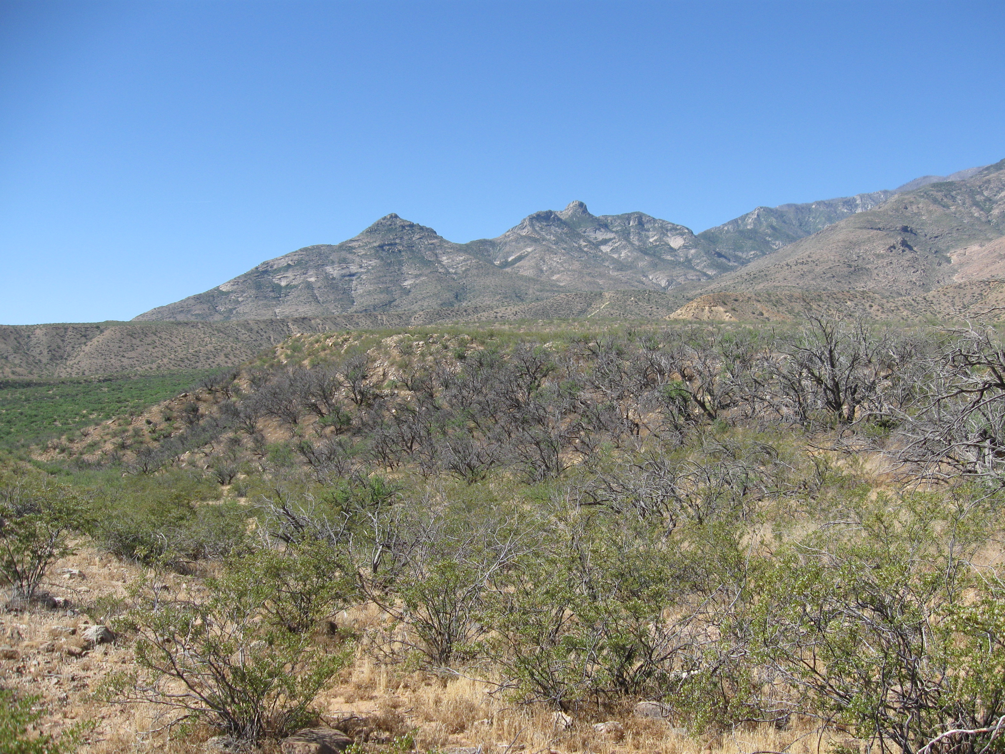
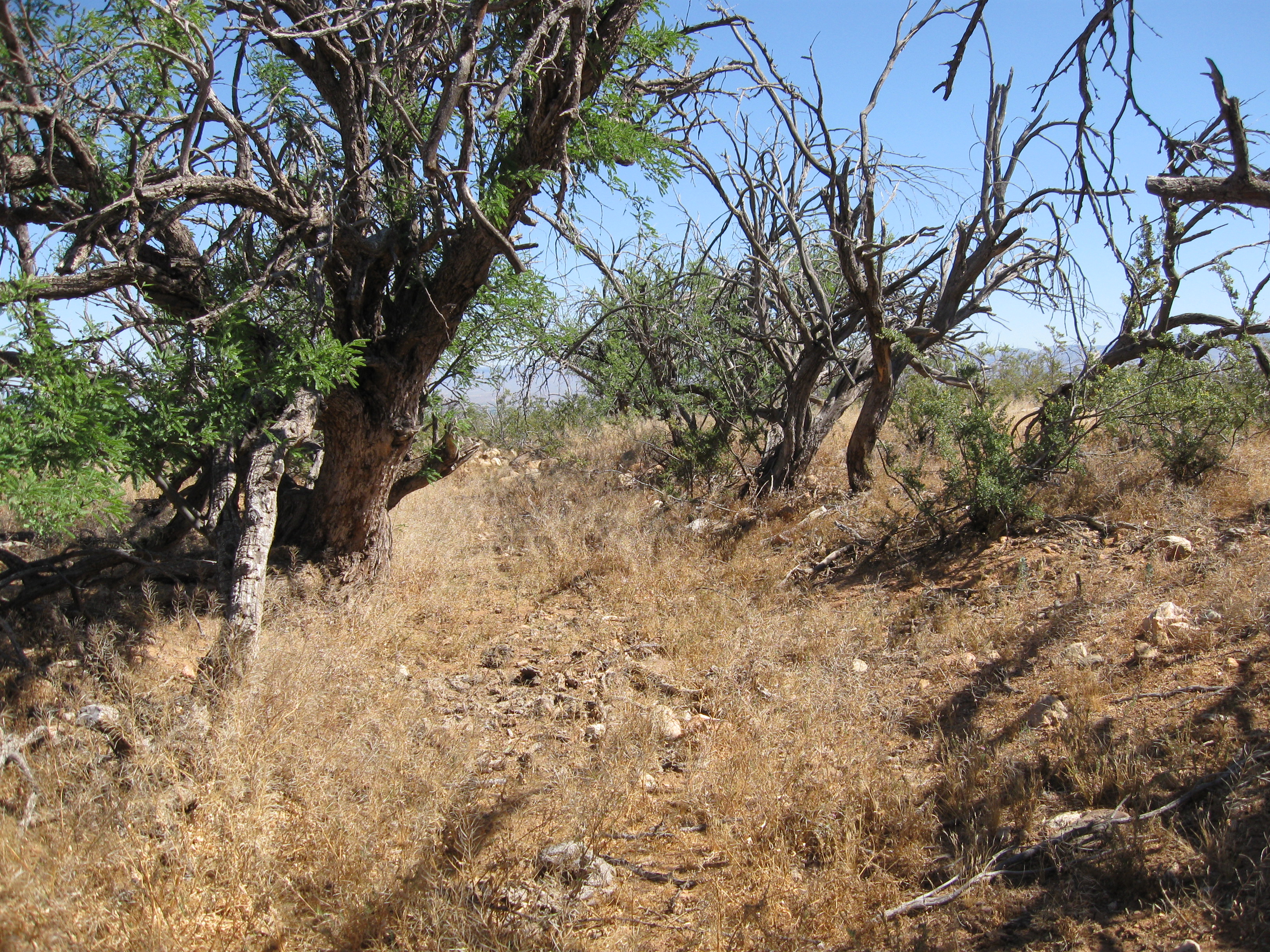
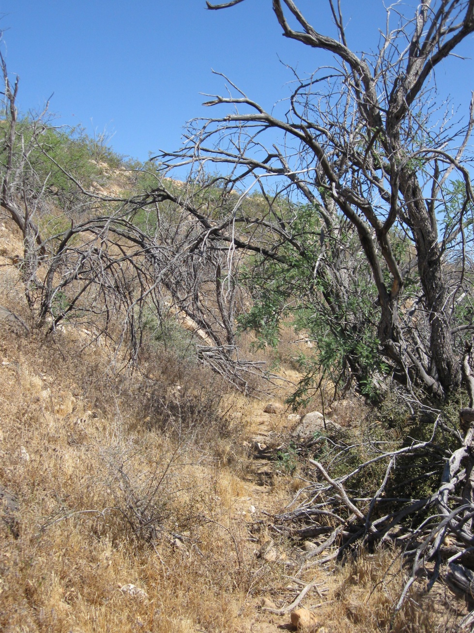
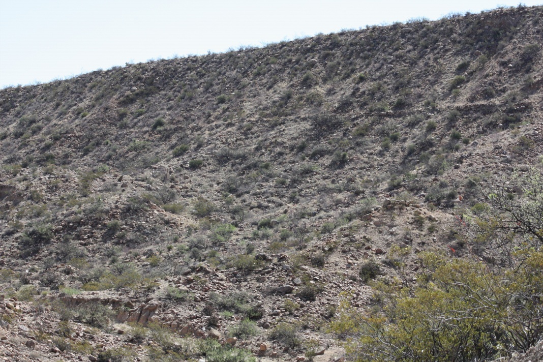